The Ultimate Guide for the Mount Timpanogos Hike

The Mount Timpanogos hike is akin to a pilgrimage for Utah locals. Timpanogos, or “Timp” for short, stands out dramatically with how different it looks, as if it belongs in the Canadian Rockies, with unique features like lush hanging gardens, striking glacial cirques, and a stunning emerald alpine lake.
Even though it stands as the second-highest peak in the range, it draws a much larger crowd than Mount Nebo (the tallest). I first reached the summit in July 2015 after years of dreaming about it, and what a lasting impression it left on me! I hiked it again just weeks later, and many times since.
Timpanogos is a long hike with consistent elevation gain. There are two main routes to the summit: the more commonly hiked Timpooneke Trail and the steeper, slightly more demanding Aspen Grove route. Let’s take a closer look at each option!
Mount Timpanogos Hike Overview
There are two established trails to the summit of Mount Timpanogos. Each trail has its own advantages and disadvantages. Here’s a quick comparison.
|
Timpooneke |
Aspen Grove |
|
Slightly longer and less steep |
Slightly shorter but steeper |
|
Parking reservations on weekends |
No parking reservation required |
|
Timpanogos Basin |
Emerald Lake |
|
Scout Falls |
Multiple Waterfalls (~10) |
|
Less Scenic (in my opinion) |
More Scenic (in my opinion) |
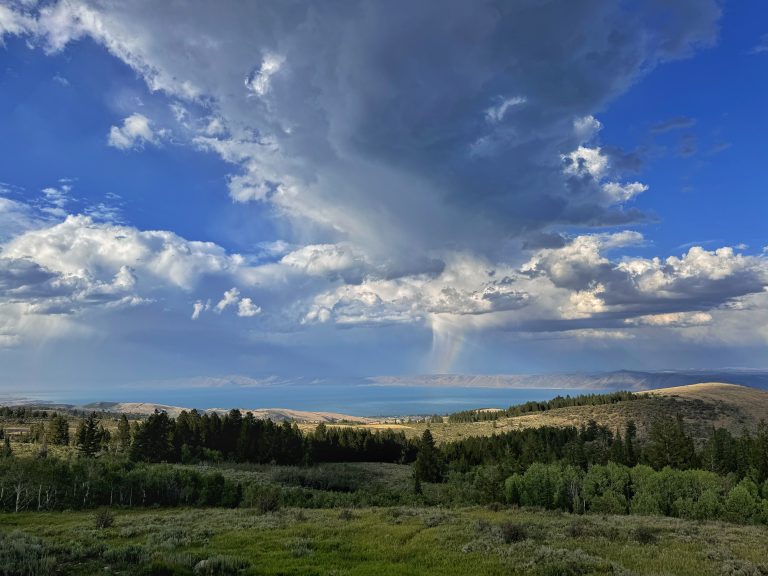
The final 1-mile (1.6 km) is the same for both trails. The two routes meet up one switchback before the saddle, where you are treated to a view west towards Utah Lake and Utah Valley. I am a little biased towards Aspen Grove because of the many waterfalls in Primrose Cirque and Emerald Lake.
Timpooneke Trail Stats
Aspen Grove Trail Stats
Choosing Your Trail: Aspen Grove vs. Timpooneke
Both routes to hike Mount Timpanogos are well worth the effort, with each offering distinct advantages. Aspen Grove is steeper and slightly shorter, but it takes you past nearly ten waterfalls and the stunning Emerald Lake. Additionally, no parking reservation is needed on weekends, though the parking lot fills up fast, so I suggest arriving early! (8 A.M or earlier).
Timpooneke is longer and more gradual, trading Emerald Lake for the wildflower-lined Timpanogos Basin. However, it draws far more hikers, so parking reservations are required on the weekends.
Pro Tip: Both trailheads require a $10 parking fee, but if you have an annual National Parks Pass, it covers the fee. Just another reason I love that pass.
The Aspen Grove (or Mount Timpanogos) Trail
The Aspen Grove Trailhead sits adjacent to Sundance Mountain Resort, one of Utah’s most underrated winter destinations. You will share the parking lot with hikers heading to the ever-popular Stewart Falls.
When I first bagged Mount Timpanogos in 2015 as a curious 22-year-old, I chose Aspen Grove over Timpooneke. The deciding factor was a strong desire to see Emerald Lake, but what caught me completely by surprise was the sheer beauty of Primrose Cirque and the nearly 10 waterfalls you pass on the way.
I remember counting each waterfall as we climbed; my amazement when I walked up to “waterfall 10” was something I will never forget. Keep in mind that only the first two run year-round. The rest depend on seasonal snowmelt; we would return in a few weeks only to find them dried out
Aspen Grove is the more challenging option due to its steep grade, but the scenery and lack of weekend parking reservations make it worth the effort. For a quicker trek, many hikers turn around at the first waterfall, which sits about one mile into the hike.
The Timpooneke Trail
I have attempted Mount Timpanogos six times, with only two attempts from Timpooneke. This doesn’t mean the route is any less scenic or worthwhile. In fact, just 1.5 miles in, you will reach Scout Falls, which holds its own against the waterfalls on the Aspen Grove Trail, but it’s the only waterfall on this hike.
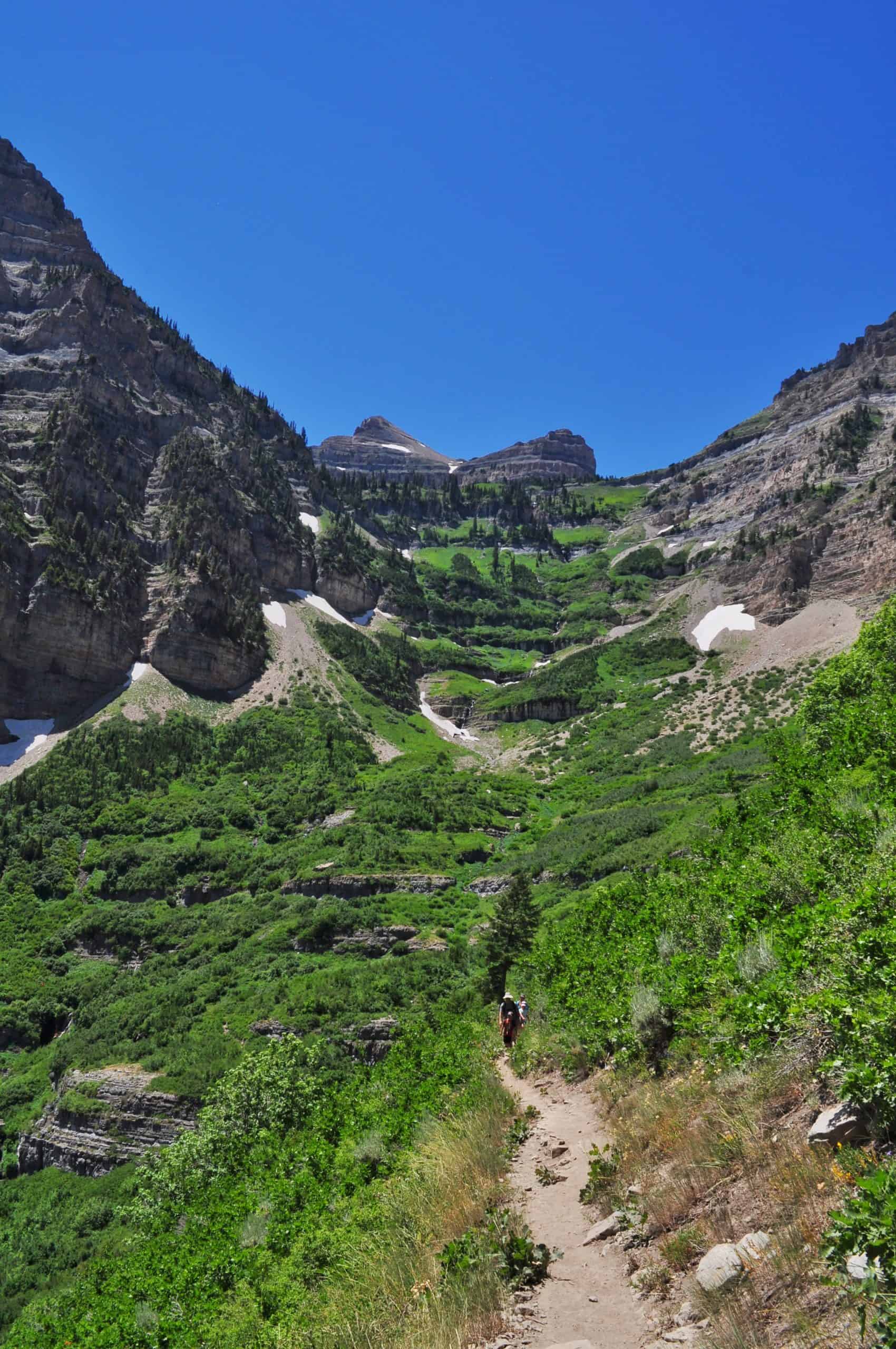
This route offers a more gradual ascent, with wider vistas and less confined canyon walls. You skip Emerald Lake in favor of the Timpanogos Basin, which bursts into the most amazing display of wildflowers in mid-July. Both trails eventually merge just below the saddle and follow the same path to the summit.
So what’s the Verdict Then?
Both routes offer stunning mountain scenery in their own unique way, so your choice comes down to personal preference, fitness level, and timing. Aspen Grove shines in early July when spring runoff gives life to the waterfalls. Timpooneke peaks in mid to late July when the Timpanogos Basin bursts into wildflowers!
First-time hikers may find Timpooneke to be a bit easier as it is more gradual. Just remember that parking requires a reservation, which opens on a rolling window:
- Early Window: 76 permits released 30 days in advance at 10 a.m. ET.
- Late Window: 24 permits are released two days in advance at 10 a.m. ET.
I highly encourage you to carpool. Meet at any number of park and rides in the valley before driving up to the trailheads.
Local’s choice: I am a little biased, but I find Aspen Grove to be the more scenic route as Primrose Cirque is just so unique and breathtaking!
Regardless of which route you choose, Mount Timpanogos is easily one of the best hikes in the Wasatch Mountains. You could even argue it’s one of the best hikes in all of Utah!
The Mount Timpanogos Hike In-Depth
Let’s break down each route into separate sections to help you prepare for your hike. While the stats for each route vary each time I track it, overall, the hike can generally be divided into three parts, with the final section being the same for both routes
The Aspen Grove Trail
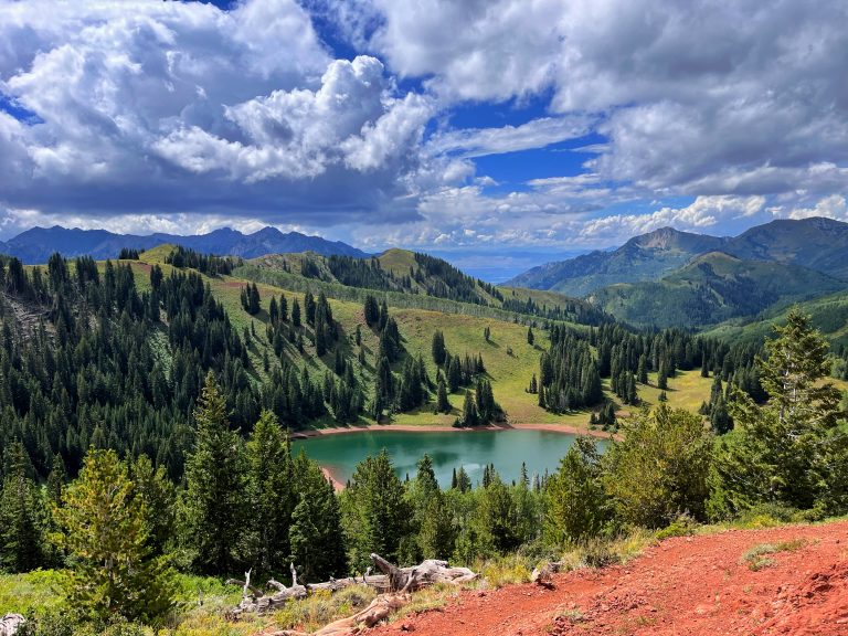
Though steeper and more eroded, the Aspen Grove trail is my preferred way to hike Mount Timpanogos thanks to its epic scenery! This route climbs about five miles (8 km) through the stunning Primrose Cirque en route to Emerald Lake, then up to the saddle before the final push to the summit.
The first 5.5 miles (8.9 km): Primrose Cirque and Emerald Lake
Within minutes of starting, you will pass the Timpanogos Emergency Response Team station. As you hike up into the forest, the path alternates between packed dirt and pavement. At roughly 1/3 mile (1/2 km), you will reach a trail junction. Turn left! We learned this lesson the hard way the first time, when we wandered onto the Lame Horse Trail because we weren’t paying attention.
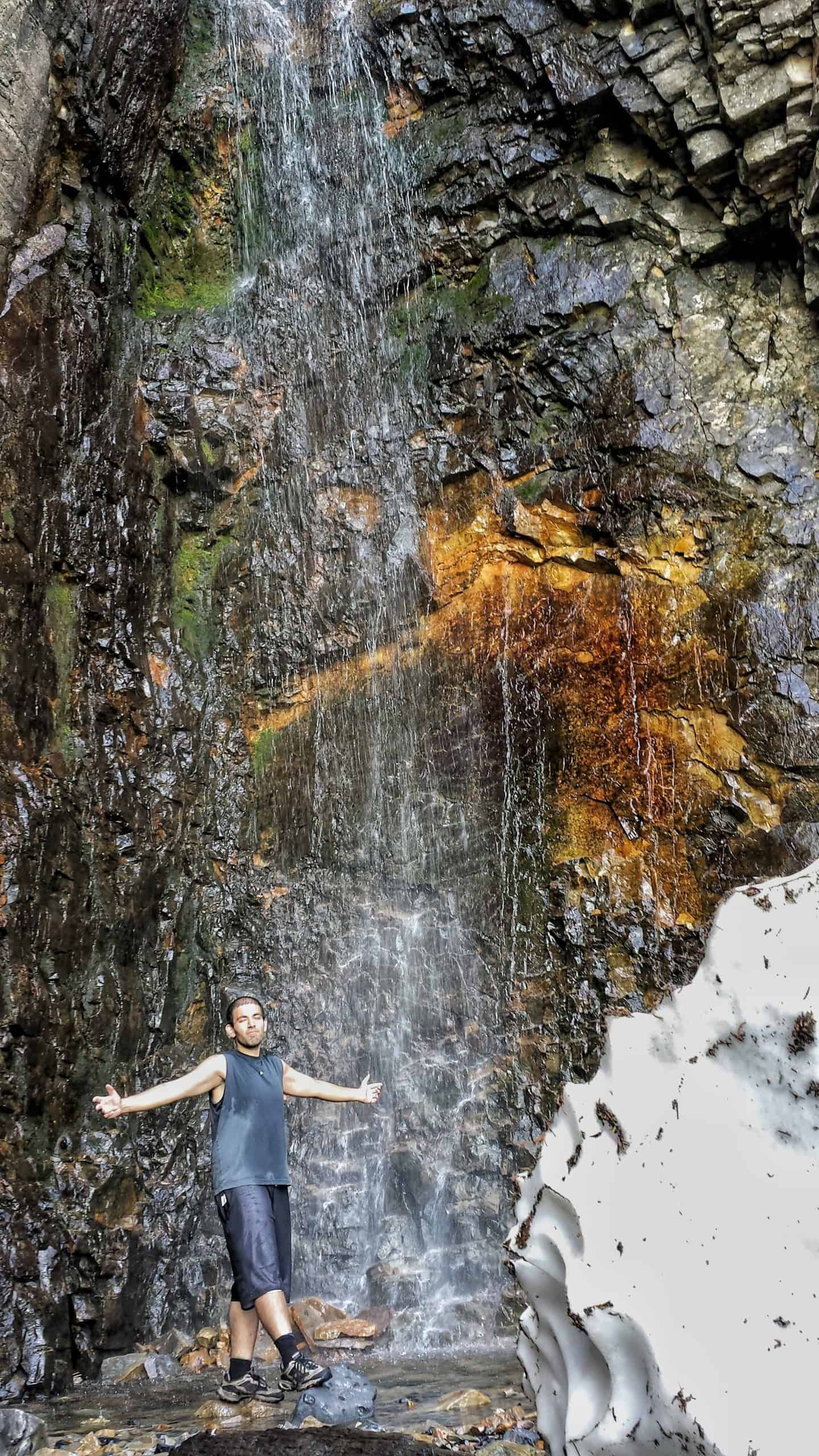
After about 1-mile (1.6 km) and 500 feet (152 m) of elevation gain, you will arrive at Timp Falls (or First Falls). For many, this is their final destination, but for you, the hike has just begun! During our 2015 hike, we spent five to ten minutes at each waterfall. We had no idea so many existed on this route.
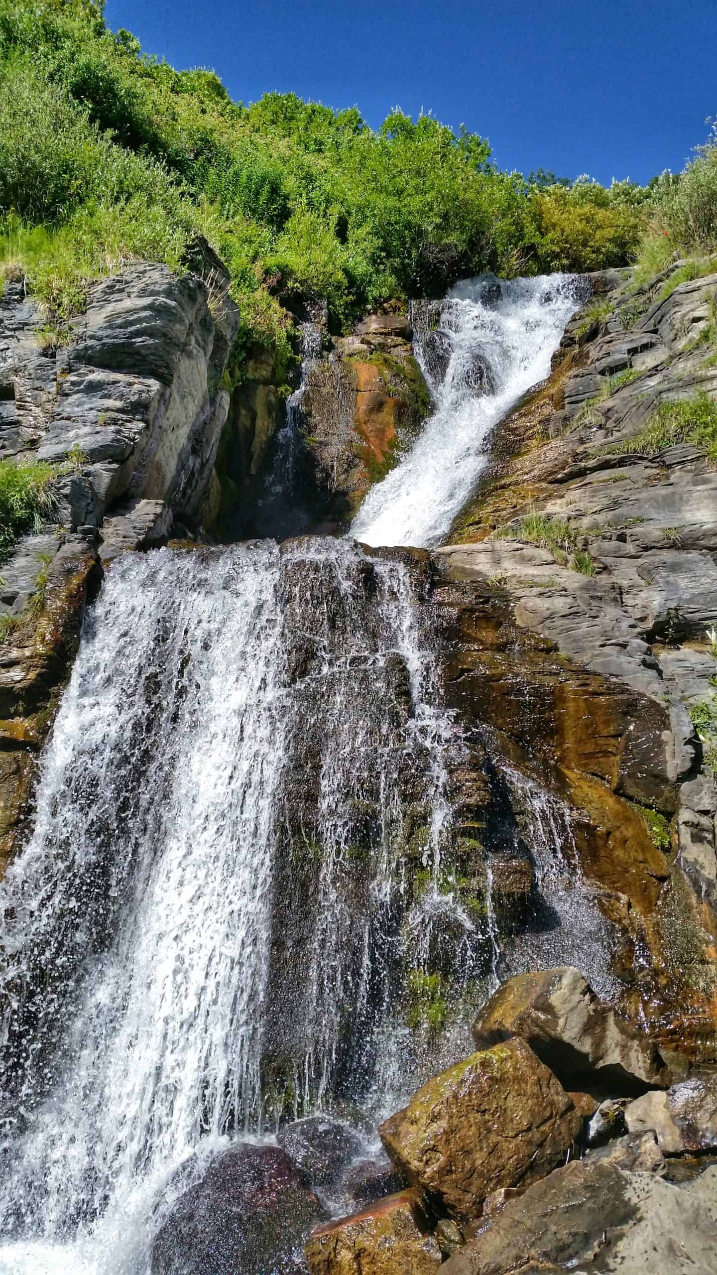
Imagine our amazement when just two switchbacks later, we reached a second, perhaps even more impressive waterfall! Wow! Even though 2015 was a low snow year, each waterfall roared with life!
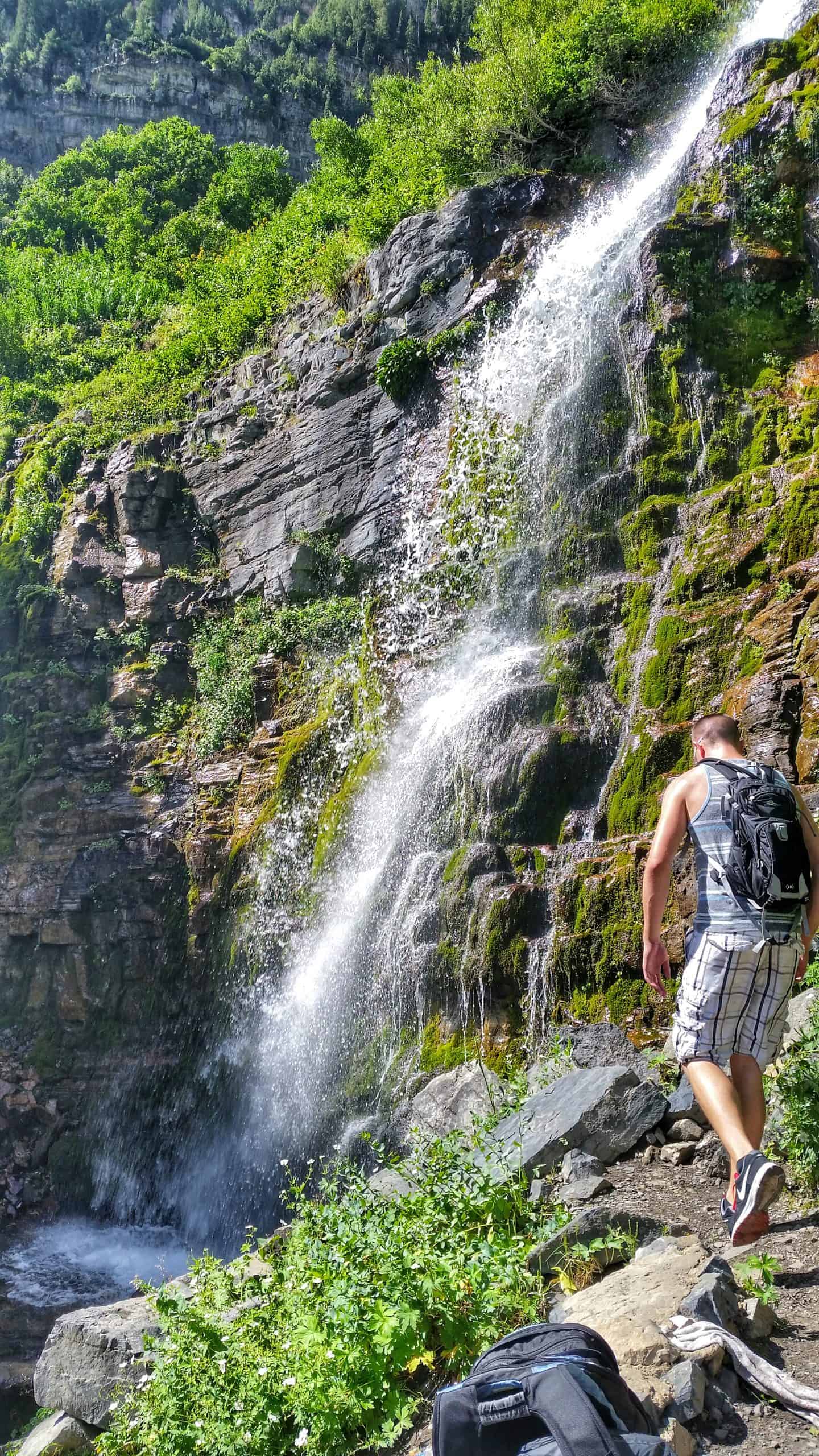
Beyond the second falls, the trail climbs through steep and occasionally eroded switchbacks, but the views opening up into Primrose Cirque are breathtaking! At 3 miles (4.8 km), you will come up on a seasonal waterfall, followed by another after the next switchback… and another…. and another!
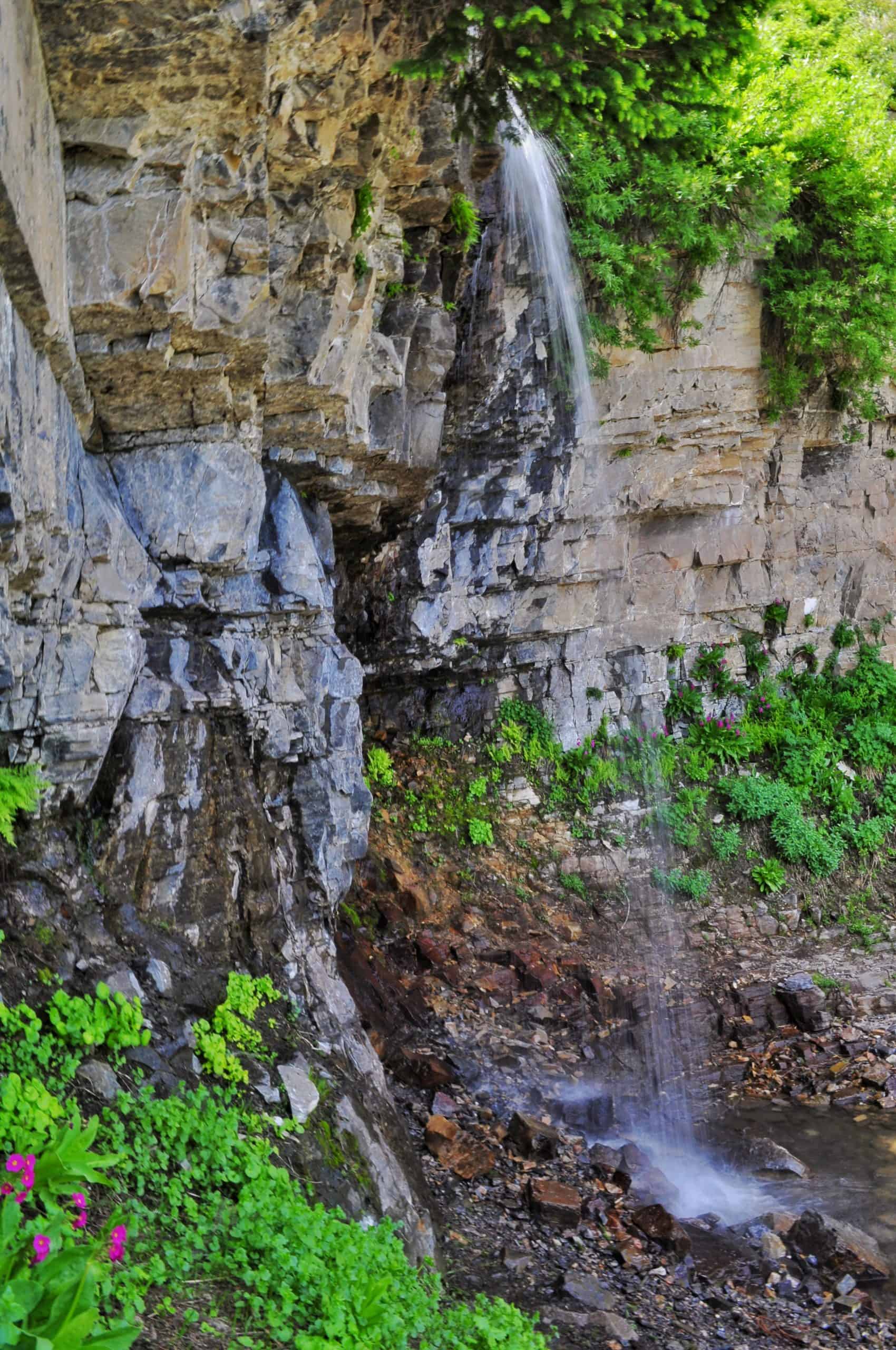
During that 2015 hike, we took some liberties with what we classified as a “waterfall!” Any “water that falls is a waterfall,” we joked! This was definitely the case with waterfalls number 7 and 8, which I didn’t photograph. Most of these cascades rely on snowmelt feeding the hanging gardens of Primrose Cirque.
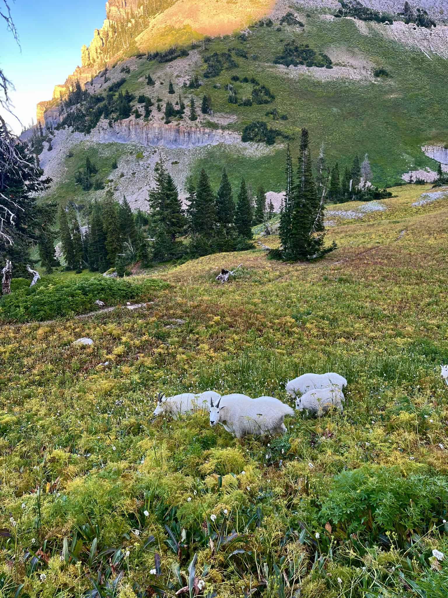
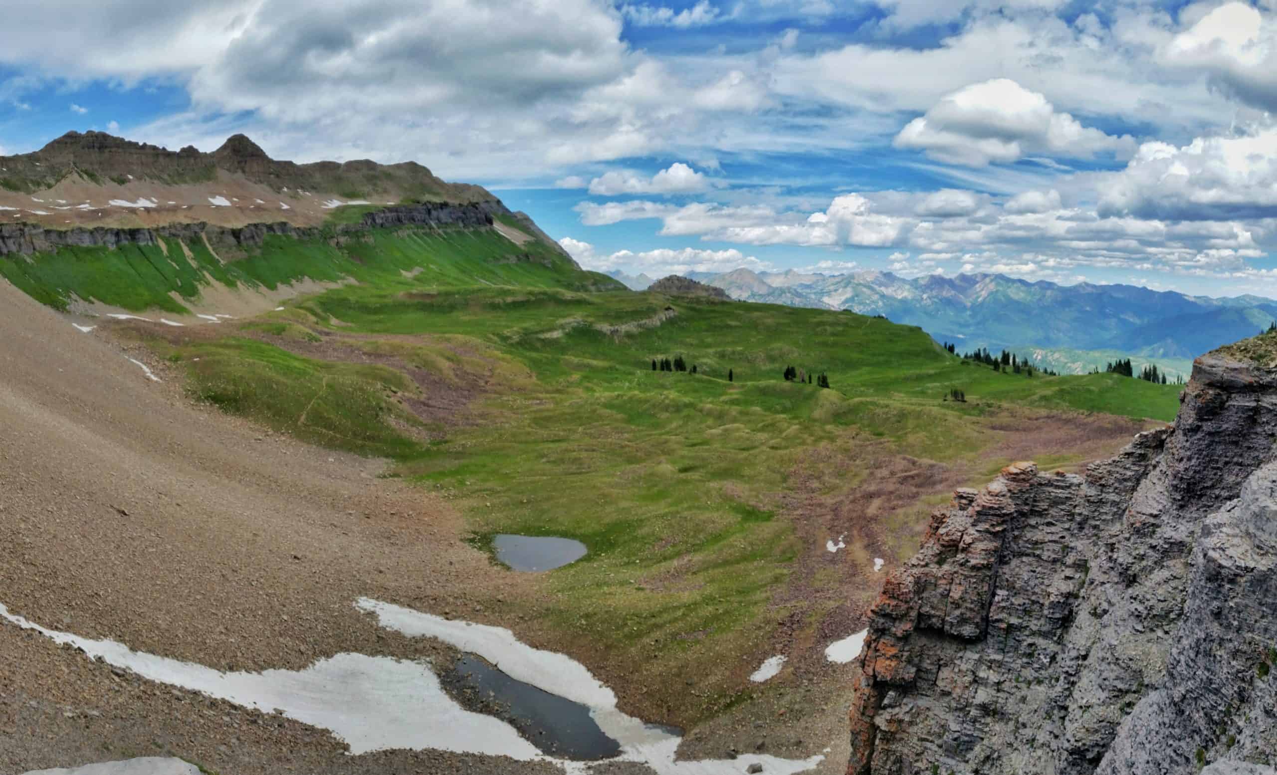
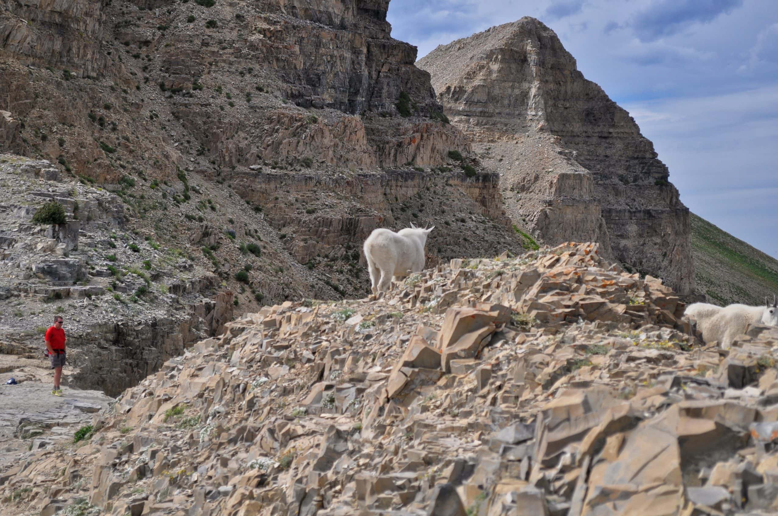
After about a dozen switchbacks, the trail bends to reveal the “Hidden Lakes” basin. I must say, they live up to their name as I have never spotted these so-called lakes from the trail. The area looks like it would be an amazing spot to pitch a tent. From this point forward, keep an eye out for mountain goats!
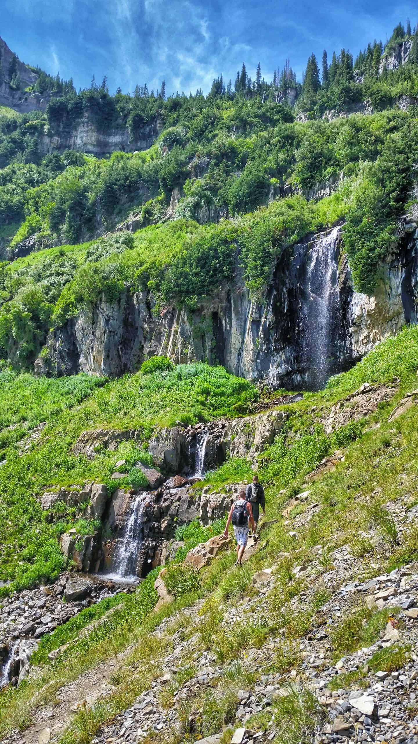
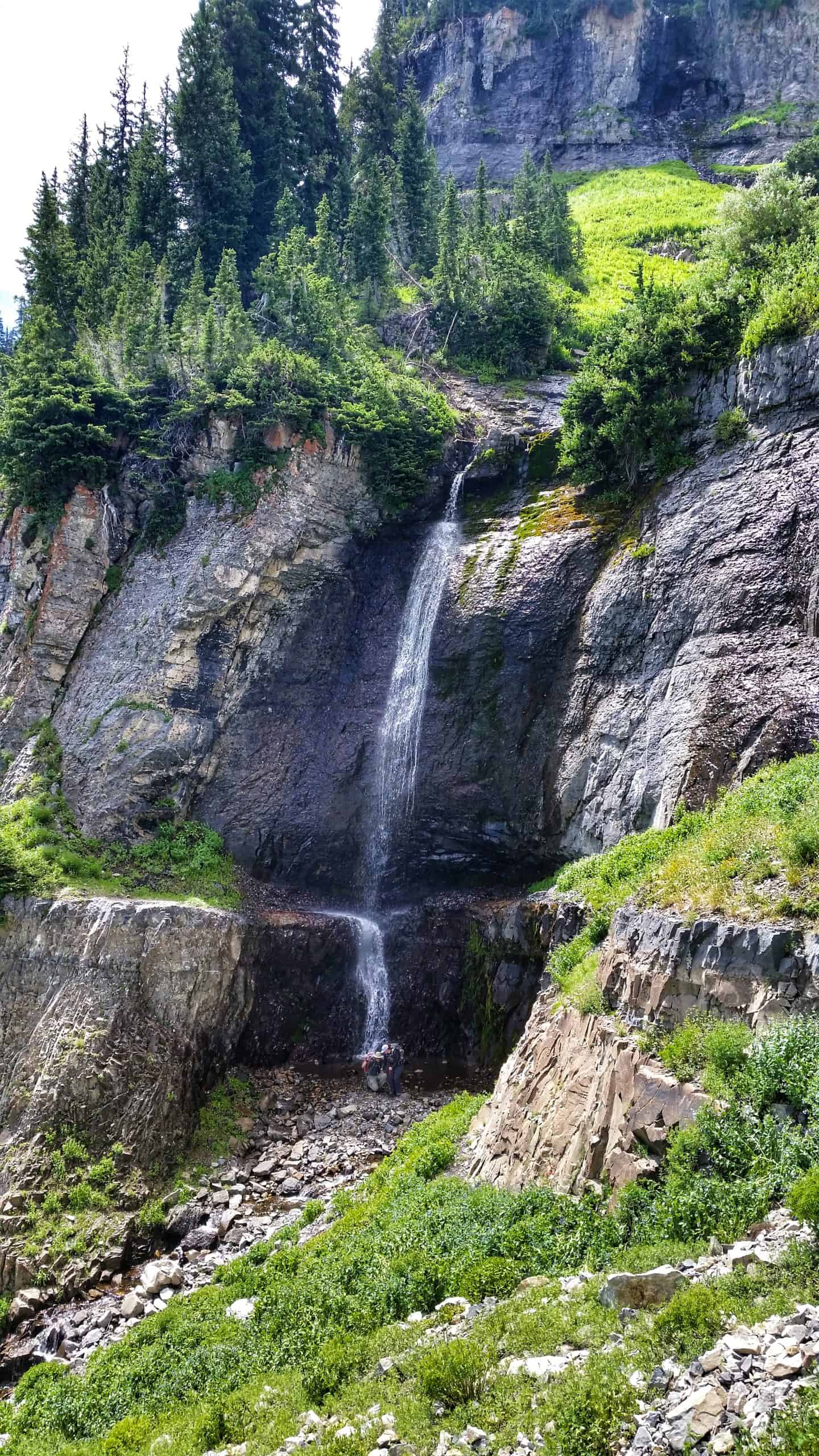
The Hidden Lakes basin sits at mile five (8 km), and from there, the trail continues through a high meadow. Robert’s Horn rises on your right, which is an amazing hike in and of itself! Soon you will climb a steep hill, and you will spot waterfalls 9 and 10 on the left. To get close to them, there is an unmaintained path you can take.
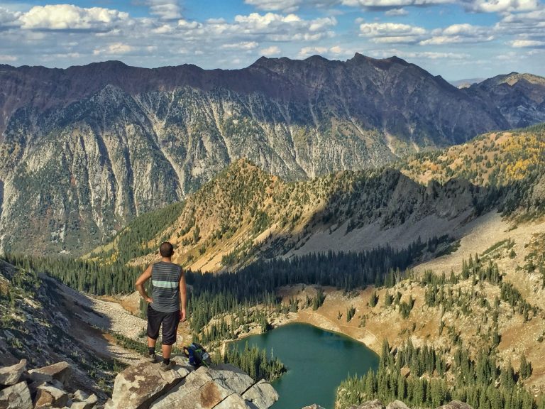
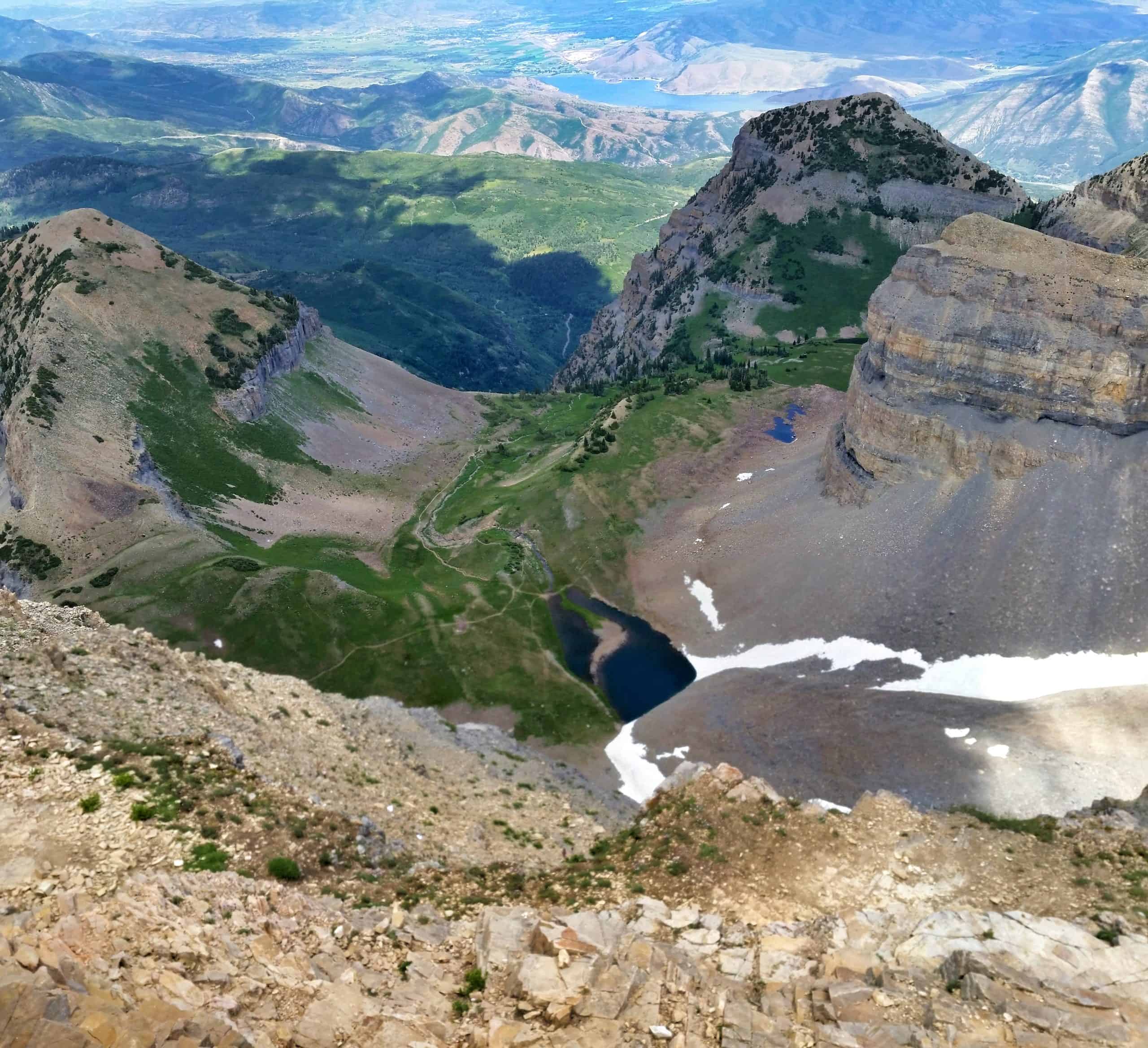
After another steep hill, you will finally crest out, and Emerald Lake will come into view! Reaching the lake at 5.5 miles (8.9km) and 3,500 feet (1525 m) of elevation gain is a solid achievement and a worthy hike by itself!
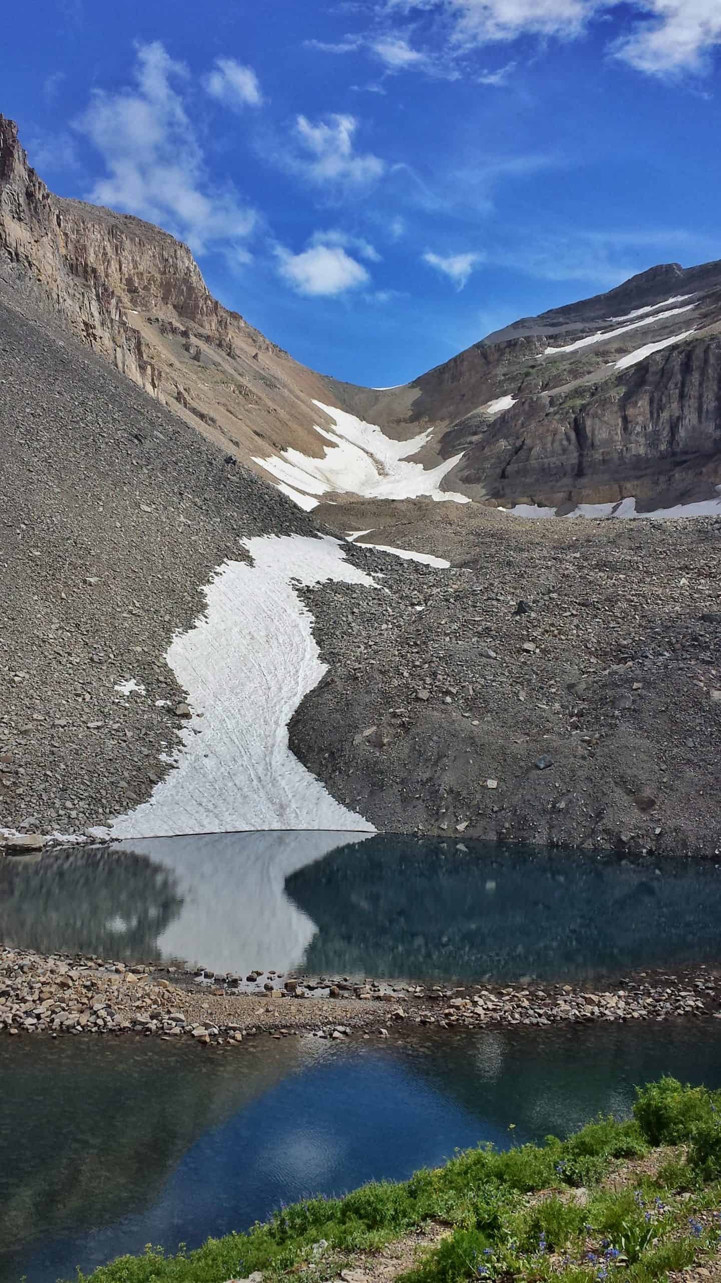
You can check out the TERT Emerald Lake Shelter, but unfortunately, it was destroyed by the record snowpack during the 2022-2023 winter season! The Forest Service is currently rebuilding it.
Update: I plan to hike Mount Timpanogos via Aspen Grove in July 2026 and will report back on any changes, including how many waterfalls I can count! 🙂
Mile 5.5-6.3: Emerald Lake to the Saddle
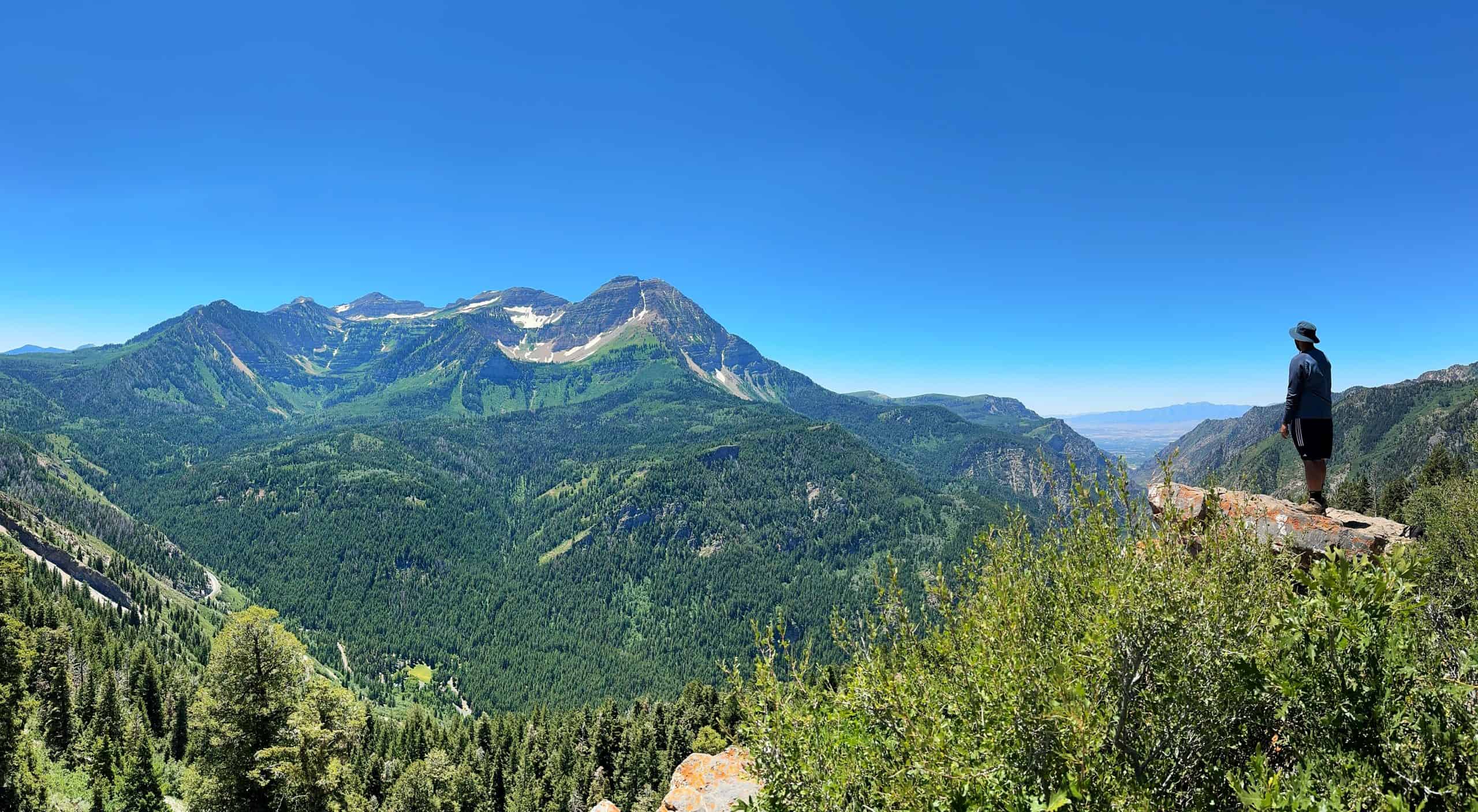
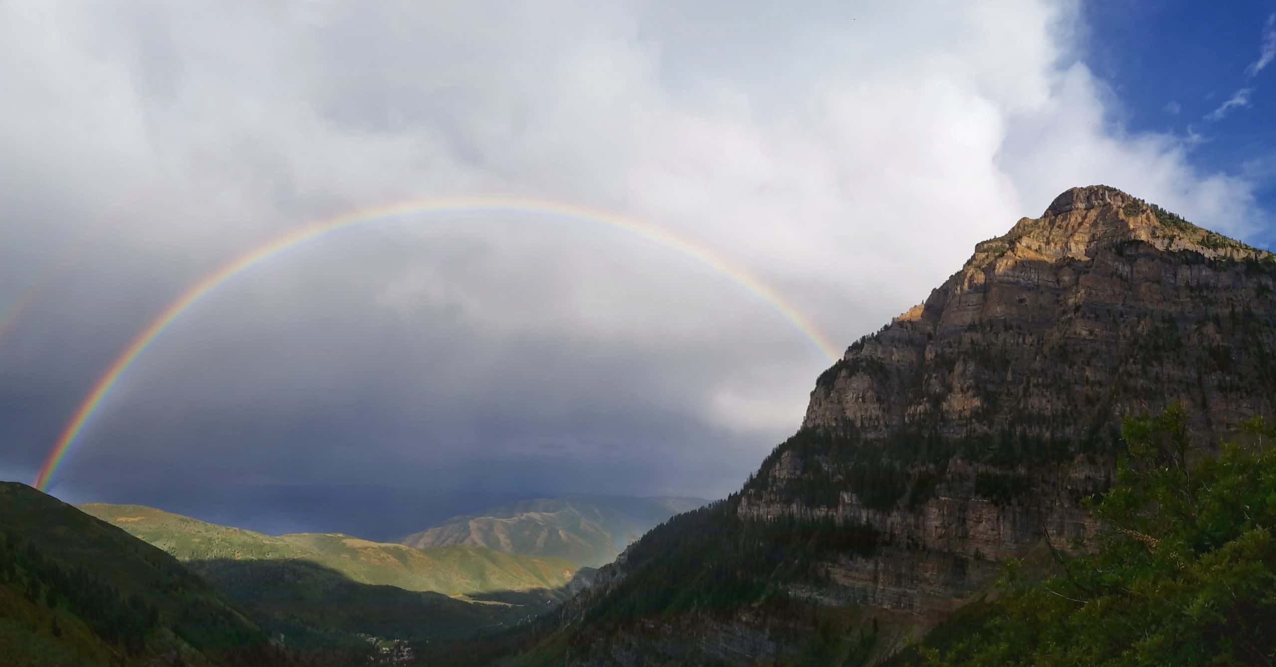
I always spend at least 15-30 minutes at Emerald Lake as it is absolutely stunning and rivals Glacier National Park. From here, the trail continues for a few minutes before you are treated to a jaw-dropping view of Timpanogos Basin below and the distant peaks of the Alpine Ridge!
As you continue, you are actually hiking over a rock glacier. If you listen carefully, you can hear water moving beneath the rocks. I recently learned that Utah is home to over 800 documented rock glaciers. I suspected their existence during my hikes, but scientists only confirmed their presence in the state a few years ago.
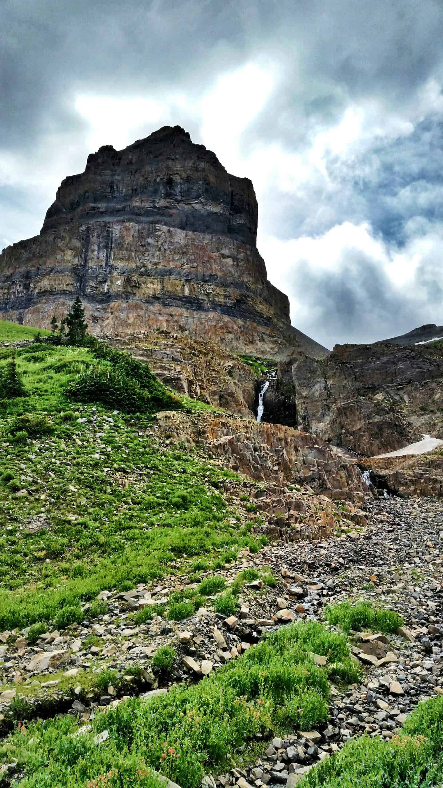
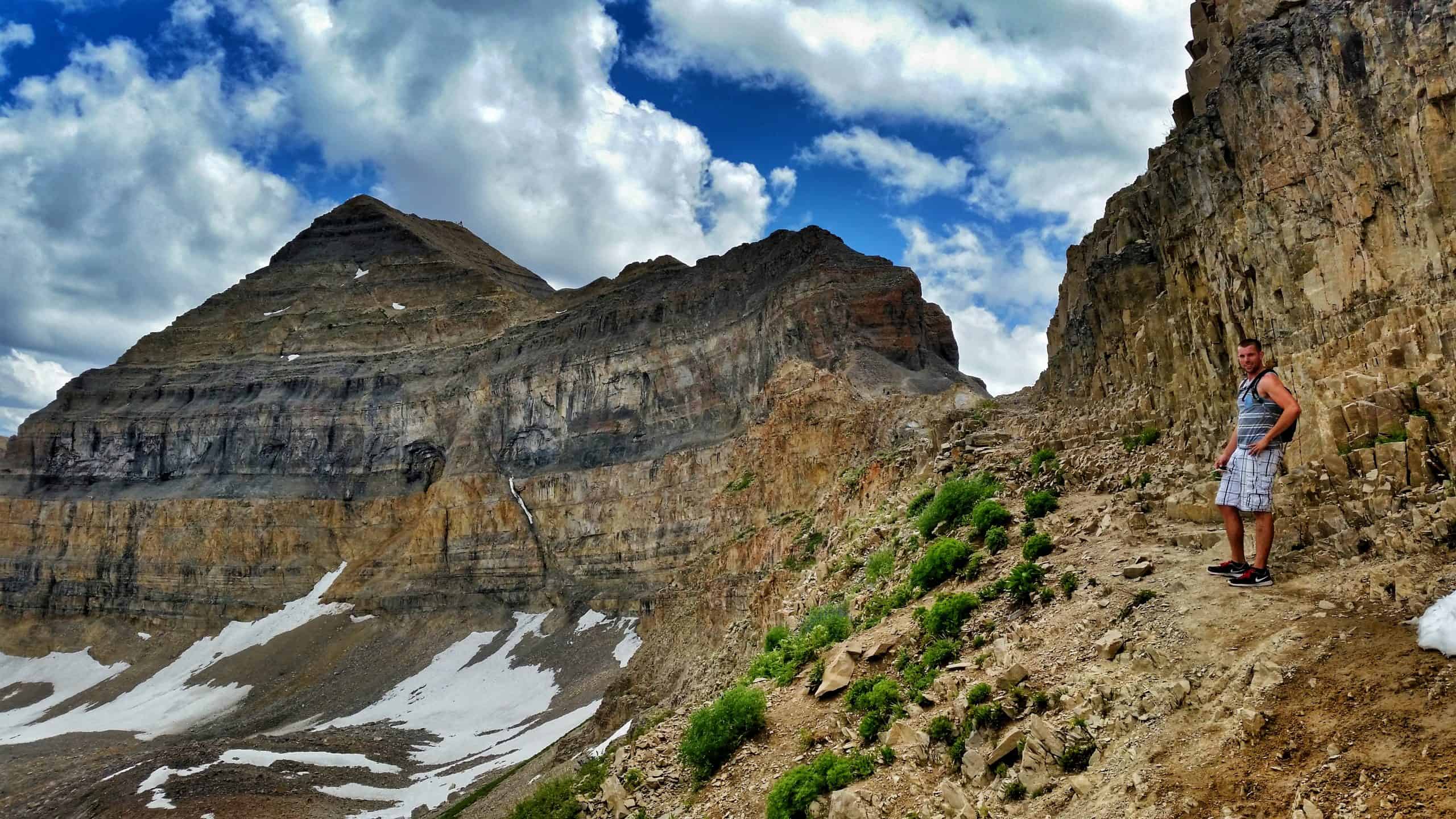
The final push to the saddle will test you! For whatever reason, the trail is very steep and eroded, and it will take an extra effort mentally and physically to cross over, but once you make it, you will be rewarded with stunning 360-degree panoramic views. For those coming up Timpooneke, the trails meet just above this steep section.
Mile 6.3-7: The Saddle to the Summit.
From the saddle, the route to the summit gets interesting! Almost immediately, you hike up some steep switchbacks carved directly into the rock face. Take your time here and be courteous of other hikers.
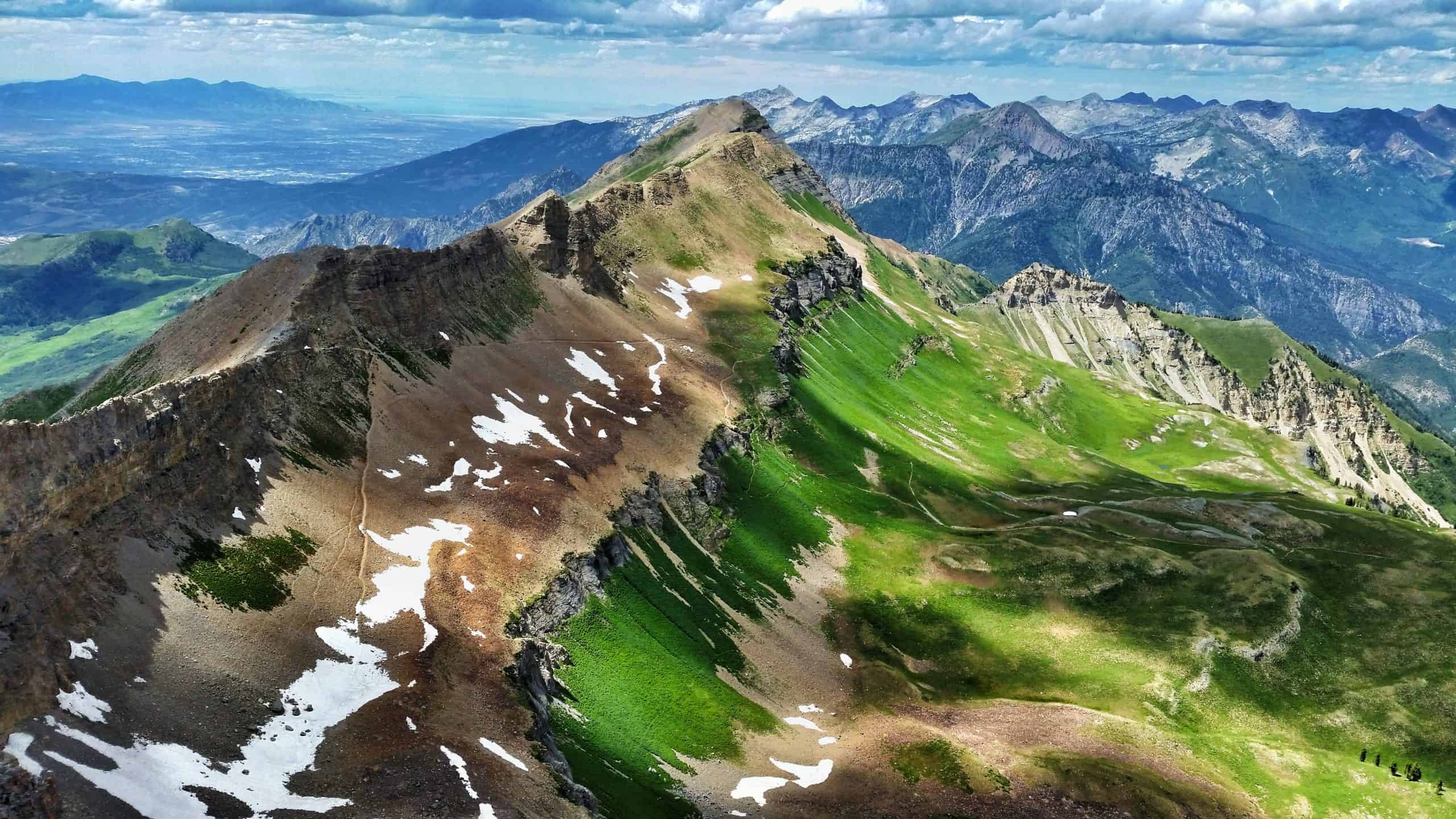
Following the switchbacks, the trail levels out briefly before the final stretch to the summit. I recommend sticking to the trail as closely as you can, especially if you’re afraid of heights. While the western side slopes downward quite a bit, the eastern side is a sheer cliff face down to Emerald Lake! Don’t worry, the trail does not follow the exposed ridge
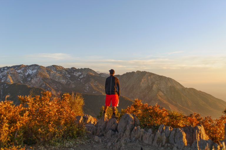
The summit shelter will stay in view the entire time, even if it seems distant. Altitude and fatigue will naturally slow your pace, but that’s okay! Take the time you need. Before you know it, you will arrive at one of the most stunning summit views in all of Utah!
Timpooneke Trail
For first-time hikers, the Timpooneke Trail is the more popular route to the summit of Mount Timpanogos. It offers a more gradual climb over the first five miles to Timpanogos Basin, followed by switchbacks leading to the saddle, where it meets the Aspen Grove route just below the ridge. From there, both routes follow the same steep push to the summit.
The First 5.5 Miles To Timpanogos Basin
At first glance, you might expect this first section to mirror Primrose Cirque. While the basins you hike through are visually stunning, I find this route slightly less dramatic. My only experiences on the Timpooneke Trail came in the autumn, when Scout Falls was dried out, which may have skewed my opinion.
At roughly three miles with 800 feet of elevation gain, you will reach Scout Falls. Much like the seasonal waterfalls on the Aspen Grove side, this cascade seemingly filters through the hanging garden. While it typically appears as two small drops, spring runoff can swell it into one wide curtain of water. A brief side trail leads to an up-close view!
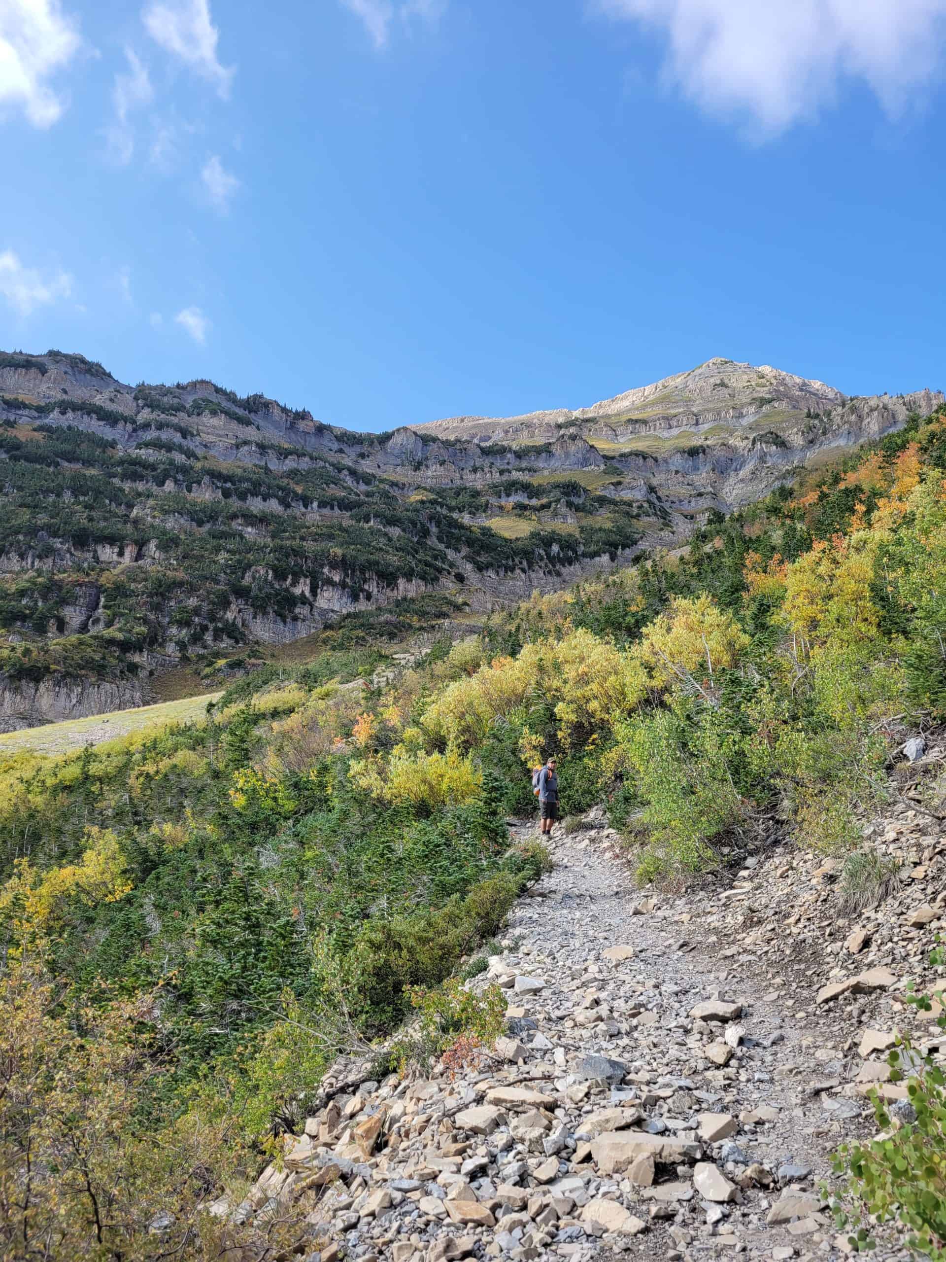
From here, the trail begins taking longer switchbacks as you enter another smaller basin, a preview of what’s to come! After endless switchbacks and no waterfalls to distract you, you will inch closer to Timpanogos Basin. The trail never gets too steep and maintains a fairly consistent grade, much different from the Aspen Grove side.
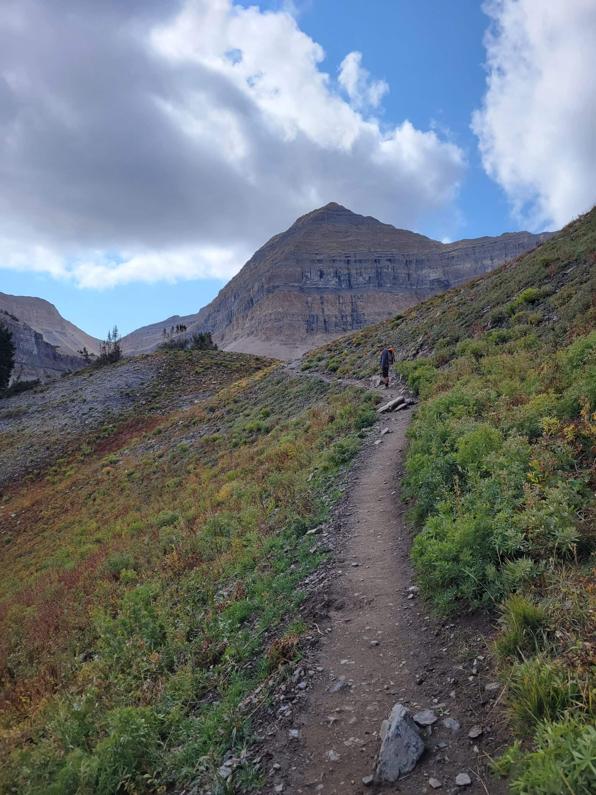
Once you arrive at Timpanogos Basin, especially in late July, you will see why this place is special! The towering pyramid-shaped mountain in front of you is the summit. Look closely, and you will spot the summit shack and small white specks dotted along the cliff bands. I can’t recall a single time I didn’t spot mountain goats here!
Mile 5.5-6.8: Timpanogos Basin to the Saddle
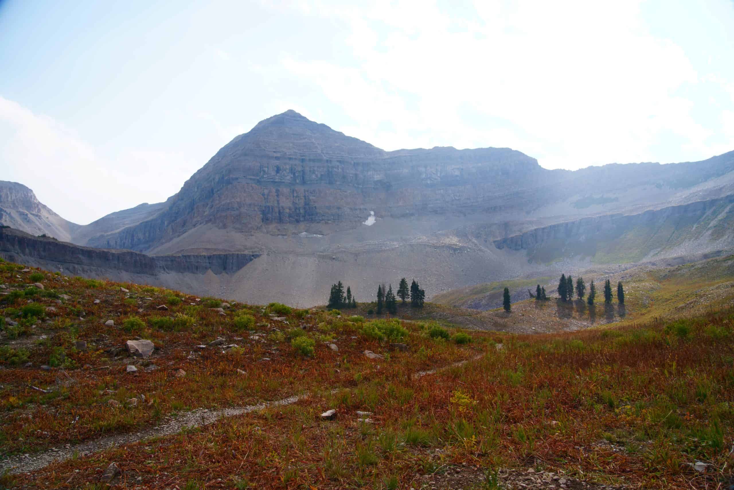
Timpanogos Basin makes for a great place to spend the night if you are backpacking. Otherwise, continue along the trail, which remains relatively flat as it skirts the basin. Before long, you’ll encounter a series of long switchbacks as you climb out of the basin and the trail begins to steepen.
Soon, you’ll connect with hikers coming up from the Aspen Grove Trail and share a short section to the saddle. Mountain goats are very common here; in fact, I’ve seen entire herds gathered right on the saddle itself. While they are accustomed to humans, it’s still best to keep your distance and keep dogs on a leash.
Mile 6.8-7.5: The Saddle to the Summit.
The rest of the trail to the summit is the same regardless of which route you take. You’ll quickly hike up a series of steep switchbacks carved directly into the rock face, after which the trail levels out briefly before the final set of switchbacks to the summit.
As you make your final approach, you’ll spot the summit shelter in view ahead. Altitude and fatigue will naturally slow you down, which is okay! Take your time, and before you know it, you’ll arrive at one of the most stunning summit views in all of Utah!
Recommended Gear
Here’s the gear I packed for my recent Mount Timpanogos hike. These are the items that I rely on for most of my adventures in the mountains:
Hiking Tips
Mount Timpanogos is a tough hike, no doubt, but with the right preparation, it’s absolutely doable. A little planning goes a long way out here. Below are some tips to help you get ready and make the most of your adventure!
- Start early to beat the heat. (aim to start by 6 AM)
- Watching sunrise at the summit is something locals love to do! You’ll never be alone on this hike.
- Wear sunscreen! There is very limited shade on this hike
- Wear trail runners or hiking shoes with a solid grip to avoid slipping and sliding.
- Bring layers! Even in the summer, the summit can get cold with the wind chill! (~30F + cooler at the summit)
- Be aware of afternoon Thunderstorms! They can appear suddenly in the summer.
Where to Stay
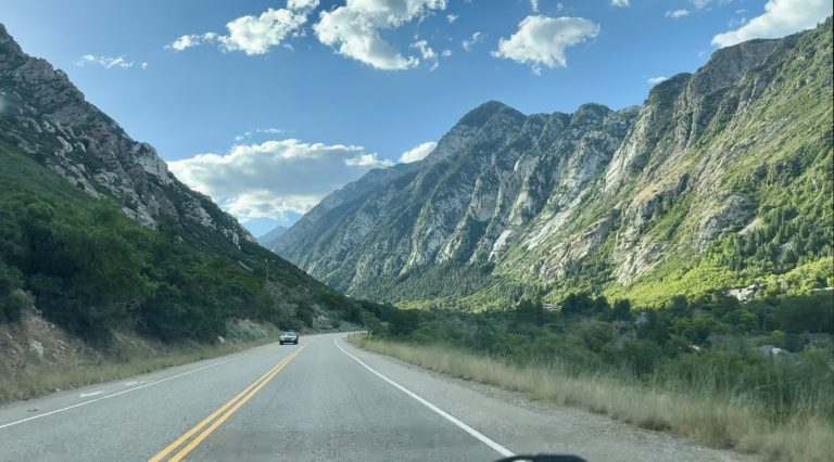
Mount Timpanogos sits under an hour’s drive from Salt Lake City, and only 30 minutes from Utah Valley, which includes cities like Provo, Orem, Lehi, etc. It truly is “Utah’s mountain!” Additionally, the Sundance Resort sits tucked away into the mountainside, offering a more mountainous retreat. Here are my favorite places to stay!
Camping Options
📍Timpooneke Campground: This quiet campground sits just a half-mile up from the Timpooneke Trailhead. While it does not offer modern amenities like showers, the alpine setting allows you to feel fully immersed in the wilderness. You can also start the Timpanogos Hike early to beat the crowds, making it a great choice.
📍Mount Timpanogos Campground: This campground sits just a few minutes’ walk from the Aspen Grove Trailhead. The sites are shaded by tall pine trees and surrounded by a scenic alpine landscape. It offers amenities such as water and flush toilets (seasonally), making it a great choice! The views are also incredible!
Lodging Options
📍Budget Option: Tru by Hilton in Lehi is a great budget-friendly option that blends comfort with a modern vibe. With clean rooms, free breakfast, fast Wi-Fi, and a convenient location just off the Timpanogos Highway and 30 minutes from the Timpoonke trailhead, it’s perfect if you want quality and value without the high price tag.
📍Luxury Cabin Option: This A-Frame cabin at Sundance is a luxury rental that features an outdoor hot tub, perfect for those tired muscles after a long day of hiking Mount Timpanogos! You get the best of both worlds with a private retreat that is close enough to the Sundance Resort, with plenty of dining and activity options
📍Luxury Resort Option: Choose the Sundance Mountain Resort if you want a true resort experience. This high-end destination sits close to walkable trails, waterfalls, and excellent restaurants right outside your door. It is an ideal choice for travelers who want resort-style comforts and a relaxed atmosphere without leaving the mountains.
FAQs
Have some questions about the Mount Timpanogos hike? Here are the questions we get asked most often!
How long is the hike up Mount Timpanogos?
Both routes are about 14-15 miles (22.5-24.2 km) round-trip with significant elevation gain.
Is Mount Timpanogos a hard hike?
Most hikers would rate Mount Timpanogos as a challenging but non-technical hike. While it makes for a long and demanding day on the trail, the route itself is clearly defined and easy to follow. Without such a well-established trail system, a mountain of this size and elevation gain would be a far more technical and intimidating undertaking.
Is it safe to hike Timpanogos right now?
To stay up to date on current trail conditions, I like to check the latest user reviews on AllTrails, which give insight into recent trail conditions, including snow levels. Keep in mind that the east side of Mount Timpanogos, where the main hiking routes are, tends to hold onto snow well into July, so plan accordingly.
What is the best or easiest way to hike Mount Timpanogos?
The Timpooneke trail is the easiest, most popular, and well-maintained route to hike Mount Timpanogos.
Final Thoughts
The Mount Timpanogos hike is one of those experiences that truly lives up to the hype. It’s demanding, scenic, and incredibly rewarding from start to finish. By now, you should be able to decide which route is best suited for your needs.
Whether it’s your first big summit in the Wasatch or one you return to year after year, the combination of alpine beauty, unique terrain, and sweeping summit views makes it a standout experience.
If you come prepared, start early, and pace yourself, this is a hike you can absolutely conquer. Don’t forget to take your time, soak in the views, and appreciate just how special this mountain really is.