24 BEST Hikes Near Salt Lake City: Most Scenic Trails
Some of the best hikes near Salt Lake City are just 30 minutes from downtown, which still amazes me, no matter how often I lace up my boots. If you know me, I’ve lived here my whole life, and I’m always searching for a new trail to explore.
With well-marked trailheads, reliable maps, and easy access, hiking here isn’t just a hobby – it’s a way of life. From spring wildflowers to snowy winter routes, the Wasatch offers year-round adventure across 1,700+ miles (2,736 km) of trails in the Uinta-Wasatch-Cache National Forest.
I could have easily listed 100+ hikes, but I narrowed it down to 24 favorites, organized by region. To make it even easier, I’ll highlight one must-do hike in each area to help you choose your next adventure!
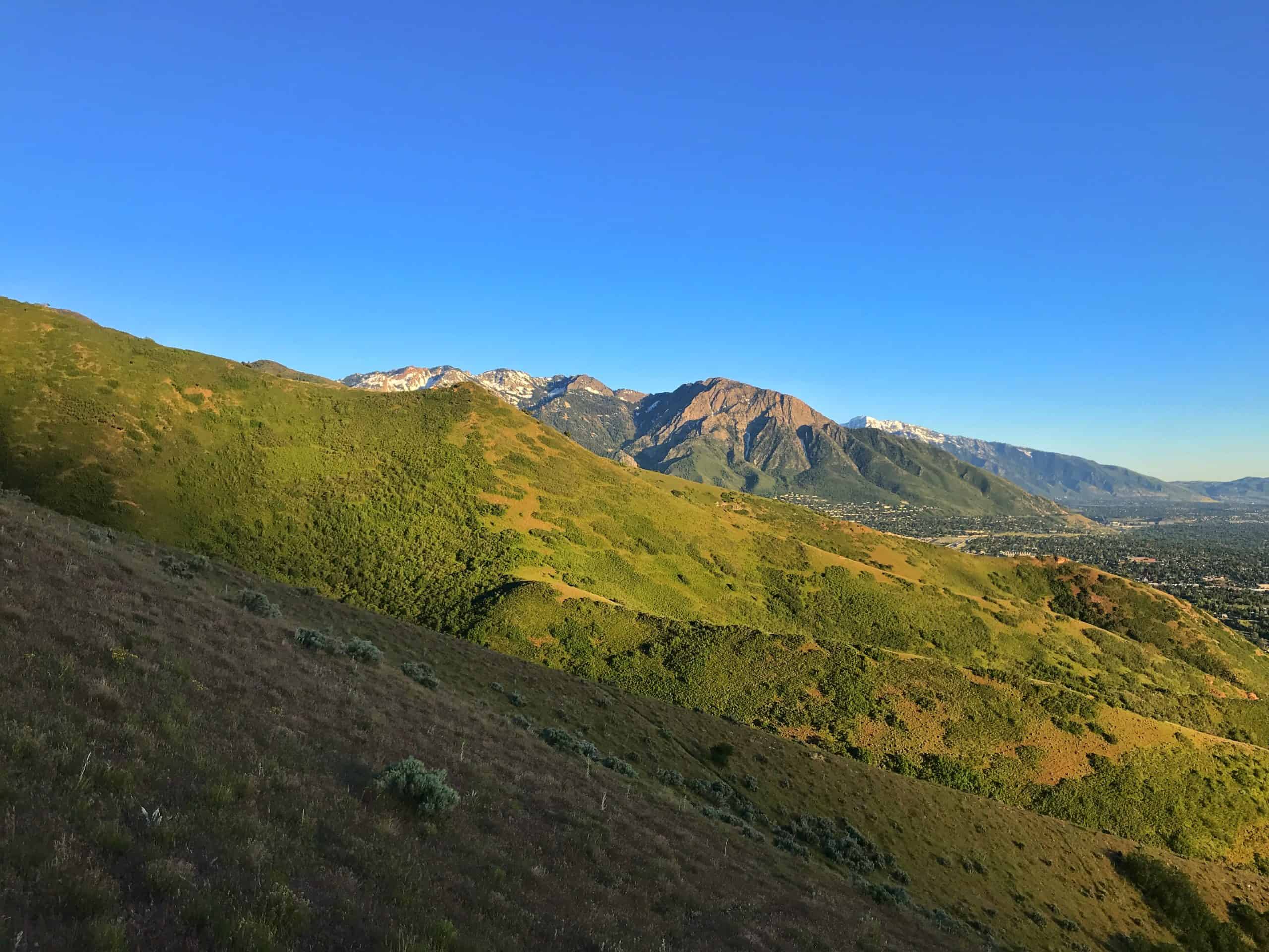
Scenic Trails In Wasatch Foothills
Can’t miss: Ensign Peak.
Runner-up: Living Room
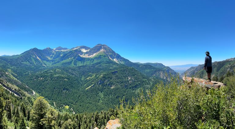
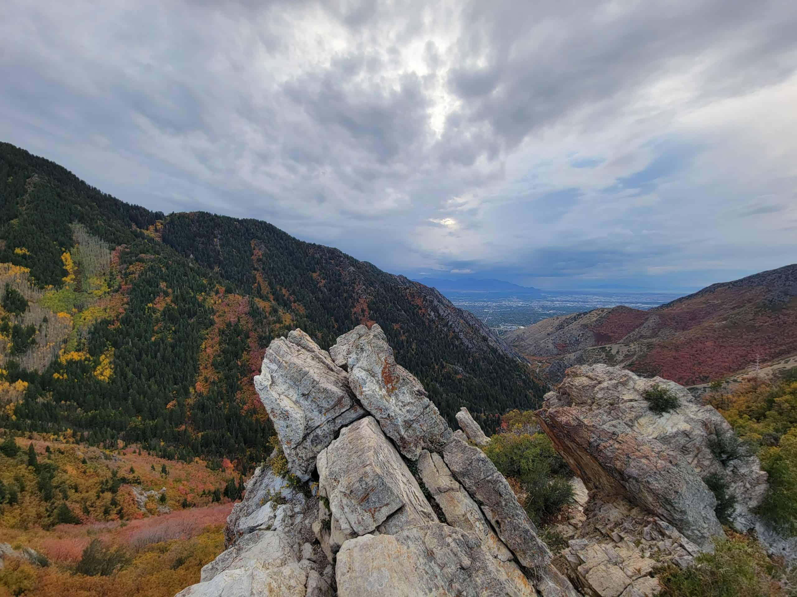
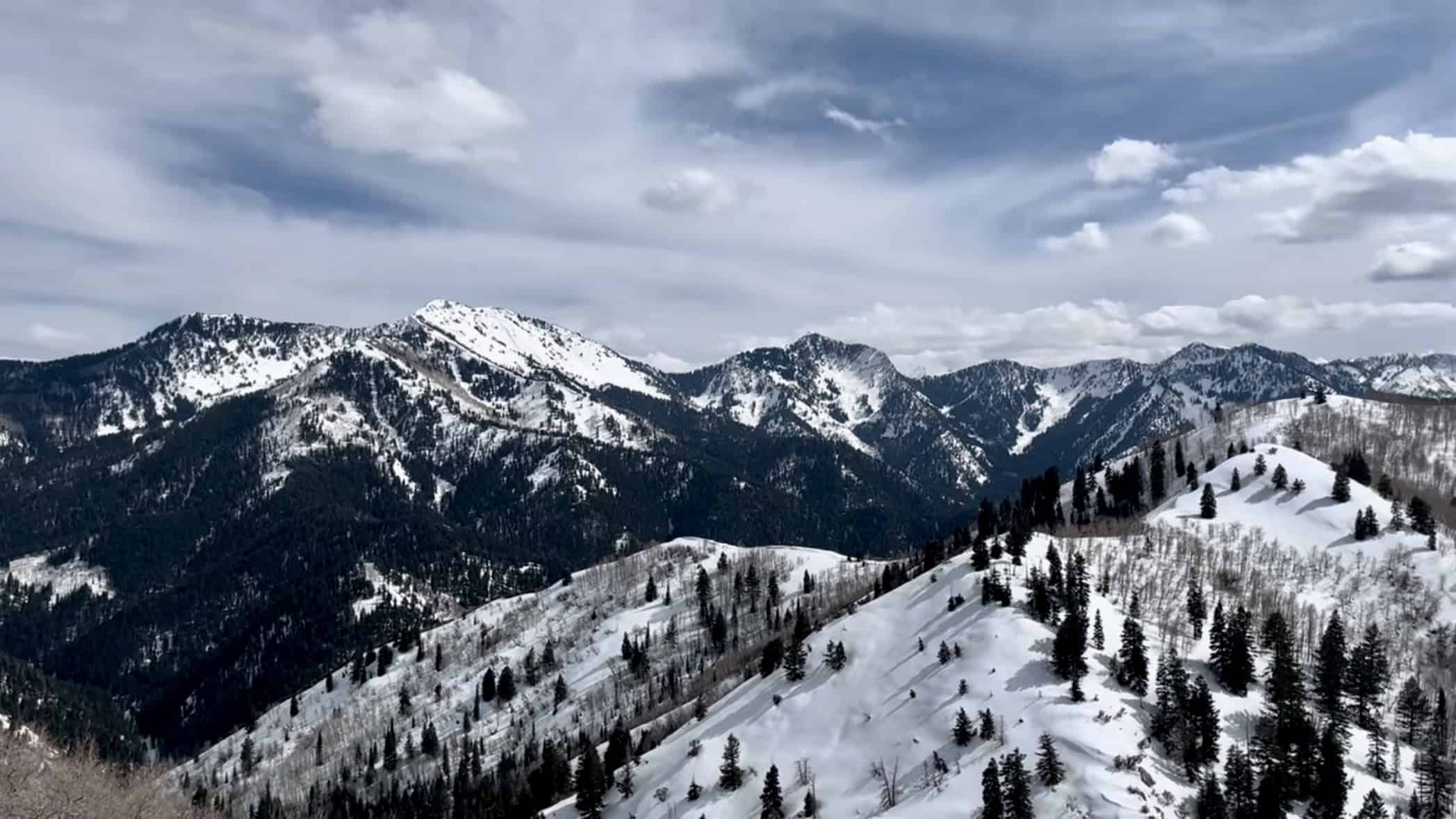
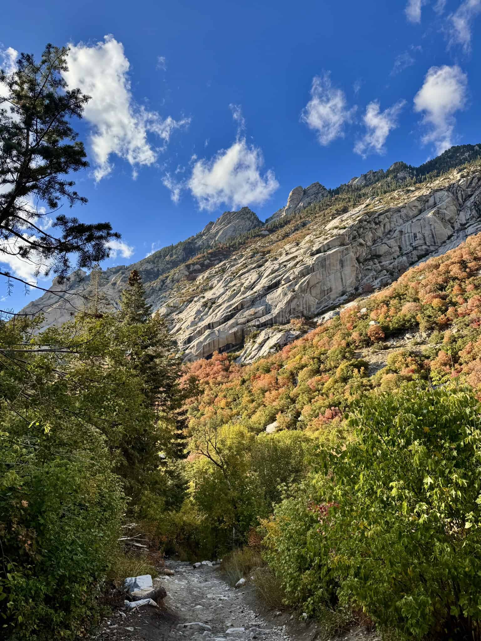
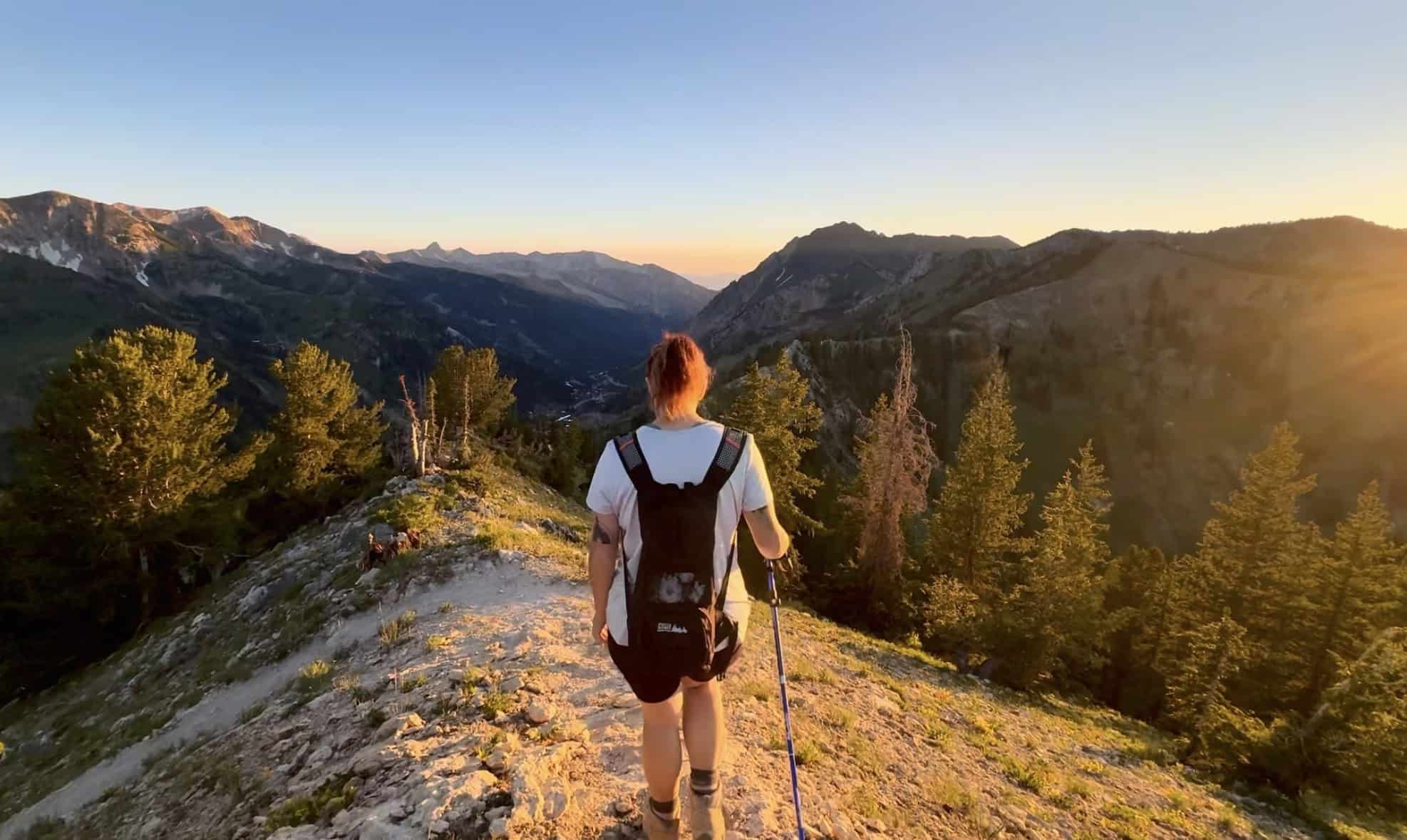
The Wasatch Foothills sit within minutes of Salt Lake City itself, and for many, these foothills are their backyards! While I have hiked most of the major peaks in this area, I often discover new hikes, as the trail system is vast and continually under development.
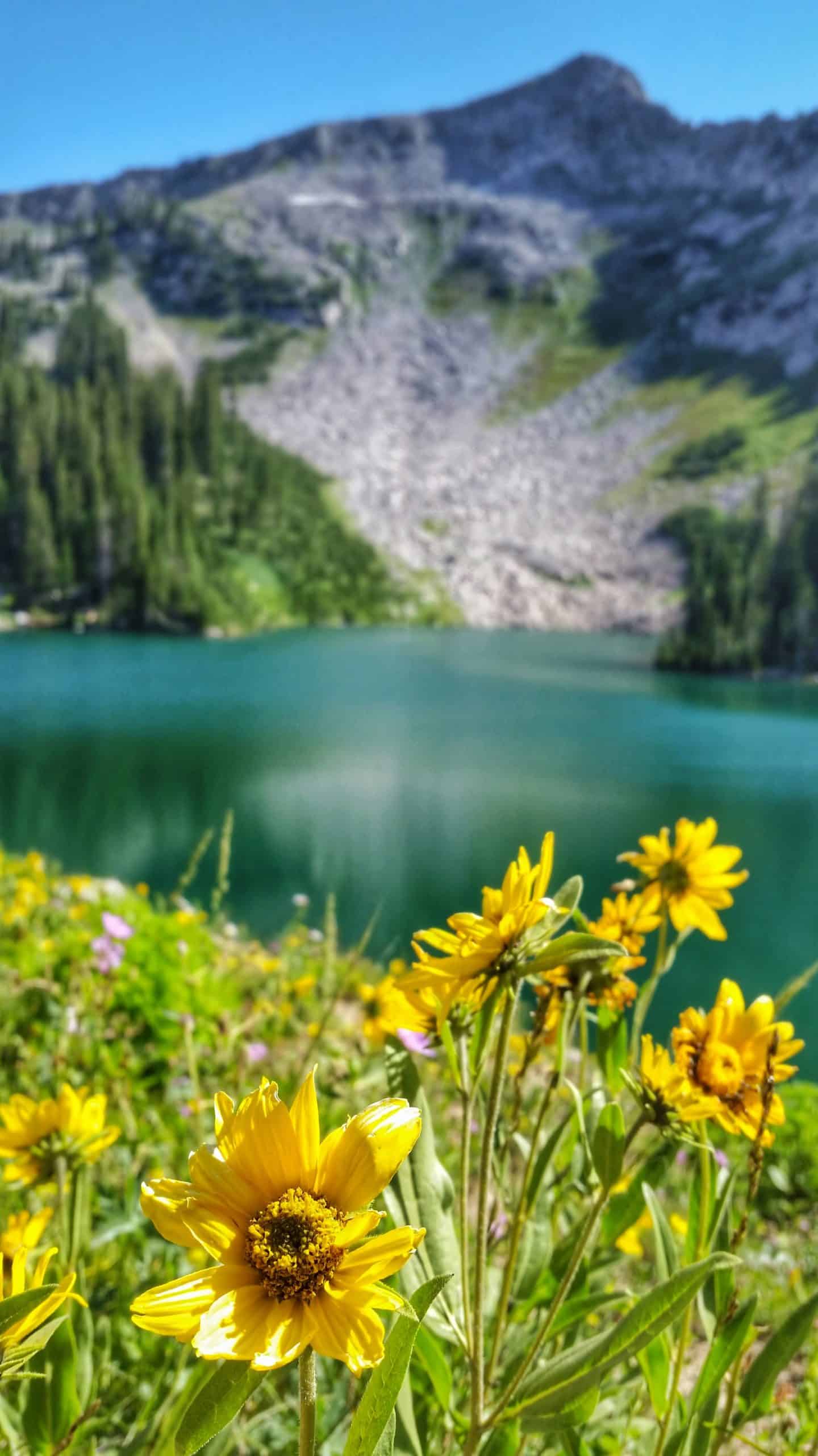
The mountains here are much shorter than the rest of the Wasatch Range, but they’re often underestimated, as these hills are steep! They also offer some of the best sunset views in the area, and in May, the wildflowers burst into spectacular color.
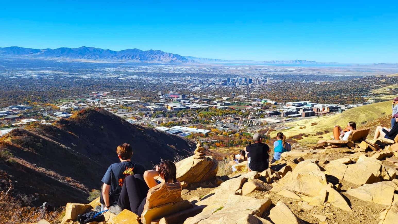
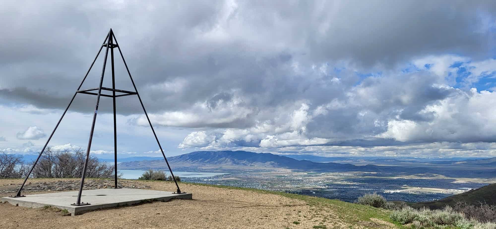
1. Ensign Peak
Ensign Peak sits high up on the bench just behind the Utah State Capitol and offers one of the best vantage points of Salt Lake City. The peak holds deep historical significance and is believed to be the spot where Brigham Young and the early pioneers first gazed out over the valley in 1847, envisioning the future settlement of the region.
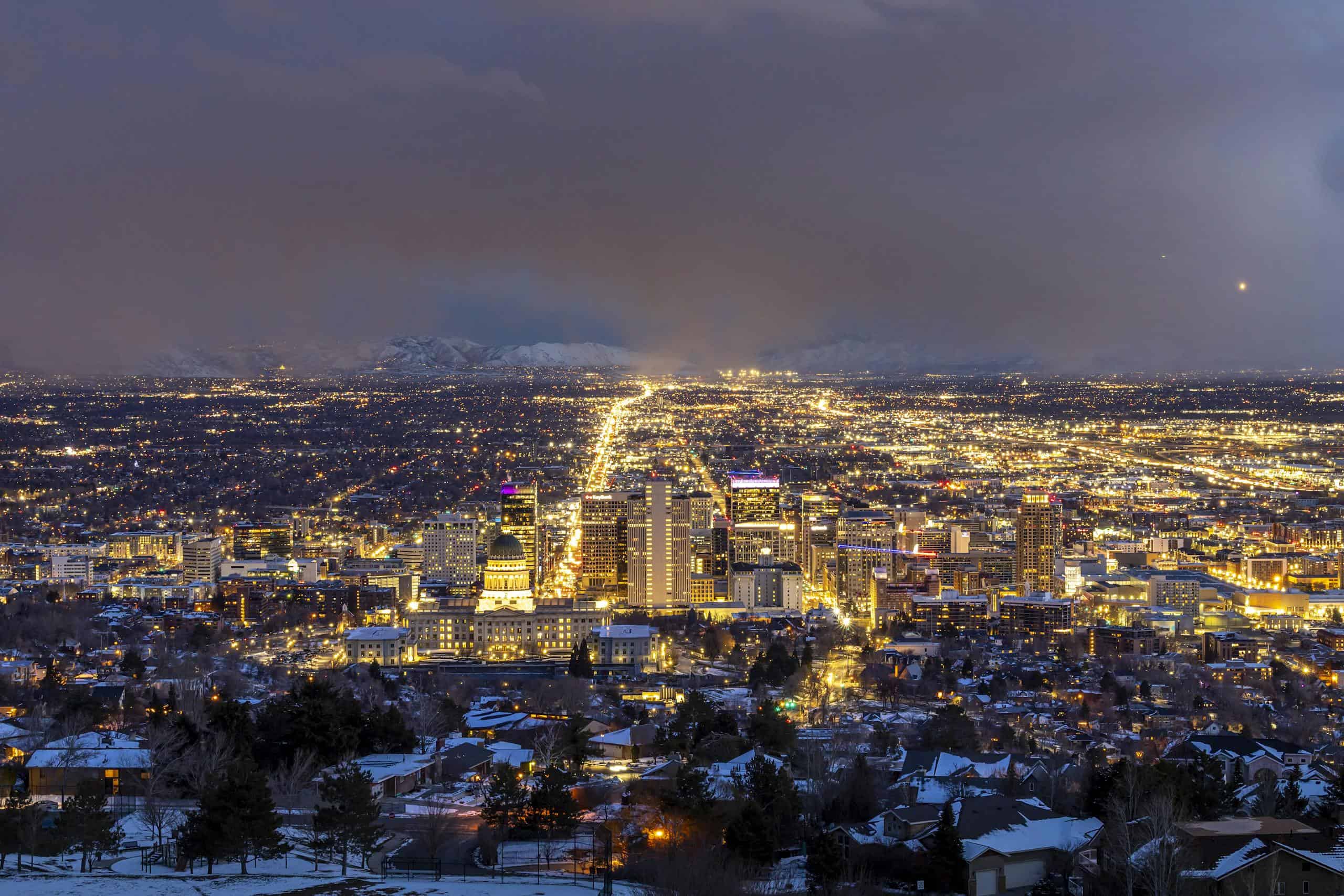
Today, a monument stands at the summit, accompanied by an unmistakable panoramic view of the valley below and the Wasatch Mountains looming in the distance! I’ve completed this hike in every season—at sunrise, sunset, and even at night—and the view truly never gets old
Pro Tip: I highly recommend watching the sunset and waiting to see the city light up at night!
2. Living Room
Do you ever reach the end of a hike and search for the perfect rock to sit on? Wouldn’t it be nice if someone had already arranged large stone slabs so you could simply show up, take a seat, and enjoy the view? Well, this scenic day hike near Salt Lake City offers exactly that.
The “Living Room” is a classic overlook perched above Red Butte Garden and the Natural History Museum of Utah. This hike is a Salt Lake City classic: short, steep, and well worth the effort for the view at the top, especially at sunset.
Just don’t forget a headlamp for the hike back down, you’ll thank yourself later!
3. Jacks Peak
Jack’s Peak is another classic day hike near Salt Lake City! It’s a short but steep hike to a “bump” on a ridgeline, with beautiful panoramic views of the Salt Lake Valley. What makes Jack’s Peak special is the memorial you’ll find at the summit, with a mailbox and a little Buddha statue. In the mailbox, you’ll find a book saying:
“Please take a moment to say hello to Jackie Jack and write a little (or long) note.”
Jack Edwards was a toddler who passed away from Lukeima in 1995. His parents hiked up to this point and spread his ashes, and since then, it’s been called “Jacks Mountain.” This hike is a gentle reminder of how fleeting life is and to cherish every moment!
4. Avenue Twin Peaks
Of the three sets of “Twin Peaks” in the Wasatch Mountains, the Avenue Twin Peaks are the easiest to hike! Similar to some of the hikes in the area, it offers open sweeping panoramic views of the Salt Lake Valley.
This hike is also the starting point for many longer hikes, should you feel adventurous enough! This area is also a mecca for mountain bikers!
Scenic Trails In Millcreek Canyon
Note: The Upper Canyon Road is closed for construction from March 15, 2026, through Fall 2026. Check the current status here.
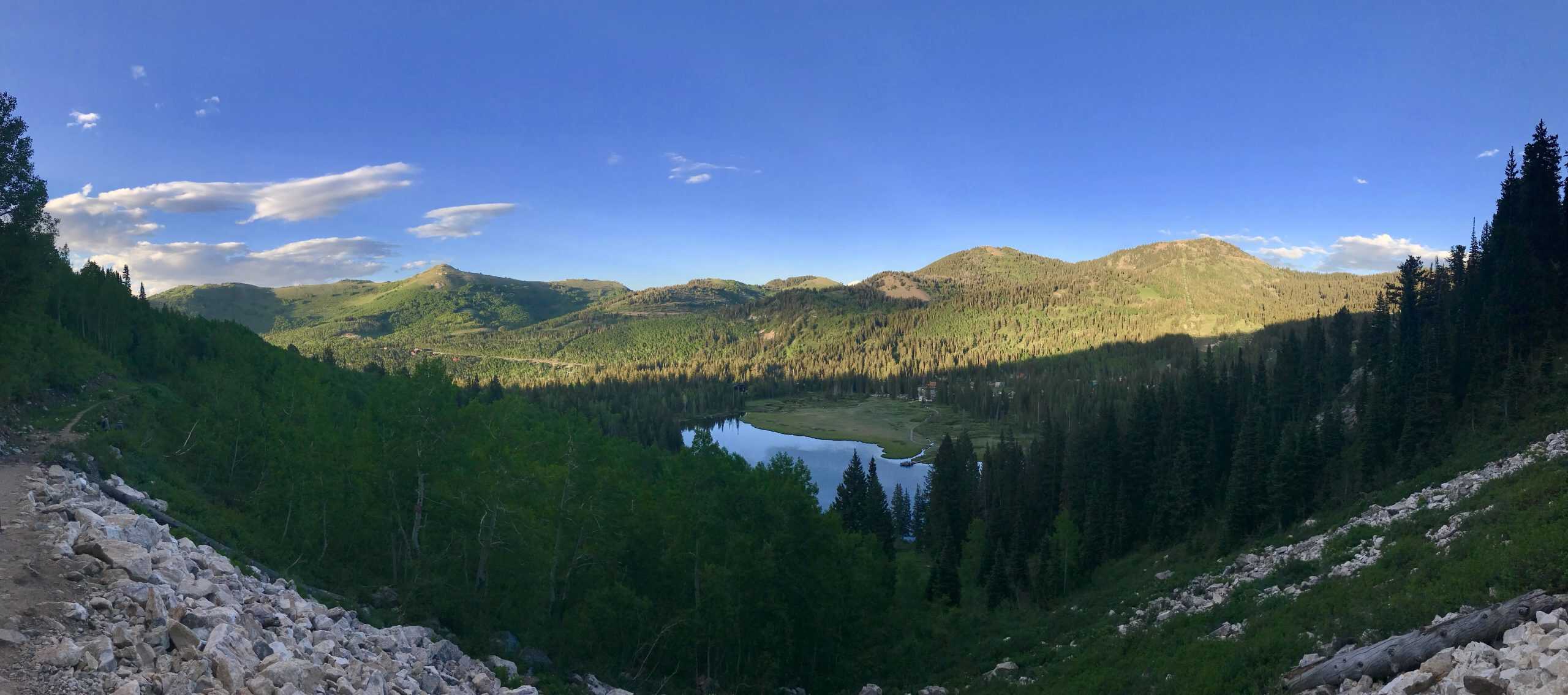
Millcreek Canyon is very much the “local canyon” near Salt Lake City. With no resorts and less hype than the Cottonwood Canyons, it is often overlooked. While not as rugged as its neighbors, it still offers eight unique trailheads and over 20+ different hiking trails! You’ll also notice numerous Boy Scout camps, as well as a one-of-a-kind restaurant (still on my bucket list).
Millcreek Canyon is worth visiting year-round. In winter, the upper canyon road closes to motorized vehicles, creating a unique playground for skiers and sledders.
Can’t miss: Grandeur Peak.
Runner-up: Pipeline to Salt Lake Overlook
5. Pipeline Trail to Salt Lake Overlook
This short hike rewards you with another beautiful vista of Salt Lake Valley and its surroundings. Along the way, you may notice water‑pipeline infrastructure – old steel and concrete that hints at the region’s development history. If you want to learn more, check out this in-depth article.
As you start hiking, you’ll immediately notice a trail branching off to the right. This is the “old” trail, and if you prefer a more gradual hike, keep going straight to reach the switchbacks.
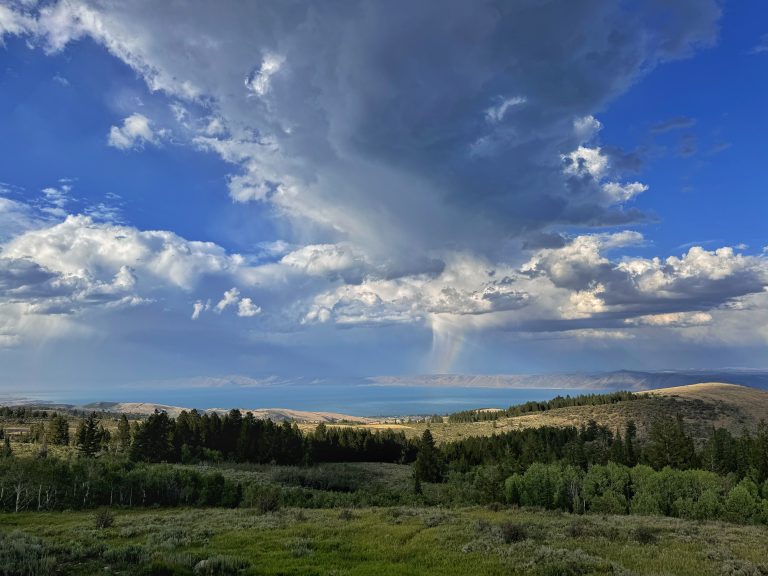
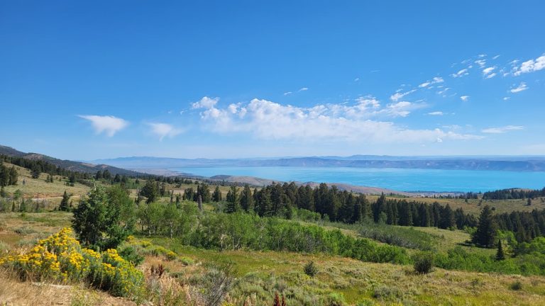
6. Desolation Trail To Salt Lake Overlook
This rewarding hike leads to a scenic view of Millcreek Canyon and Salt Lake Valley. The trail climbs through an old-growth pine forest, which leads to a stunning overlook where Salt Lake and distant mountains stretch across the horizon.
I personally enjoy the steady incline on this hike! Be sure to bring snacks, as the view at the end is very much “snack-worthy”.
7. Grandeur Peak
This hike begins at the Church Fork Picnic Area. If the small parking lot at the end of the picnic area is full, roadside parking is permitted (I park here regardless).
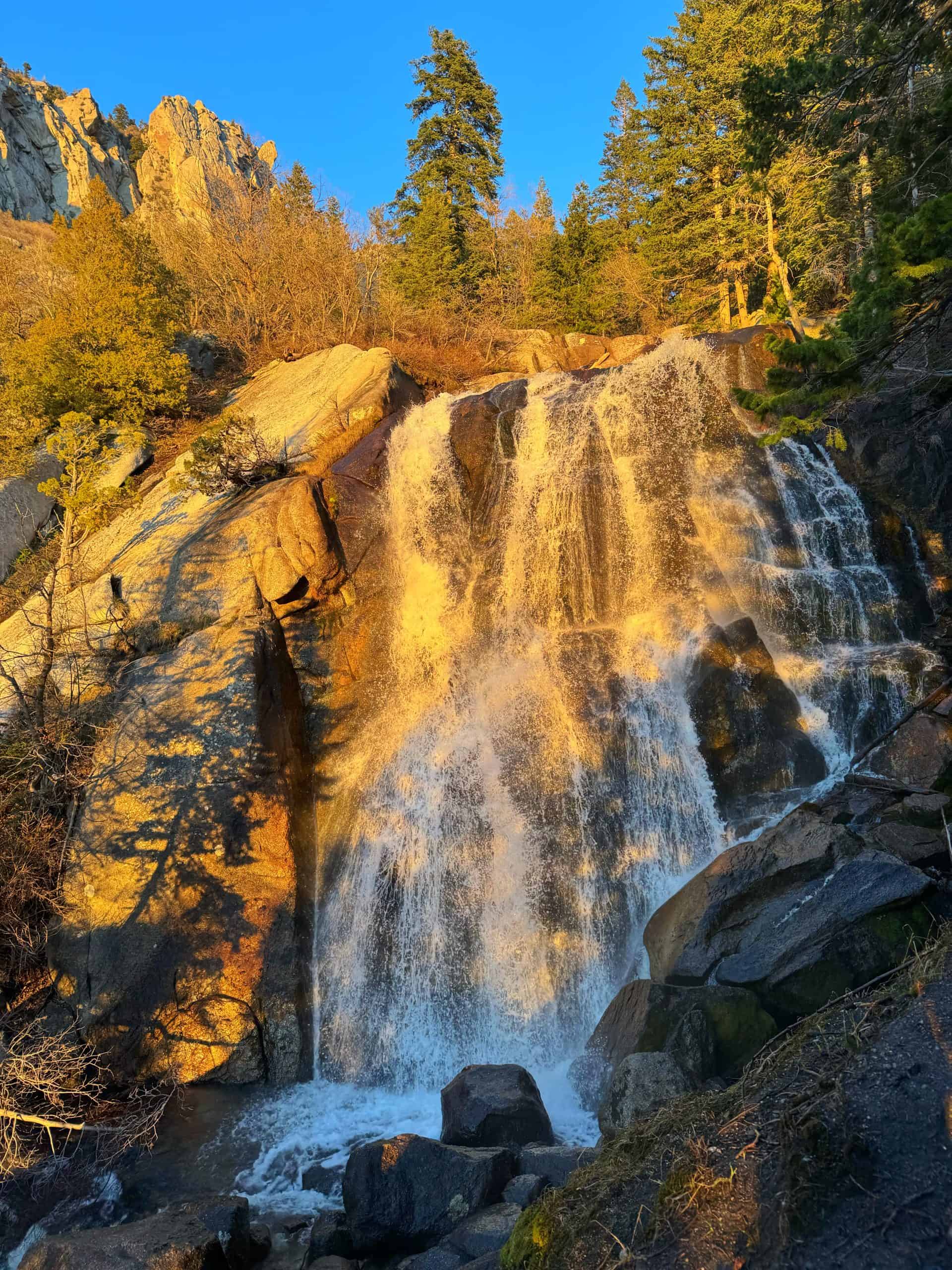
Grandeur Peak is a Wasatch classic, rewarding hikers with some of the most scenic summit views in the range. In the spring, the trail comes alive with numerous waterfalls flowing throughout the picnic area.
Winter brings a quieter, more peaceful experience with minimal avalanche danger, while the hike can be quite popular during the warmer months.
8. Mount Aire
Mount Aire starts at the “Elbow Fork Trailhead” in Millcreek Canyon, which is aptly named as the canyon road takes a sharp 90-degree turn. It’s a short and steep climb, but the summit views make it super worthwhile. Mount Aire is the high point on the same ridgeline as Grandeur Peak, so you know the views will deliver.
Don’t forget plenty of water, snacks, and sunscreen! If you’re hiking in the evening, keep an eye out for moose or deer along the way. In winter, the trailhead is only accessible by foot, which means a longer hike (and a bit more effort) but more solitude!
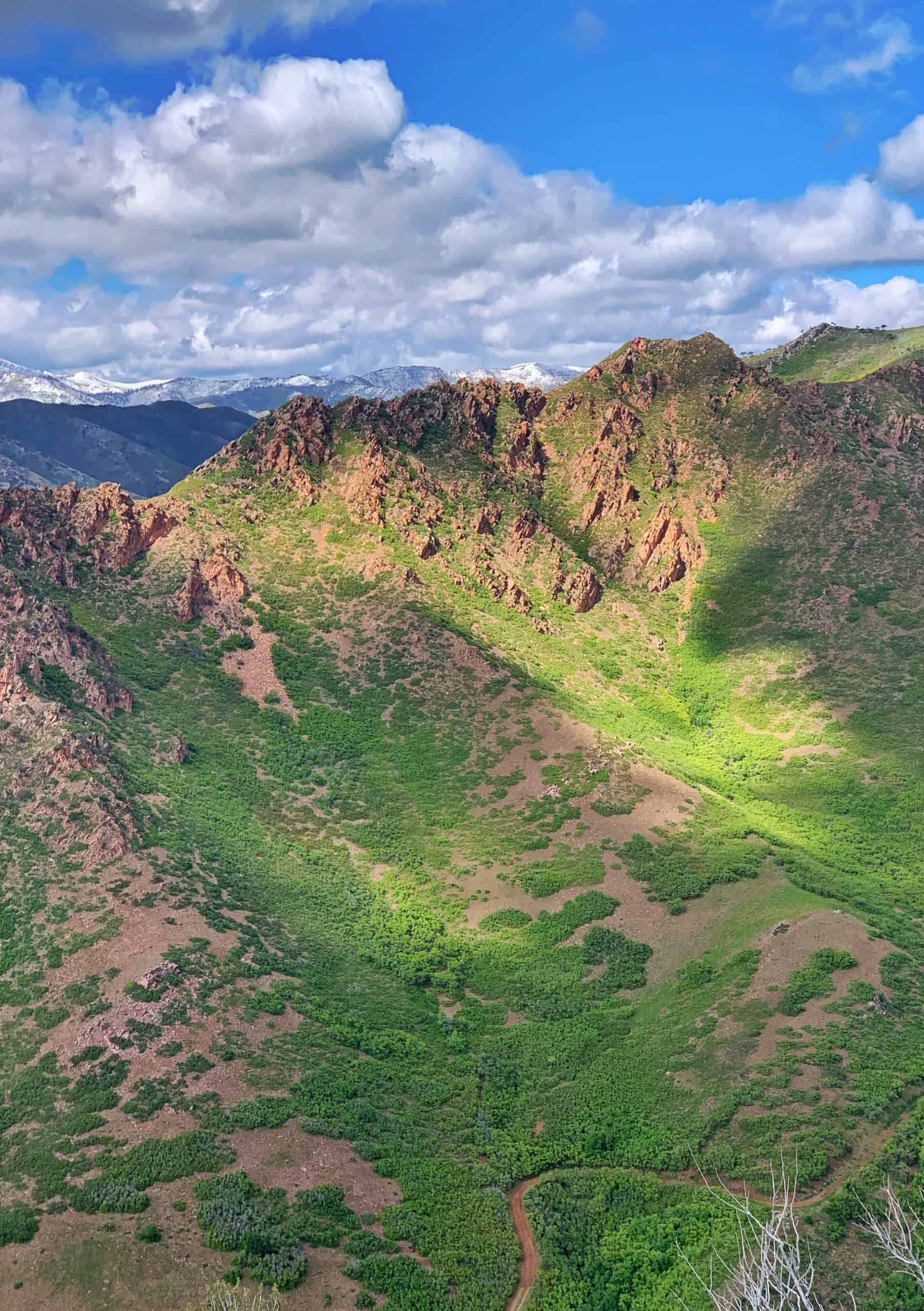
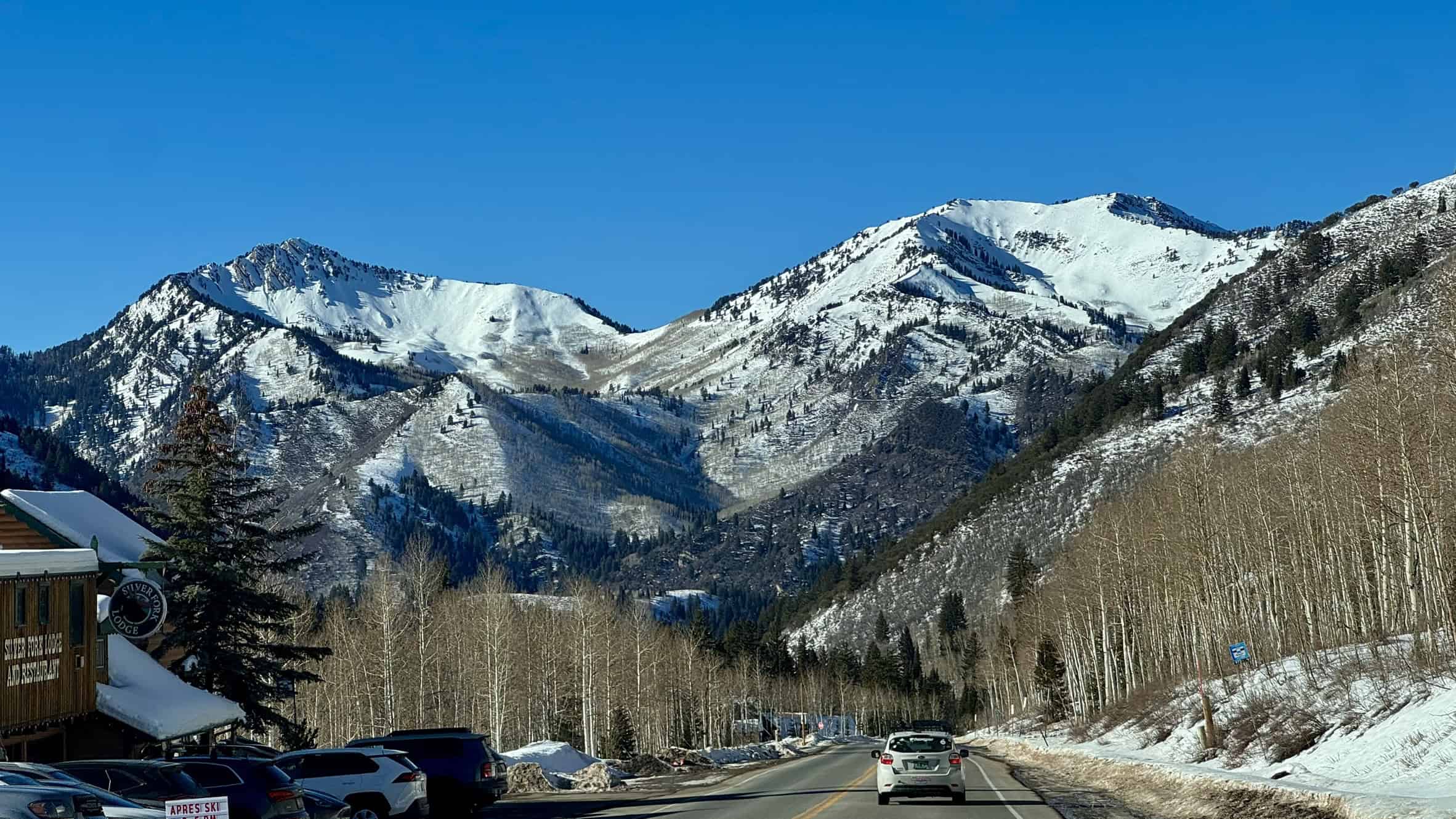
Scenic Trails In Big Cottonwood Canyon
Can’t miss: Lake Blanche.
Runner-up: Donut Falls
Big Cottonwood Canyon is one of the most popular hiking destinations near Salt Lake City, offering access to dozens of trails and two world-class mountain resorts. It’s a great place for everything from easy hikes to longer alpine adventures.
The canyon spans 15 miles (24 km) and delivers incredible views along a scenic drive dotted with trailheads. With so many options packed into one area, it’s home to some of the best hikes in the Wasatch.
Check out my full guide: 16 Incredible Hiking Trails in Big Cottonwood Canyon
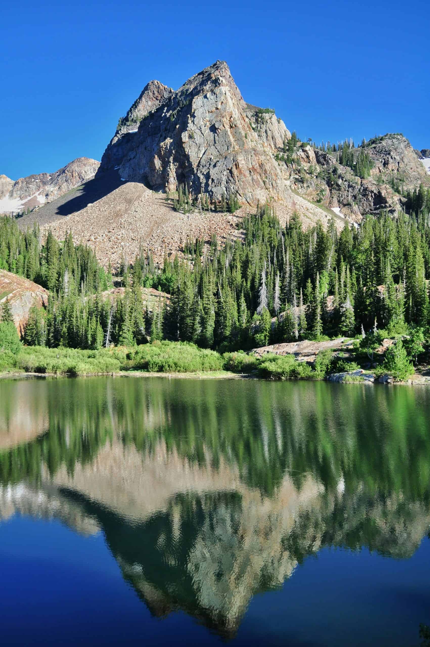
9. Lake Blanche
Locals know that Lake Blanche needs no introduction! If you only have time for one hike, this is the one! In fact, Lake Blanche was the first hike I ever completed, at the age of 13, and it’s been an annual tradition ever since.
Be sure to arrive at the trailhead early, especially on weekends. I’ve started this hike as early as 6 a.m. just to beat the crowds. The parking lot fills up quickly and can spill a mile out onto the road.
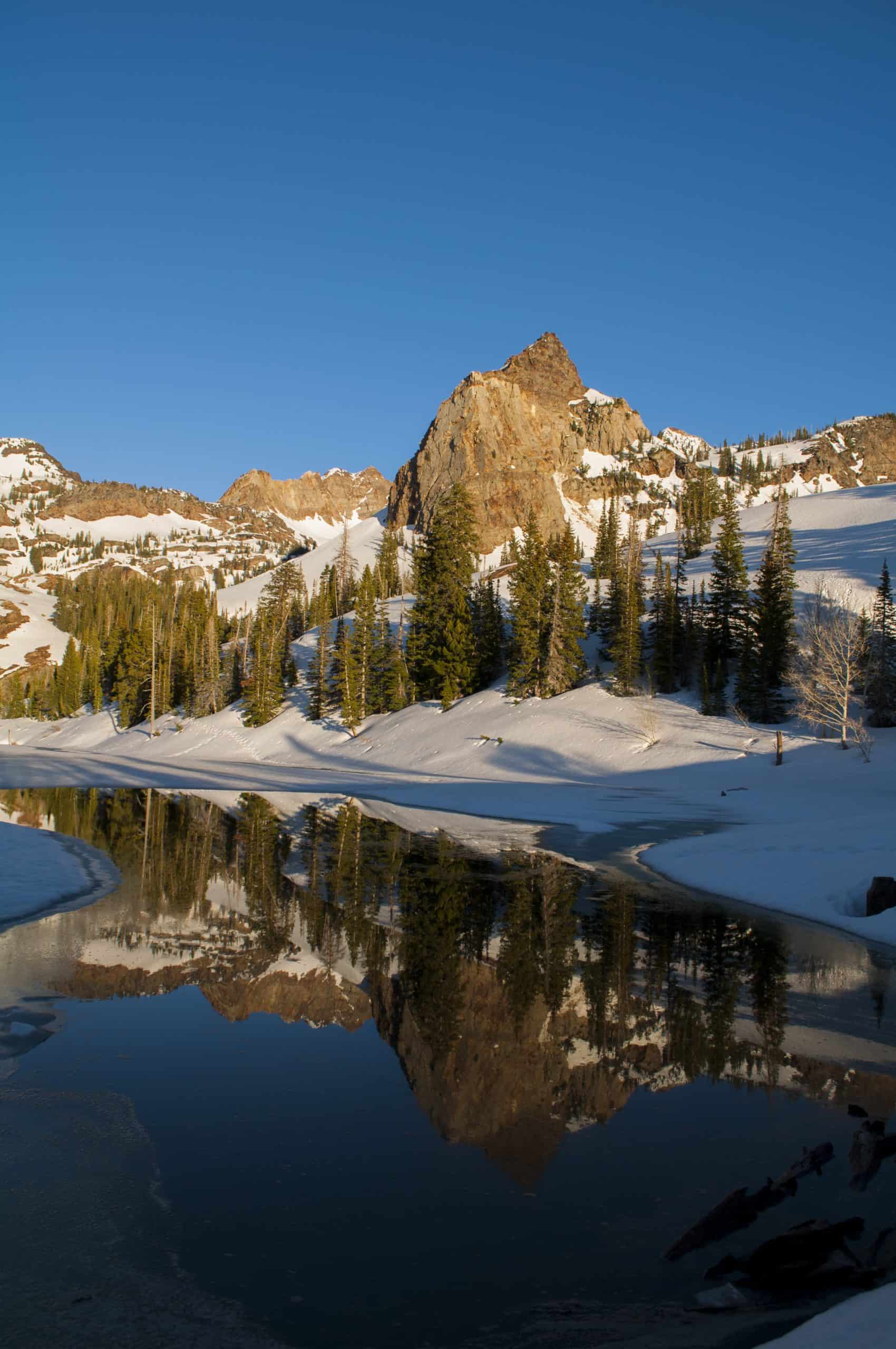
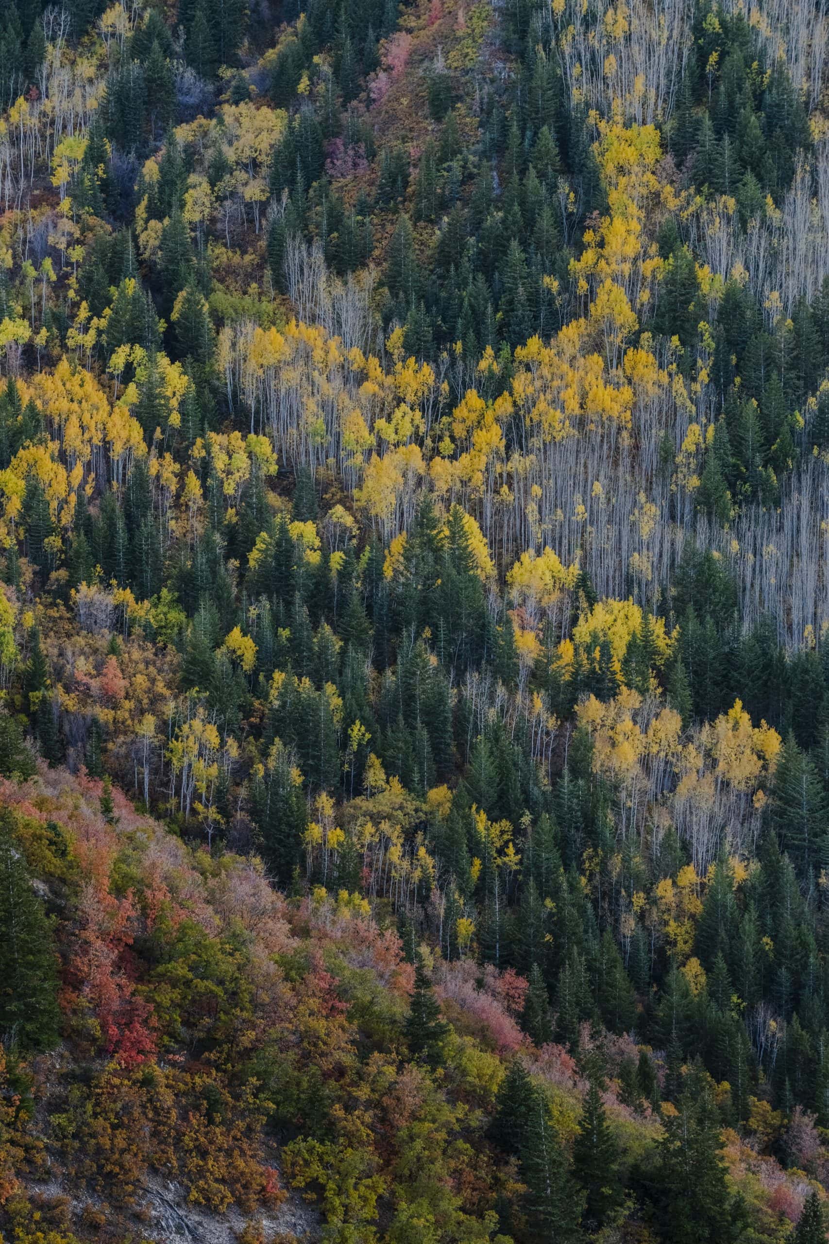
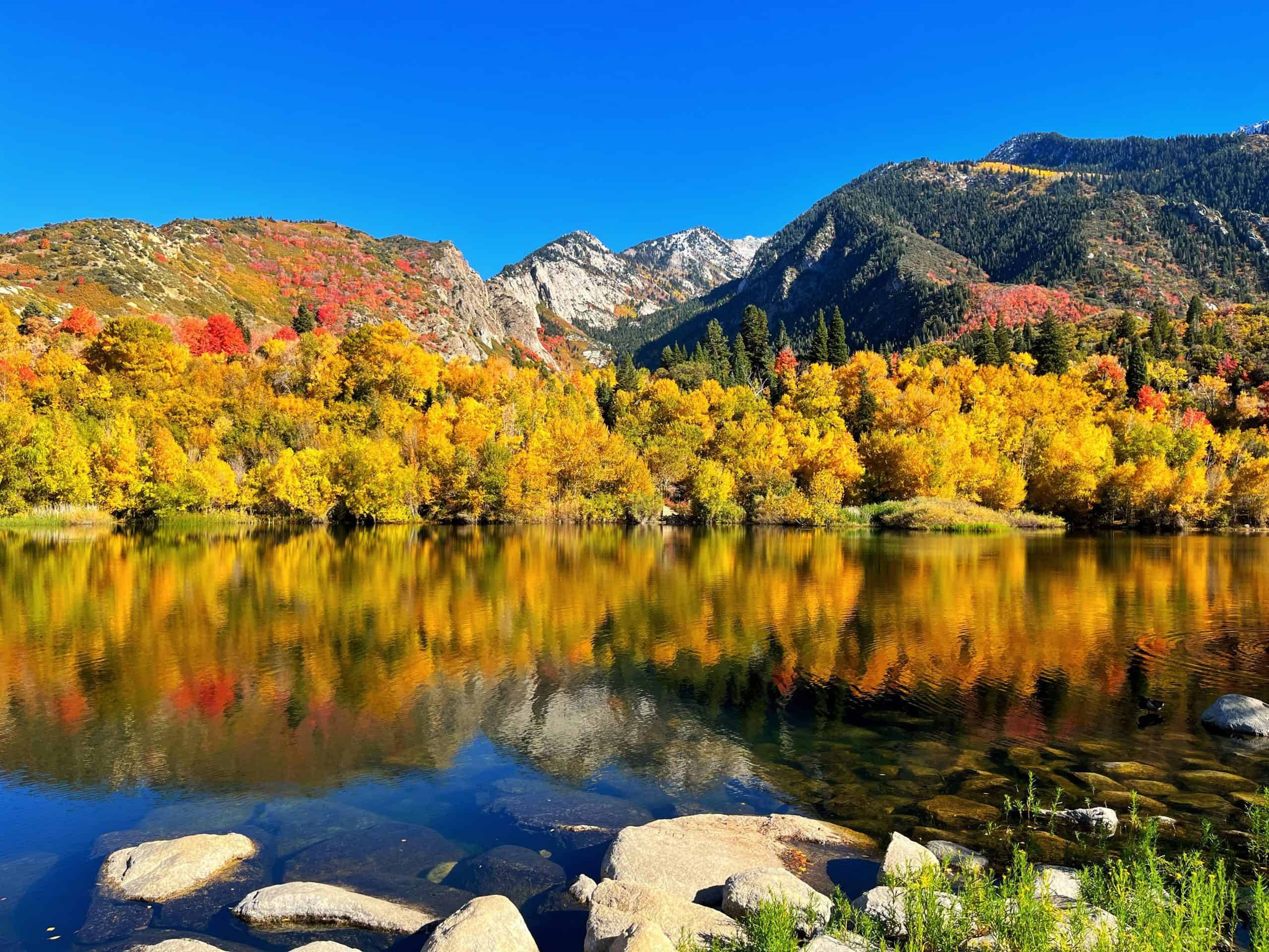
Lake Blanche is a fantastic year-round hike. Autumn is especially beautiful when the aspens light up the trail. In winter, it’s crucial to check avalanche conditions and trail conditions (AllTrails is a great resource). Microspikes are highly recommended when the trail is icy, and snowshoes are necessary after fresh snowfall.
While a winter trek may seem daunting, it offers solitude on an otherwise busy trail.
Pro Tip: Many people who visit Lake Blanche have no idea that two equally stunning lakes sit only five minutes further to the west.
10. Moss Ledge Waterfall
Moss Ledge always feels like a hidden gem. I first visited the area as a teenager, back when there was a small picnic area right at the trailhead. Today, no trace of the picnic area remains, but the place still carries the same sense of awe.
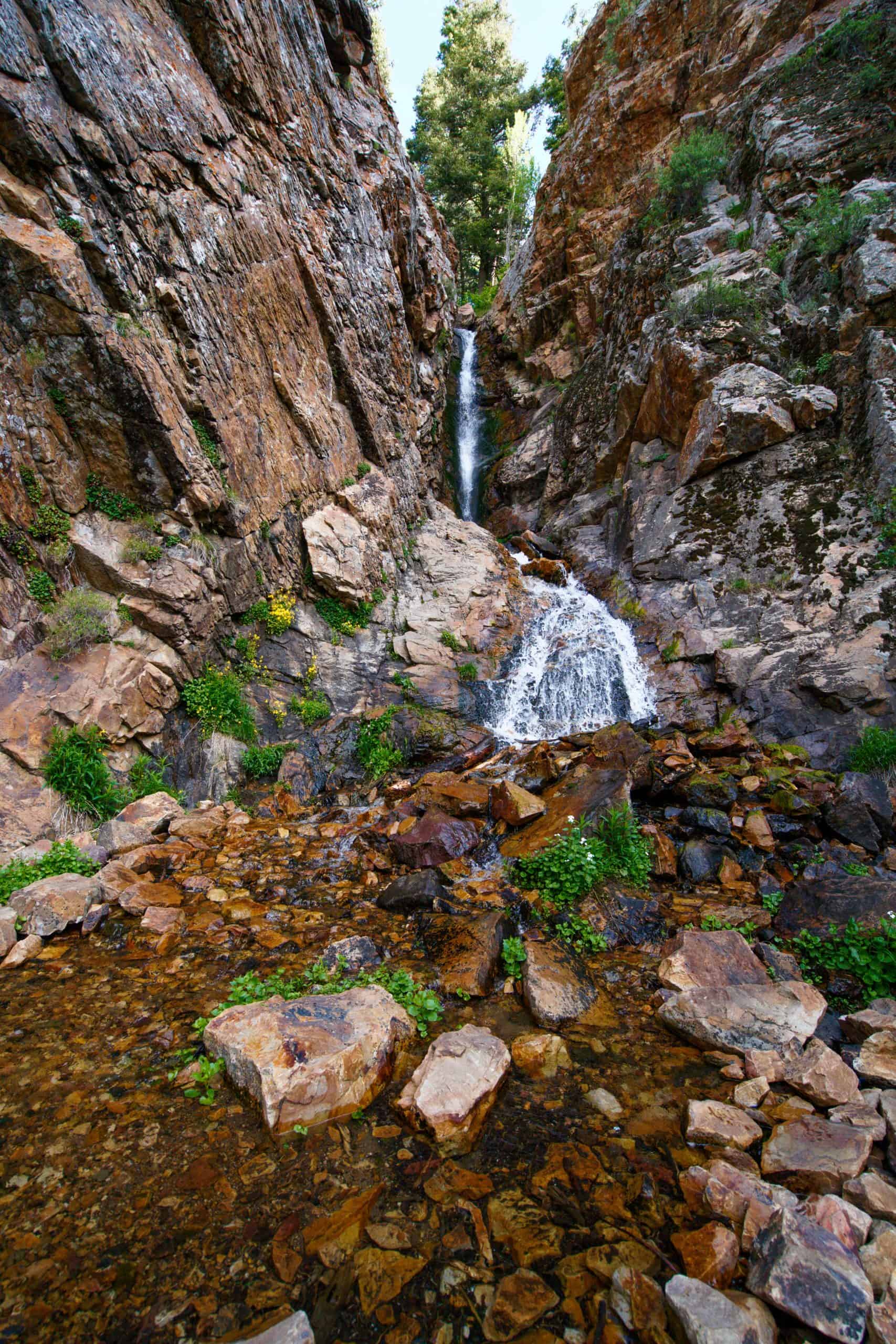
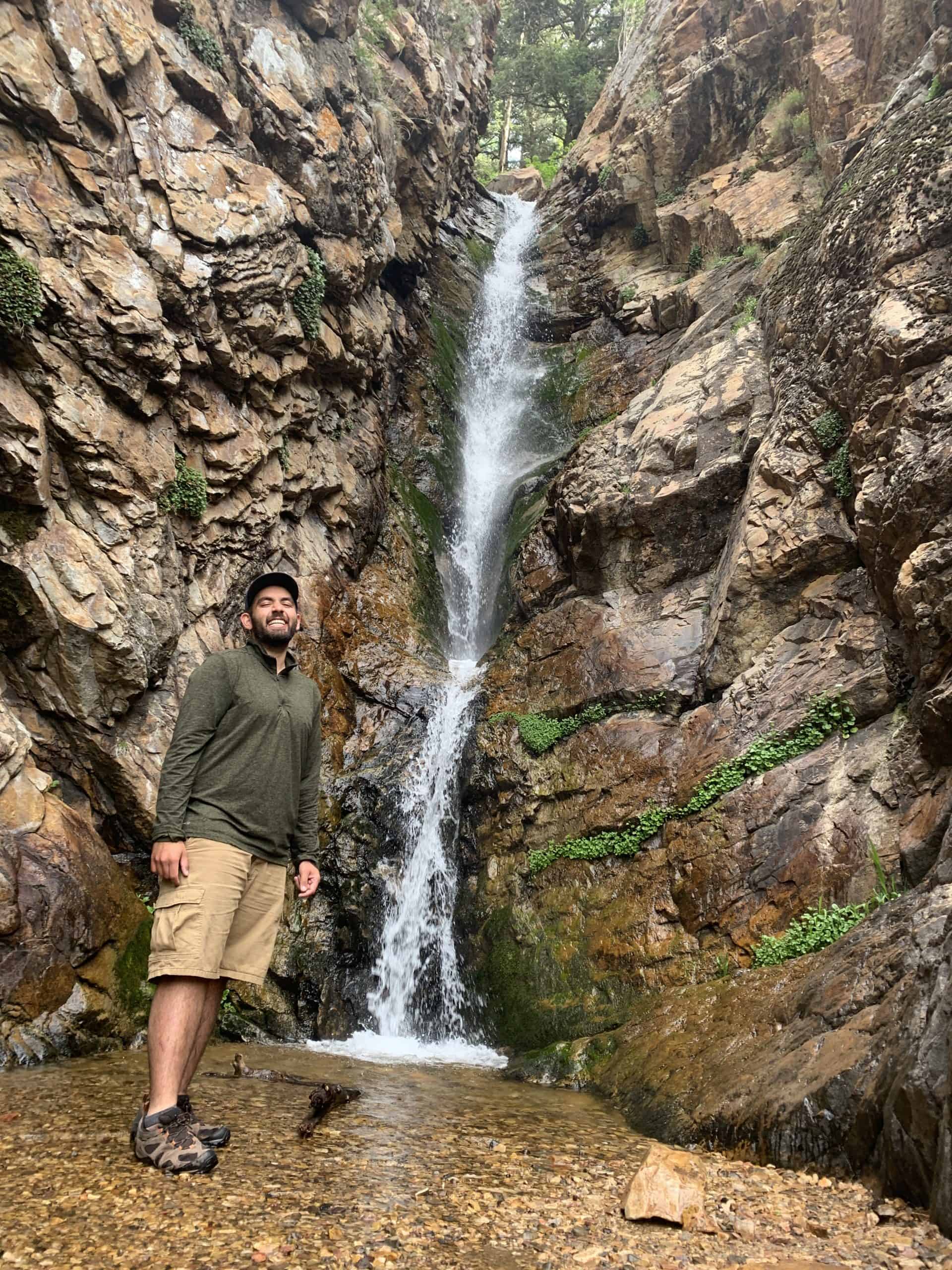
Getting to the waterfall requires a short but steep scramble along the creek. The route requires a sense of adventure as slick surfaces and light route-finding are part of the experience. The payoff is a secluded waterfall at the end, and an opportunity to cool off on a warm summer day!
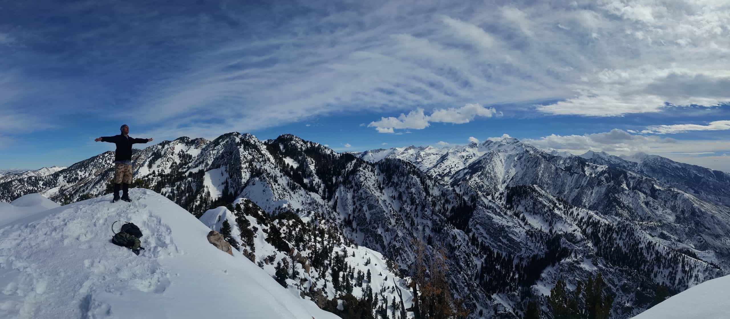
11. Mount Raymond and Gobblers Knob
Mount Raymond and Gobblers Knob are the highest points along the ridge separating Big Cottonwood Canyon and Millcreek Canyon, so you can hike them from either canyon.
The route starts at Butler Fork and climbs to Baker Pass. From there, Gobblers Knob lies to the east, while Mount Raymond is to the west. The final push to Gobblers Knob follows a steep trail, whereas Mount Raymond involves a Class 3 scrambling section.
The stats listed above are for completing just one peak. If you’re feeling ambitious, you can tackle both summits in one outing, turning the hike into roughly 10 miles (16 km) with 3,900 feet (1,190 m) of elevation gain. The reward? Jaw-dropping 360-degree panoramic views that are hard to beat
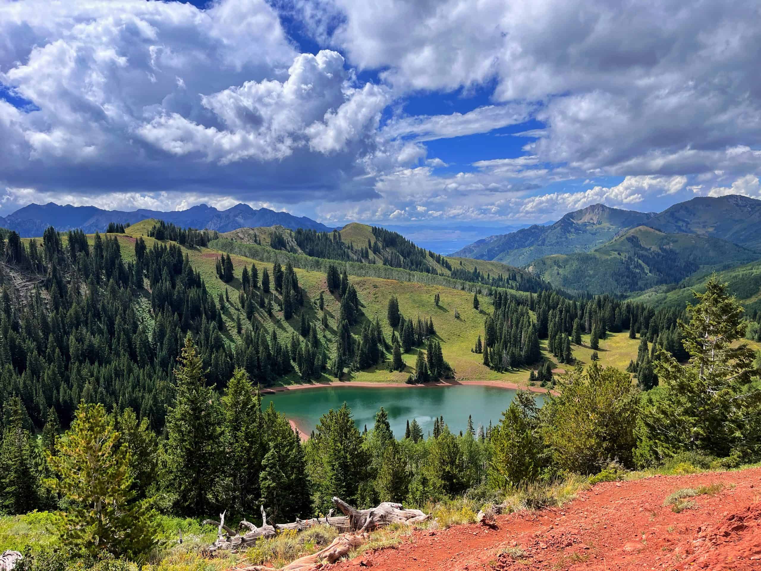
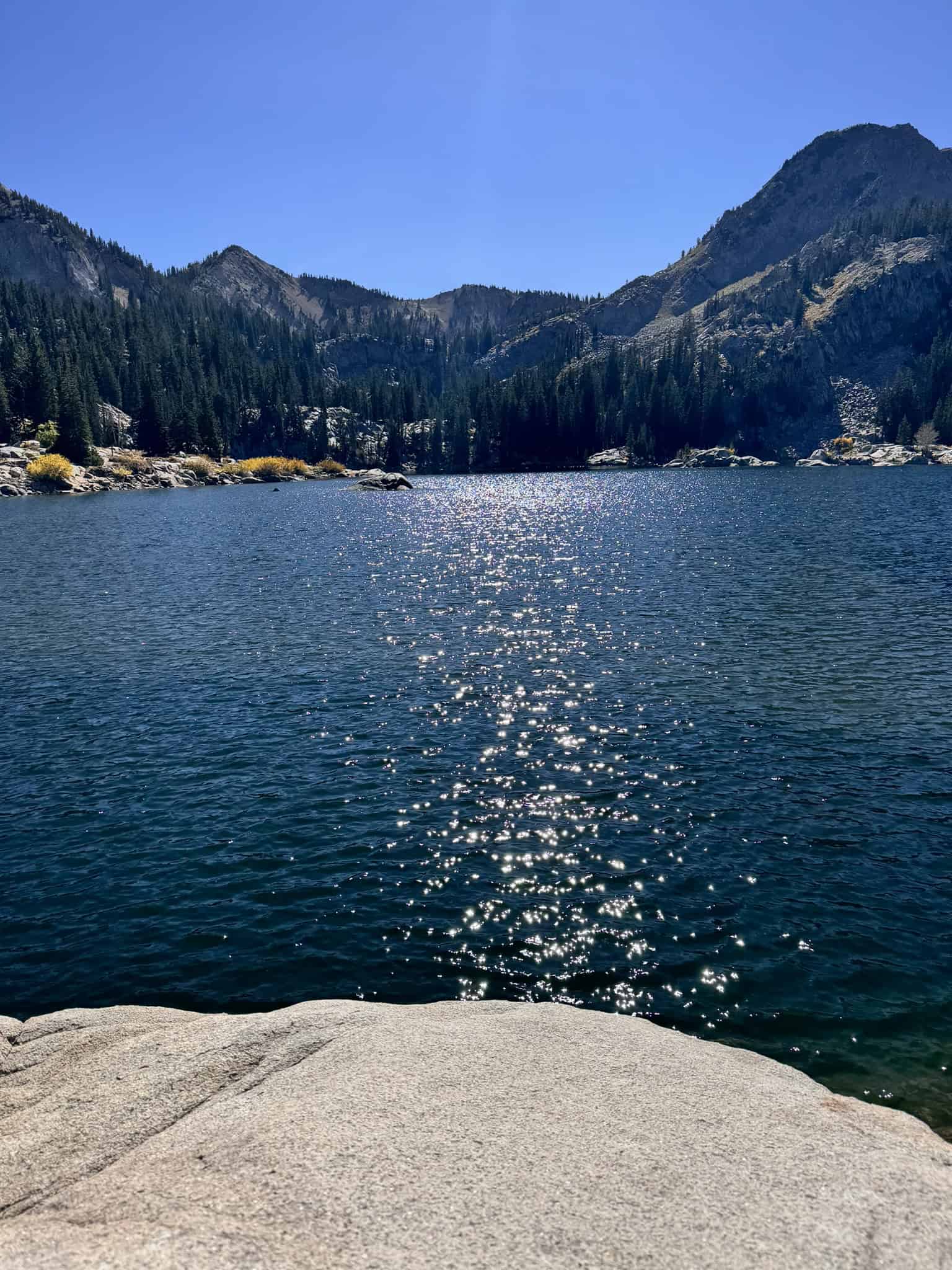
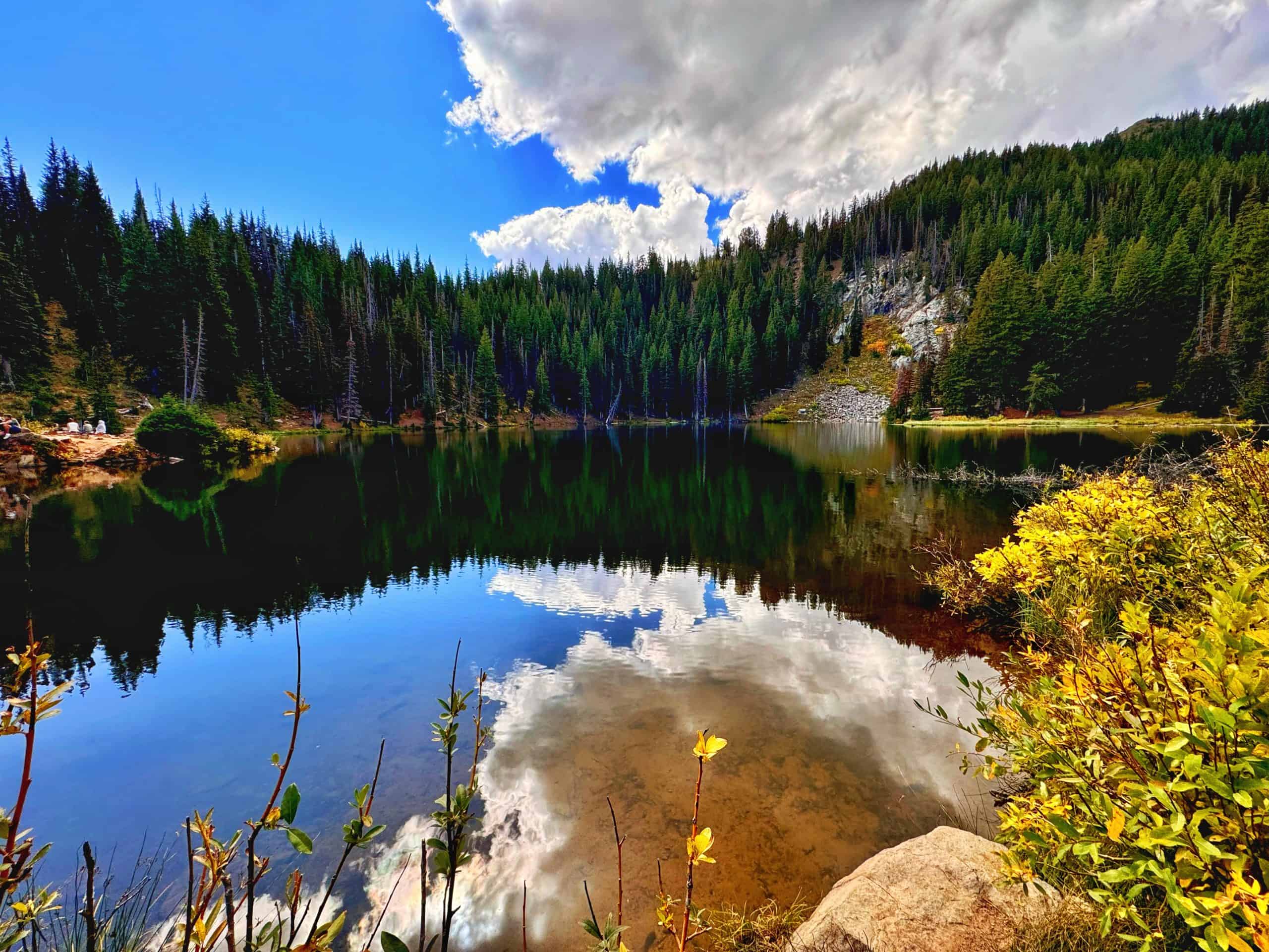
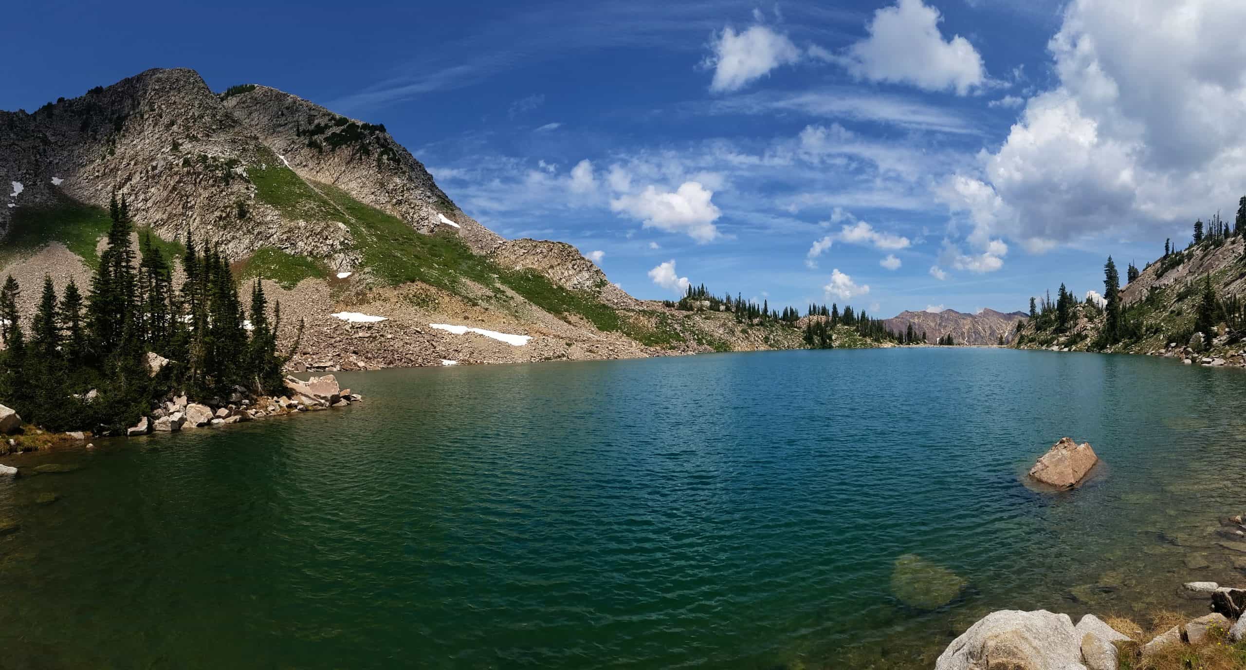
12. Desolation Lake
Desolation Lake is an underrated gem and doesn’t quite get the same attention as Lake Blanche or the Brighton Lakes. Its emerald-green water is framed by grassy meadows, aspens, and pine trees – making it less rugged but beautiful in its own way!
This trail is long but well-graded, and connects to a larger network of trails, including the Desolation Trail and the Wasatch Crest. This makes it very popular with mountain bikers and trail runners. There is ample parking at the trailhead, but as of 2025, a fee is required.
Bonus: If you’re feeling energetic, hike up to the pass directly east of the lake. This turns the hike into 10 miles (16 km) round trip with ~2,356 feet (718 m) of elevation gain. The view of the lake from the pass is postcard-worthy!
Pro Tip: Bring a hammock to hang along the south end of the lake!
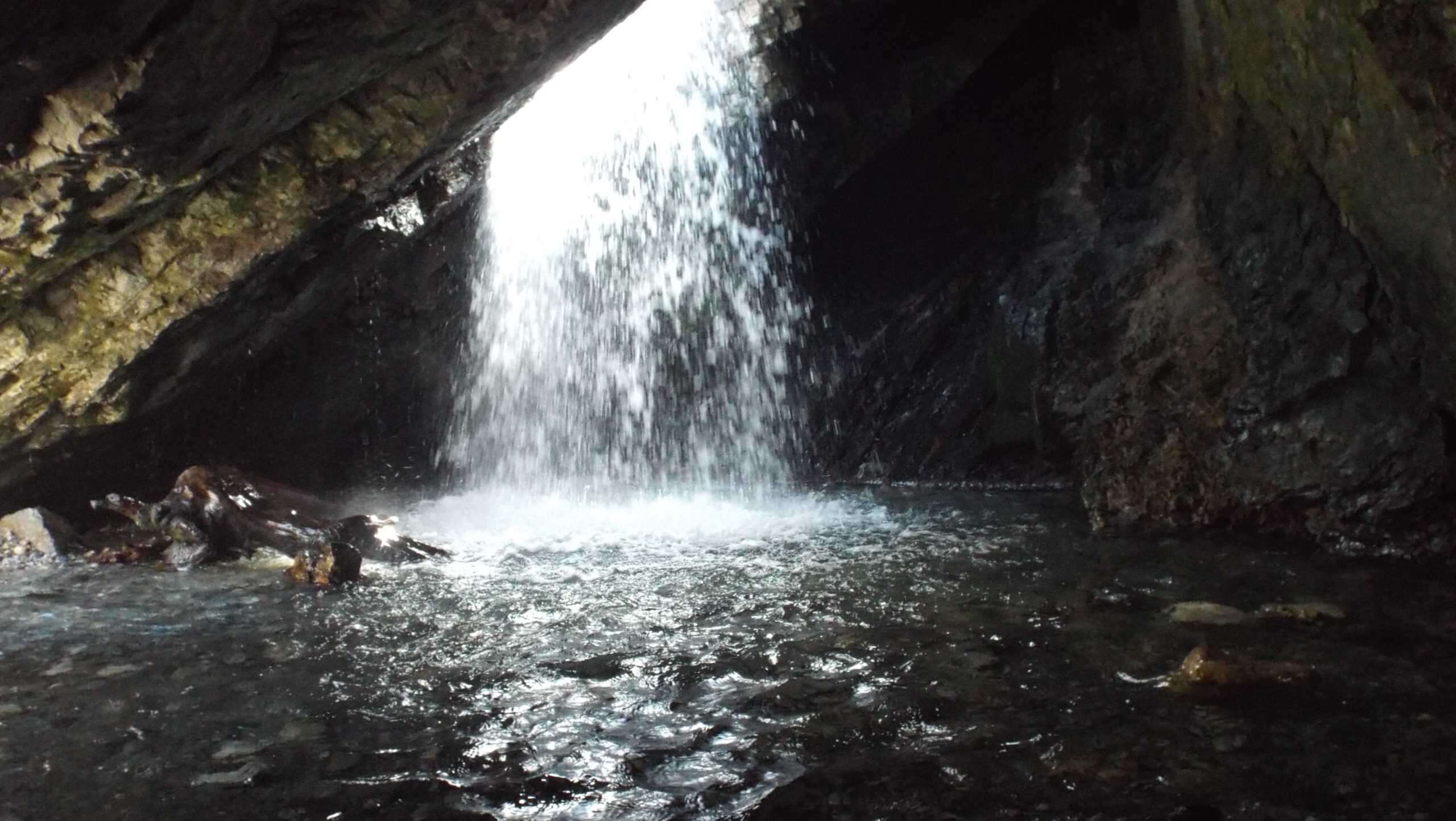
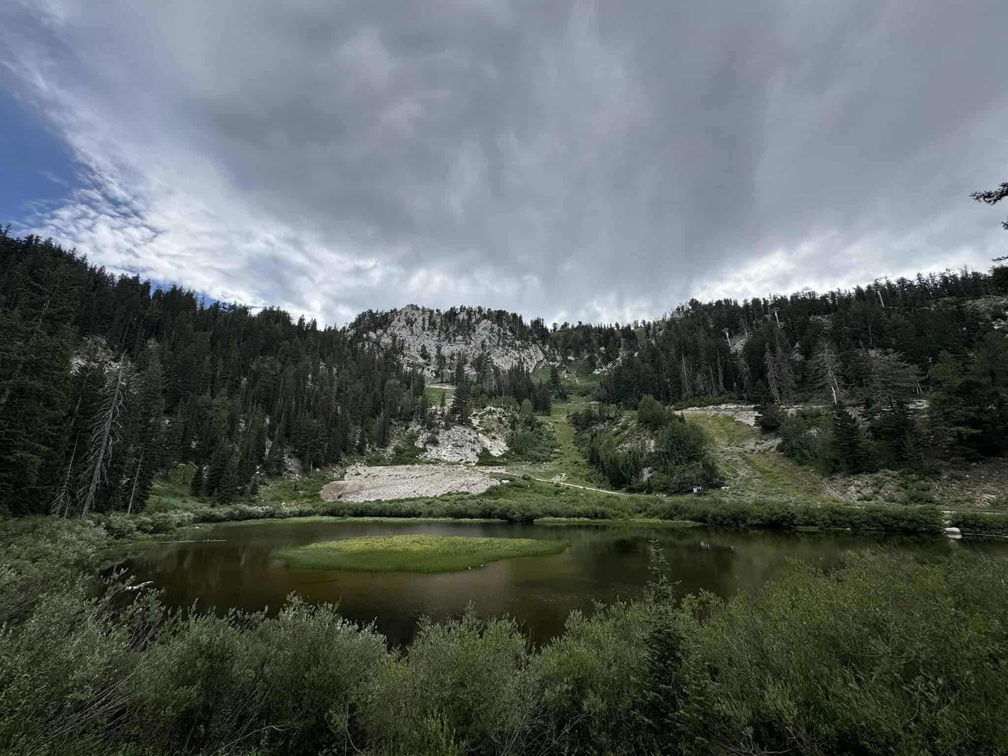
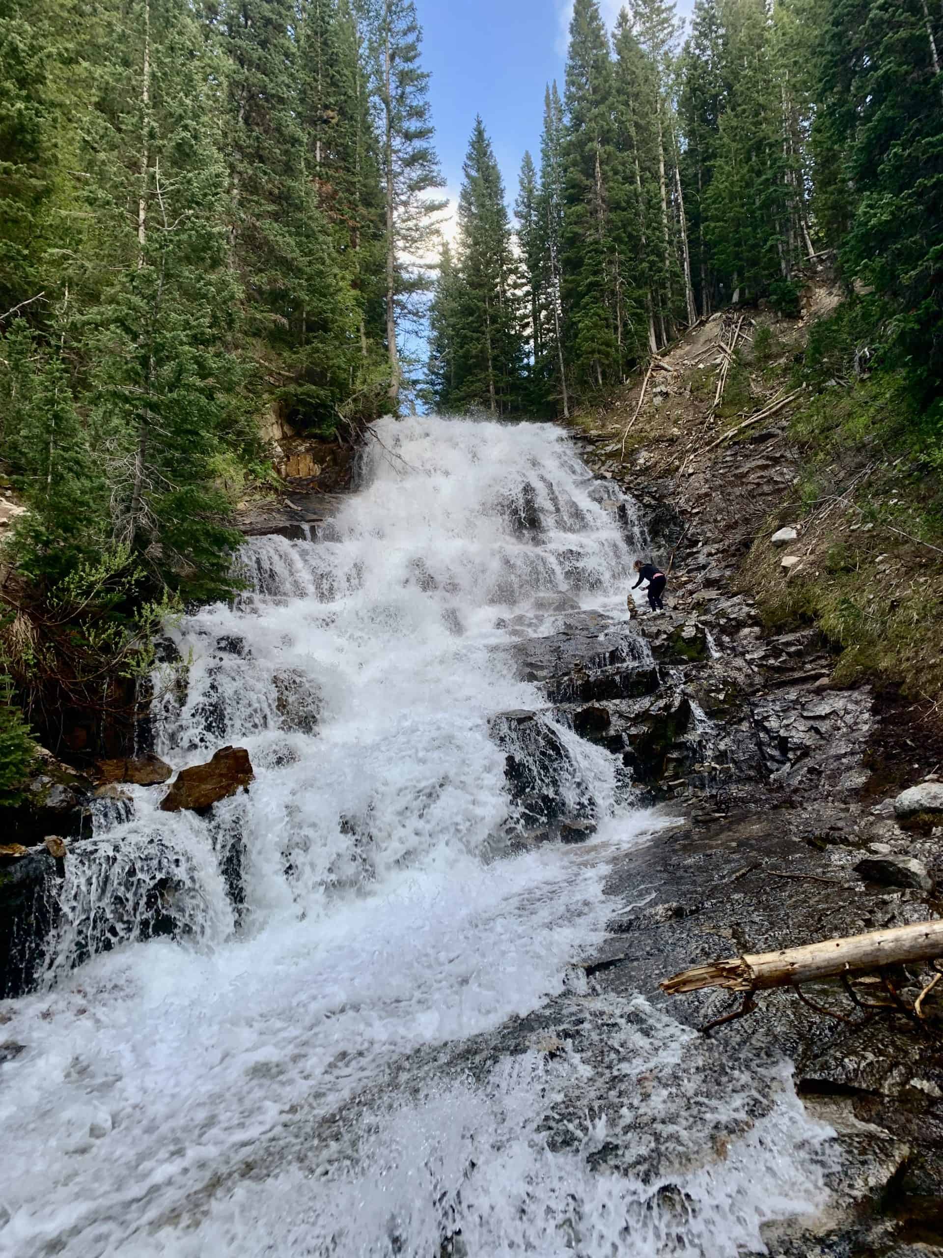
13. Donut Falls
Ask any local, and they’ve likely been to Donut Falls at some point. It is a unique waterfall that falls into a cave through a donut-shaped rock. But sadly, there’s no donut shop at the end!
The summer trailhead has limited parking and starts at the end of a short dirt road. As a result, the more commonly used trail begins at the main road. From there, use the newly established trail that avoids the dirt road, per the request of the area’s cabin residents.
While many hiking guides label Donut Falls as an easy, family-friendly hike, the final section surprises many first-timers. Reaching the falls requires a short downclimb, followed by a rock scramble to enter the cave.
Pro-Tip: Avoid going in the springtime during peak runoff (April-June). I first went years ago in June and left disappointed, as the cave is inaccessible when there’s too much runoff.
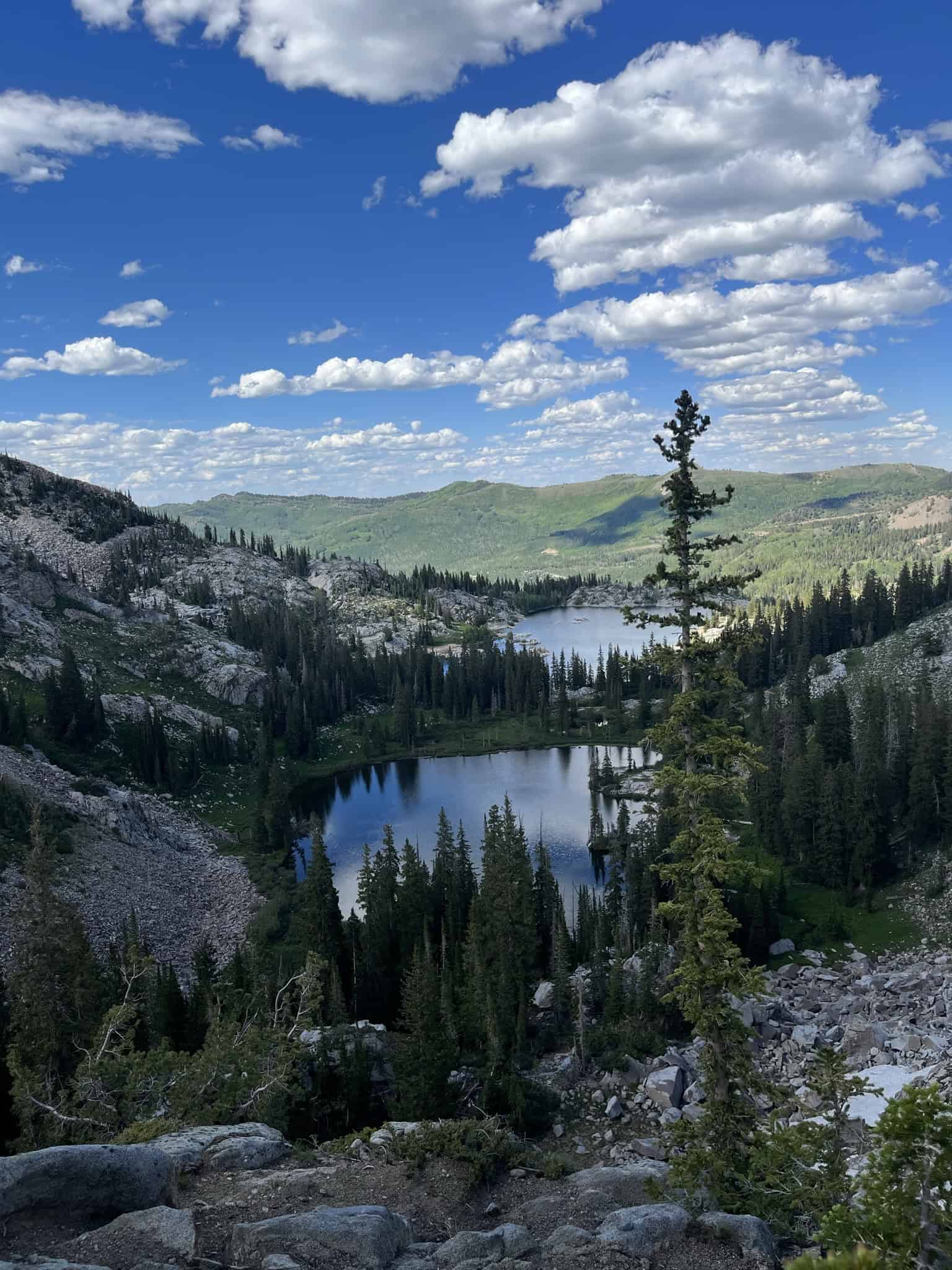
14. Brighton Lakes Loop
This one-loop hike takes you past seven alpine lakes within the Brighton Resort at the top of Big Cottonwood Canyon. It’s the only hike in the Wasatch Range where you can see this many scenic alpine lakes in a single outing.
The loop begins at Brighton Resort on the Lake Mary Trail. Next stop is a short detour to Dog Lake, then to Lake Mary → Lake Martha → Lake Catherine → Catherine Pass, before returning to Lake Mary. From there, follow the connector to Twin Lakes → Lake Solitude → Silver Lake, and back to the trailhead.
I’ve built this exact route on AllTrails for easy navigation. Check it out there before you go.
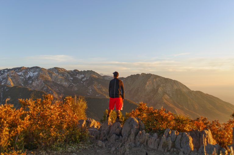
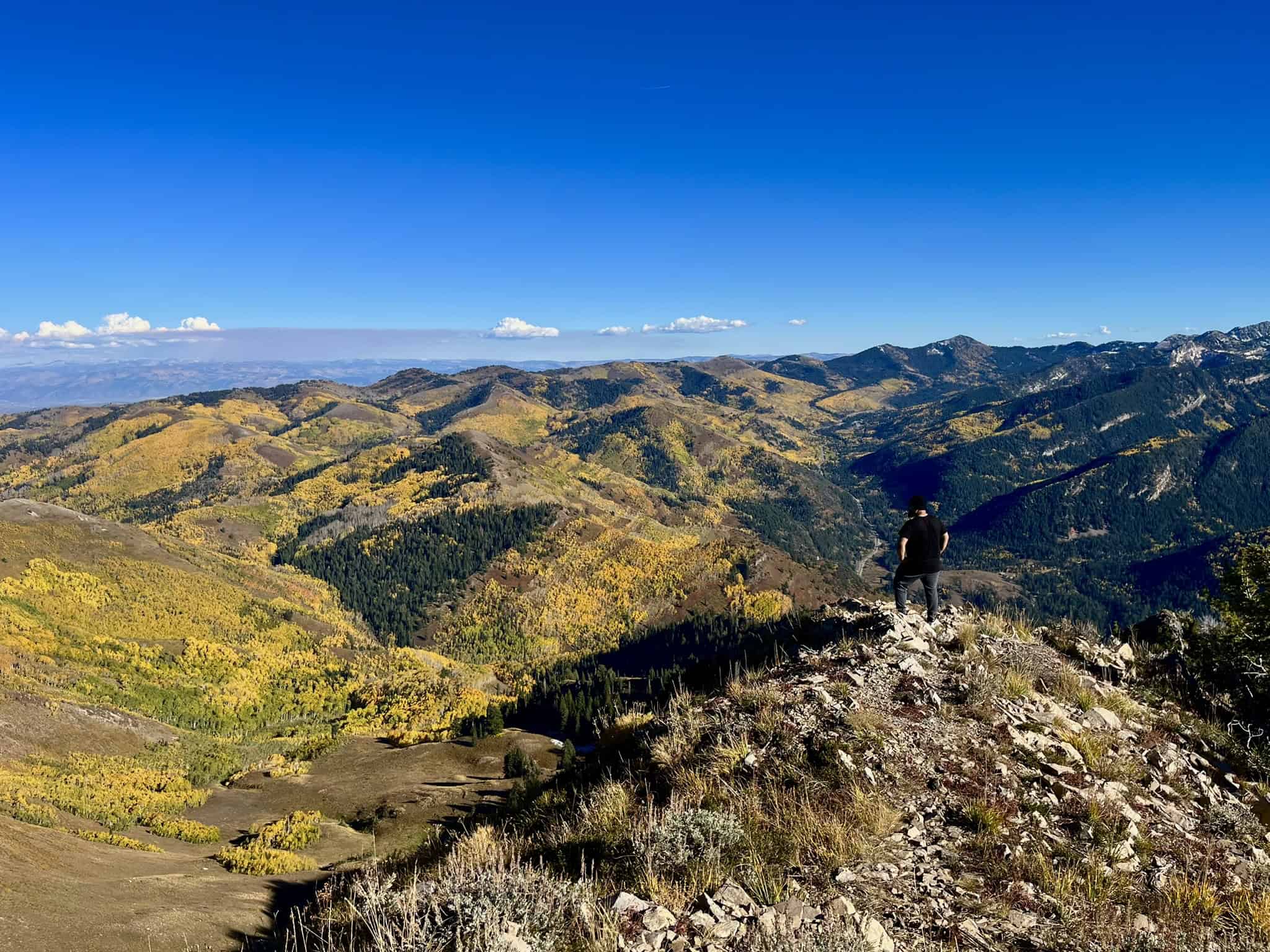
15. Clayton Peak
The summit of Clayton Peak offers one of the best views of Big Cottonwood Canyon, making it one of my favorite day hikes near Salt Lake City! It sits along a ridge of peaks that form the spine of the Wasatch Mountains, known as the Wasatch Crest. The final 1/4 mile (0.4 km) is steep and involves some easy rock scrambling.
1.5 miles (2.4 km) into the hike, you’ll reach Bloods Lake, and at 2.1 miles (3.4 km), the trail splits, with a short 1/3 mile (0.5 km) detour taking you to Lackawaxen Lake. Both lakes are very scenic, with Lackawaxen being the quieter, more secluded option.
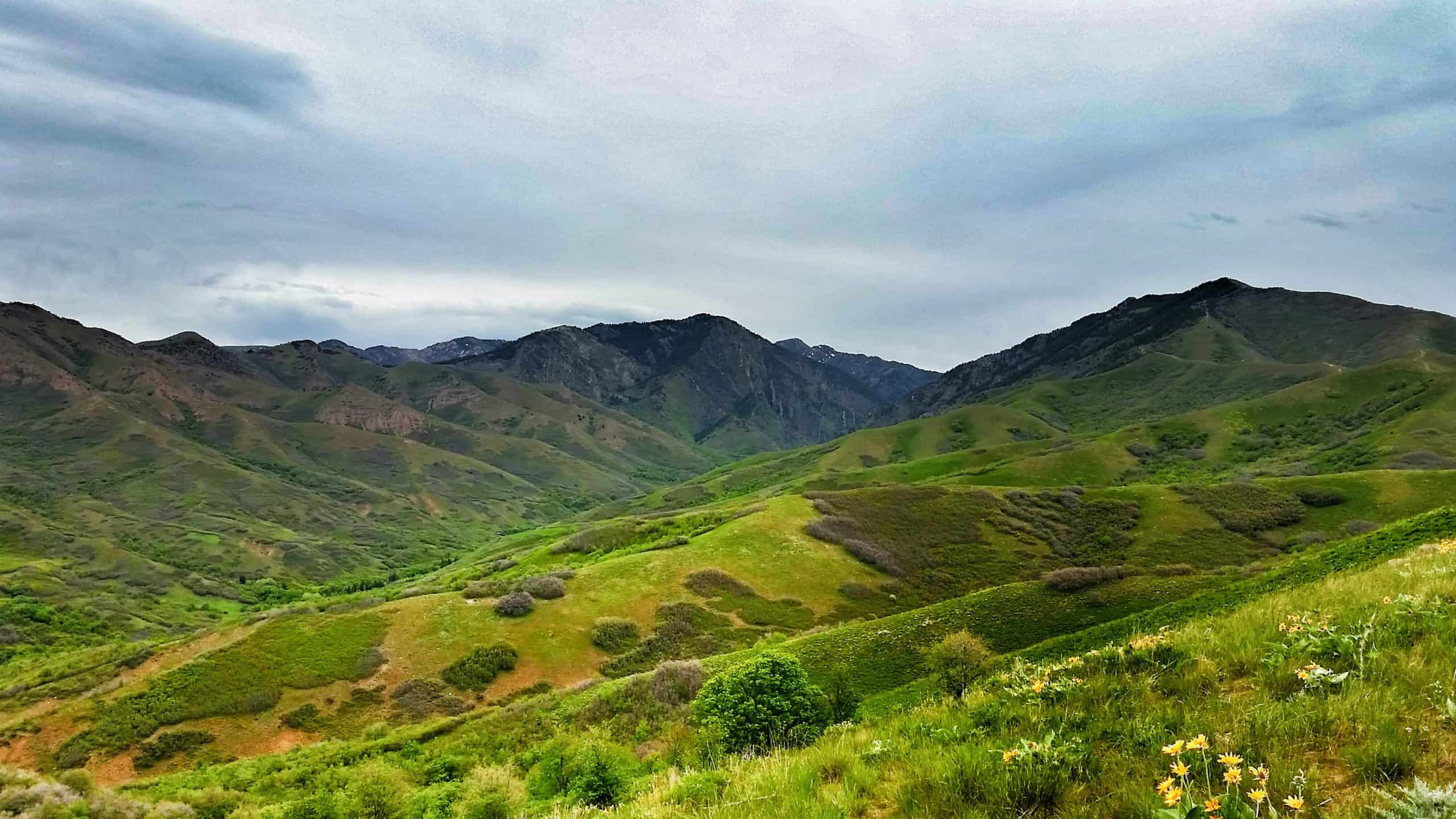
Scenic Trails In Little Cottonwood Canyon
Can’t miss: Red Pine Lake
Runner-up: Cecret Lake
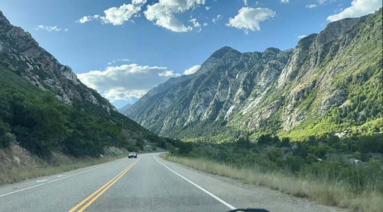
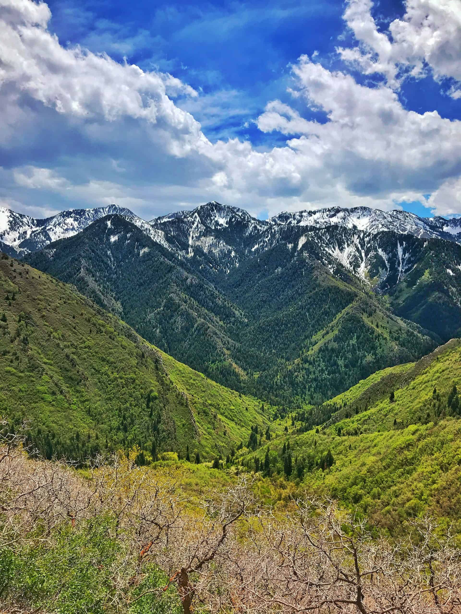
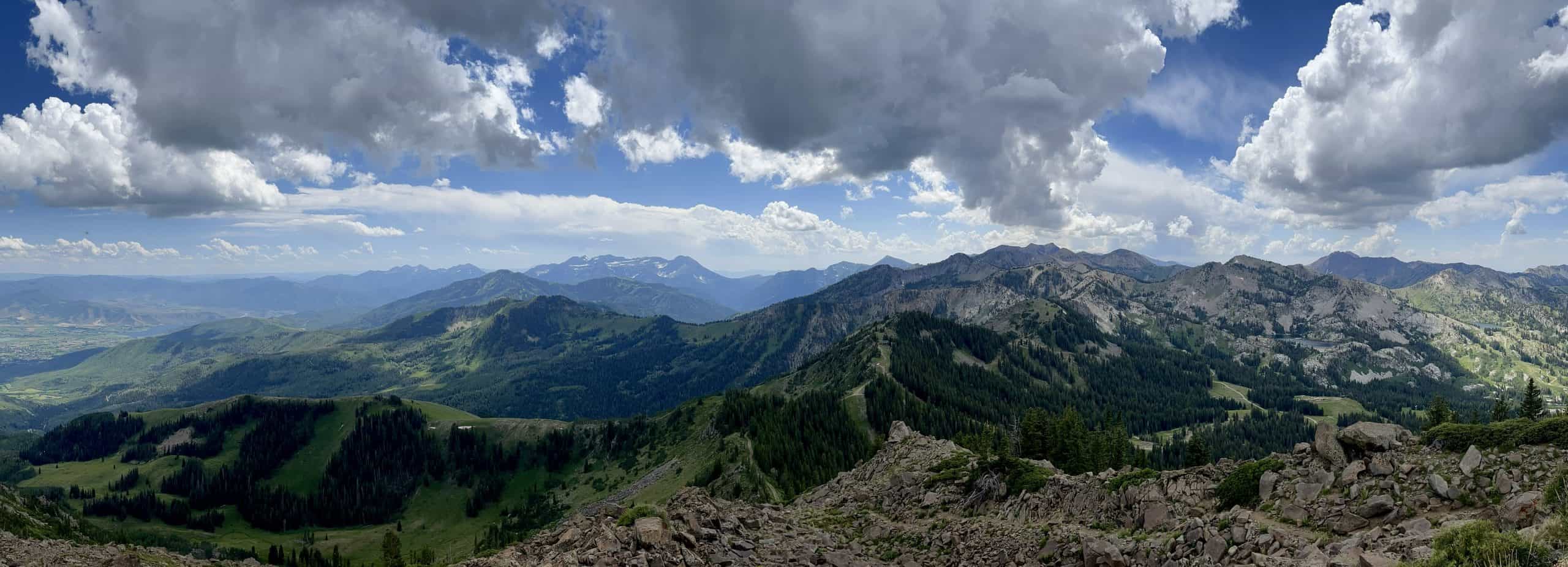
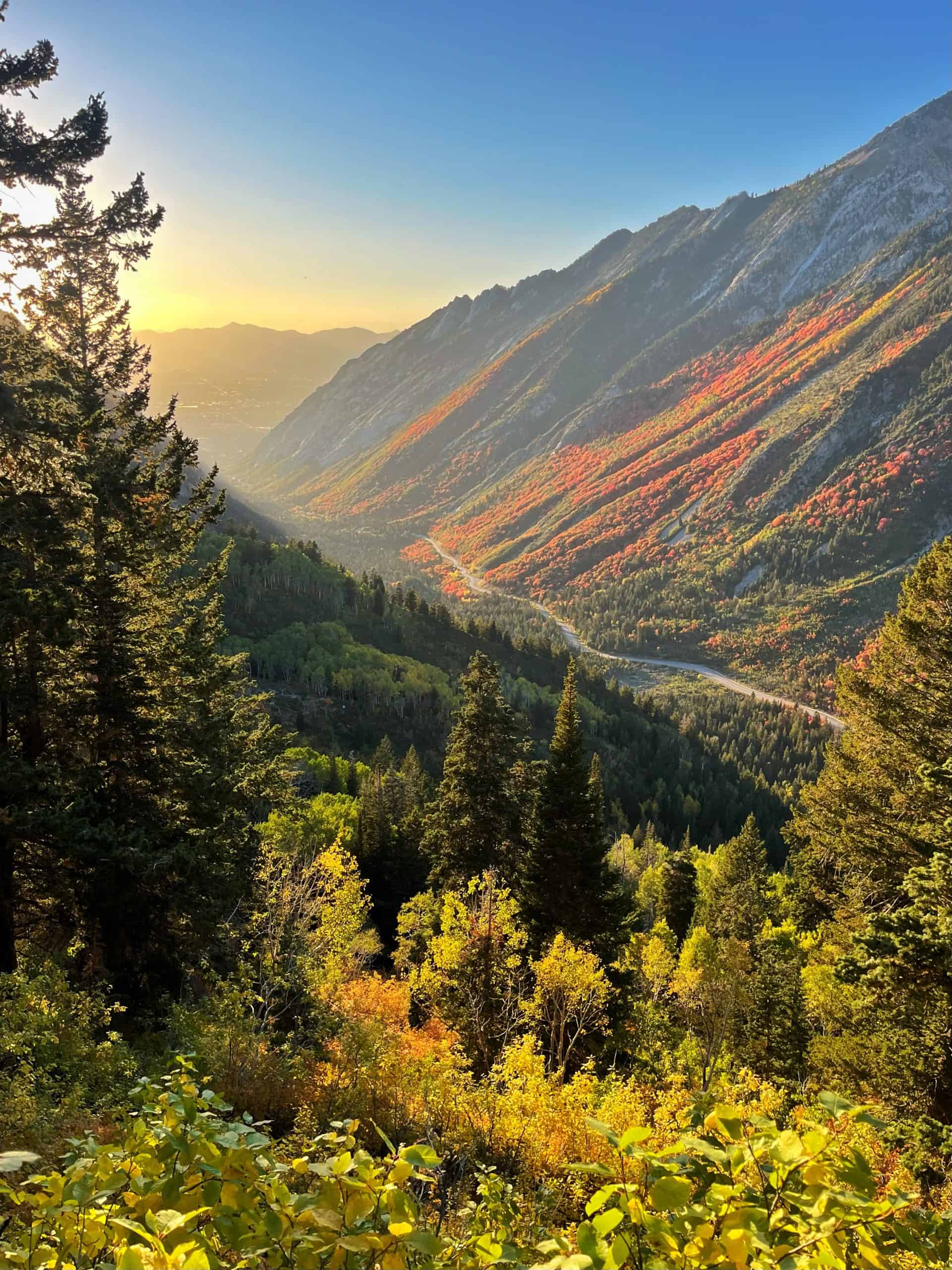
Nestled just a short drive from Salt Lake City, Little Cottonwood Canyon is a 9‑mile (14.5 km) scenic canyon that rewards you with dramatic cliffs and sweeping vistas. Unlike Big Cottonwood, this canyon boasts taller, more rugged walls, giving it an almost untamed feel.
Because of its challenging terrain, there are fewer trailheads in Little Cottonwood Canyon, yet each one offers multiple adventures! I’ve hiked every marked trail in the canyon and explored many off‑trail routes as well, and here are some of my favorite hikes nestled within this rugged landscape.
16. Little Cottonwood Canyon Trail
This hike follows Little Cottonwood Creek from the base of the canyon. I overlooked this trail for years, but finally completed the 5.5-mile round trip in 2025. Since then, I’ve learned there’s a second section that continues even farther up the canyon, which gives me a solid excuse to go back!
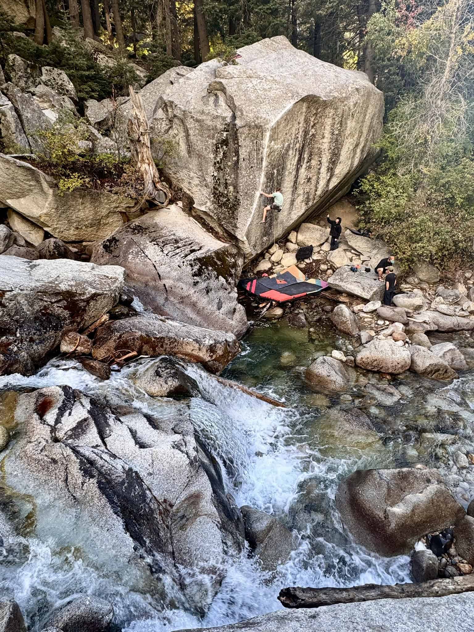
This hike is a true gem, and you might spot some rock climbers along the way. The canyon offers some of the best climbing in the Wasatch Range! I was also surprised to find several hidden waterfalls tucked along the route.
Pro Tip: Hike from the trailhead to the Tanner’s Flats Campground, and then hitch a ride down or call an Uber/Lyft. You could also do this in reverse if you prefer downhill!
Hikes 17-19 share the same trailhead, which requires a $10 parking fee valid for three days. A National Parks Annual Pass covers this fee; be sure to display it on your dashboard.
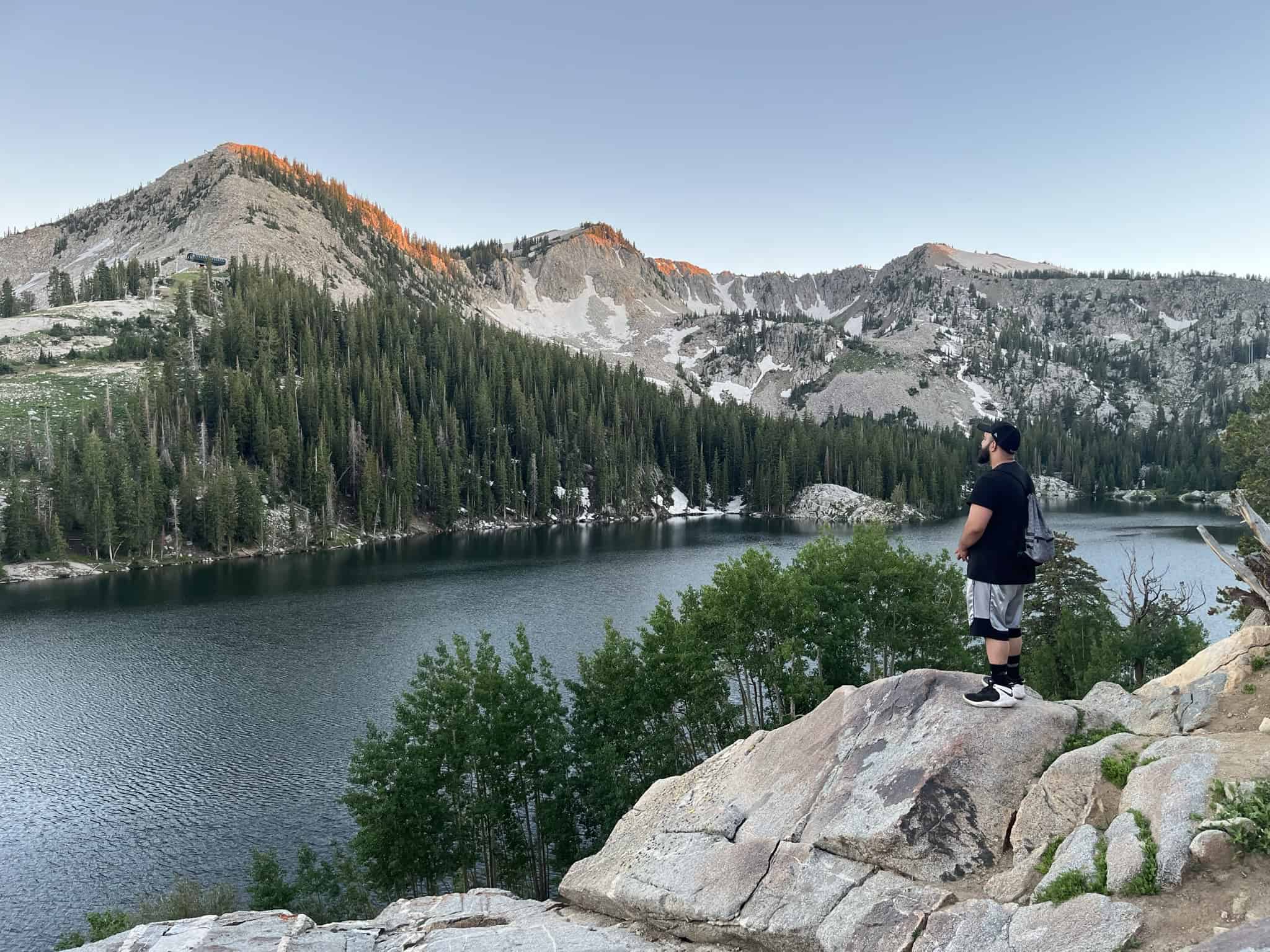
17. White Pine Lake
White Pine Lake sits in a beautiful alpine basin at 10,000 feet (3,048 m) and is framed by sheer granite cliffs. The hike follows a long, wide trail, likely an old mining road, that guides you deeper into the canyon. About 1 mile (1.6 km) in, you’ll reach a clear junction with the Red Pine Trail; stay on the wider path.
White Pine Lake is often overshadowed by the more popular Red Pine Lake, but in return, it rewards those who make the extra effort with a quieter, more peaceful alpine experience.
18. Lower Red Pine Lake and Gloria Falls
Gloria Falls was once a hidden trail only a few knew about, but once the 2020 pandemic hit, it was posted on AllTrails, and the secret was out! If you’re short on time, Gloria Falls is well worth the shorter 2.3 miles (3.7 km) and 541 feet (165 m) hike. Hike another half mile, and you’ll come to a beautiful overlook of Little Cottonwood Canyon, which is also a great stopping point.
For those willing to go all the way, Lower Red Pine Lake is one of the most scenic alpine lakes in Utah. However, if you’re still not satisfied, there are three bonus lakes further up! A 0.75-mile (1.2 km) rock hop with 500 feet (152 m) of elevation takes you to the stunning Upper Red Pine Lakes.
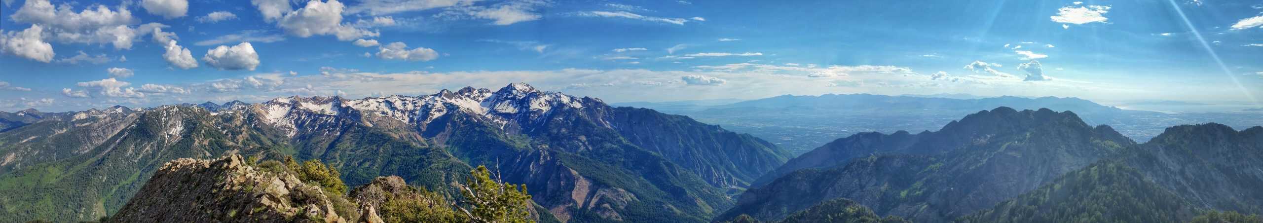
19. Pfeifferhorn
If you find yourself at the Upper Red Pine Lakes and notice a line of hikers heading toward the rocky ridge to the west, they’re likely making their way to Pfeifferhorn. Rising to an elevation of 11,326 feet above sea level, it is one of the famed “Wasatch 11ers.”
So how many “11ers” are there? That’s a topic of ongoing debate, with 22 true peaks, plus a dozen additional “bumps” that don’t quite meet the technical definition of a mountain peak.
Pfeifferhorn offers arguably the best summit view in the entire mountain range. Add in Gloria Falls and the four Red Pine Lakes, and this hike truly has everything a hiking enthusiast could ask for.
Note: The trail isn’t well-maintained past Red Pine Lake. The path is rocky, loose, and involves scrambling. The last 600 feet are notoriously steep.
20. Cecret Lake
No, the lake’s name isn’t misspelled! Cecret Lake is a popular alpine lake in the Wasatch Mountains, and it’s definitely not a “secret” by any means.
The last three miles to the trailhead are on a well-graded dirt road, which is open only in the summer. Check Alta’s official website to check the road’s status. It is $12 to enter, and they allow a limited number of cars to drive up.
The hike doesn’t have to end at the lake; continue to a stunning viewpoint by following the trail due right from the lake! For the extra adventurous, summit Sugarloaf Peak or climb Devil’s Castle!
Local’s Tip: If you want solitude, I recommend hiking to Cecret Lake from the base of Alta before the summer road opens! Late May and June are ideal, but expect to encounter snow!
21. Davenport Hill
While Albion Basin and Cecret Lake get most of the attention, Davenport Hill is a hidden gem tucked away near Alta. It’s a short but steep hike that leads to a unique view of the Wasatch Mountains and Little Cottonwood Canyon. Its solitary location gives it a quiet, remote feel.
Bonus: If you have extra time, take the detour to the Prince of Wales Mine. Also, look closely, and you’ll spot remnants of Alta’s mining past scattered throughout the area.
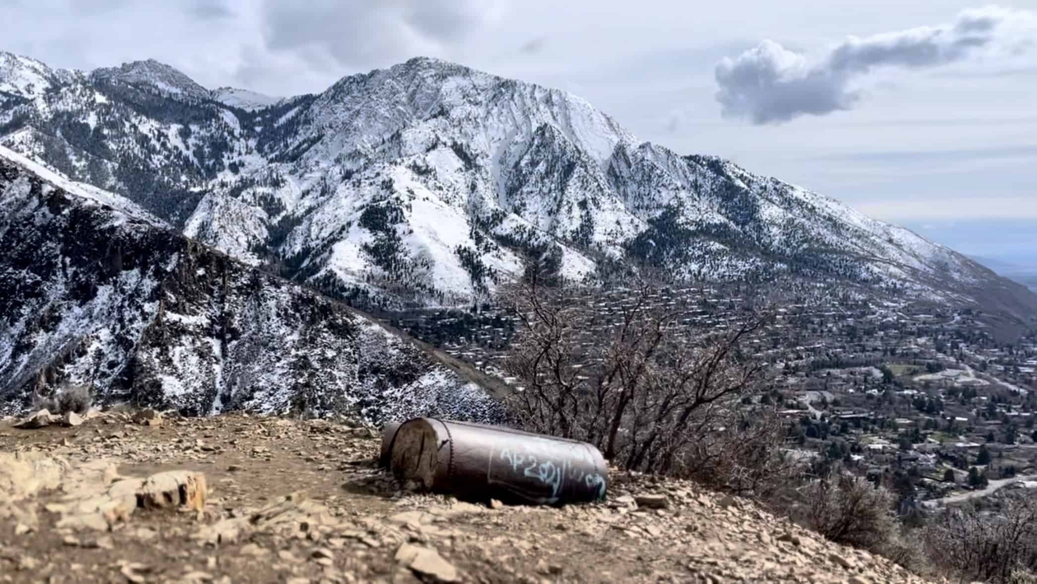
Other Scenic Trails On The Wasatch Bench
The Wasatch Bench sits along the eastern edge of the valley and follows the shoreline of the ancient Lake Bonnevile, which once covered most of western Utah. The ambitious Bonneville Shoreline Trail project aims to create a 280-mile trail along this ancient lake bed, with 100 miles currently completed.
With a vast established trail system, there are endless trails to explore along the bench that offer open valley views and make for great after-work hikes!
Can’t miss: Bells Canyon First Falls
Runner-up: Mount Olympus
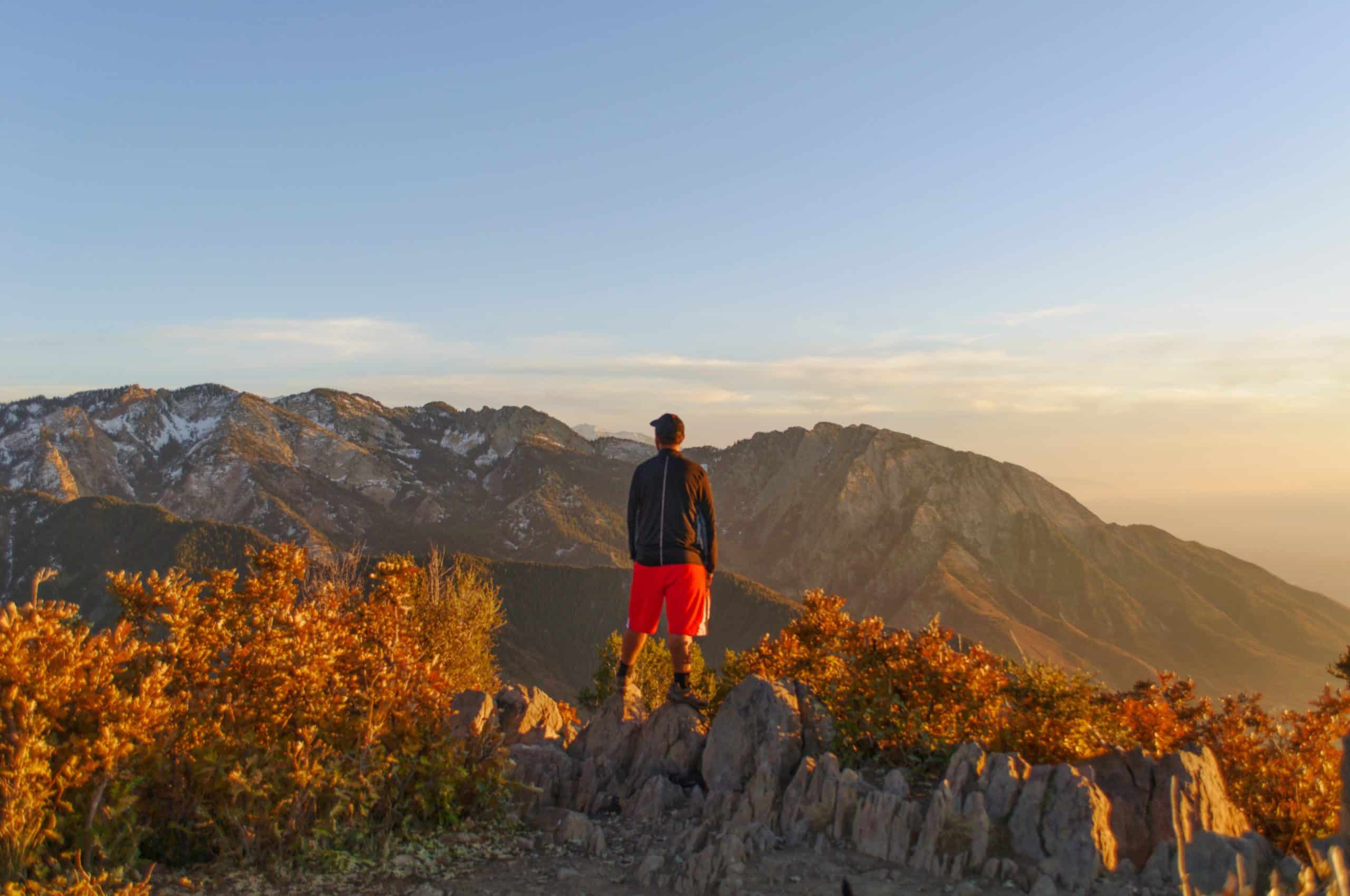
22. Alien Tower
While there aren’t any aliens at the summit of this little peak, it does offer fantastic views of both Salt Lake Valley and Utah Valley. Its unique position between the two valleys provides a very unique view! The trailhead starts in what may be one of the most expensive neighborhoods in the valley.
In summer, avoid hiking during midday, as the trail offers little to no shade. It’s especially enjoyable as a sunset hike, when the views really shine. 🌅
23. Bells Canyon
Bells Canyon is a unique “sub-canyon” adjacent to Little Cottonwood, and is home to the impressive Bells Canyon Lower Falls. It is truly “in our backyard,” yet just a mile into the hike, the sounds of the busy city fade away.
Along the way, you’ll pass the Lower Bells Reservoir, a great spot for a snack break before continuing to the falls. The final 1/4 mile (0.4 km) is steep, and the turnoff to the waterfall is easy to miss. Reaching the base requires a short, slippery descent; good shoes are a must!
For the more adventurous, continue hiking about an hour further to the lesser-known upper waterfall (unmarked) and another hour to the upper reservoir, where the trail officially ends.
24. Mount Olympus
Mount Olympus is one of the most recognizable mountains near Salt Lake City, especially from the University of Utah, with its dramatic north face towering 5000 feet (1524 m) above the valley. Luckily, the south summit is the higher of the two and is a non-technical hike, but the north face is a rock climber’s paradise.
The second half of the hike is incredibly steep, with the last 600 vertical feet involving a class 3 rock scramble. The view from the summit is well worth the struggle, but shouldn’t be attempted if you’re uncomfortable with route-finding and exposed terrain.
In Winter, the trail generally gets tracked out by snowshoers, but microspikes are required. Some say to use an ice axe and crampons for the final section, but I’ve never needed them.
Hiking Tips
Bring the Right Gear
The right gear can make or break a hike. Solid hiking shoes, a comfortable backpack, trekking poles, and weather-appropriate clothing go a long way toward keeping you safe and comfortable. That said, gear doesn’t have to be expensive: buying secondhand, thrifting, or shopping at outlets and off-price retailers are great ways to find affordable gear.
Hydration is key
Hydration is non-negotiable. I carry 3 liters of water in my reservoir on every hike, even short ones, with at least 1 liter of electrolytes. I also bring a water filter or purification tablets as a backup.
Use a Navigation App
With today’s technology, getting lost should be far less common than it is. Apps like AllTrails, OnX, Trailforks, and Gaia make navigating trails easier. Download your maps before hitting the trail!
Don’t Underestimate The Mountains
People underestimate how big these mountains really are. Many assume the summit is closer than it looks, and the most common reasons for rescues are dehydration and getting lost. The mountains’ proximity to the city creates a false sense of confidence.
Knowing your limits comes with experience. Getting out of your comfort zone is always worthwhile, but it’s just as important to plan for the unlikely moments when things go wrong. Thankfully, there are plenty of resources to help you prepare, learning the 10 essentials is a great place to start.
Where To Buy Gear
REI: The Salt Lake Valley has two REI locations, and while prices can be steep, their expert staff, lifetime guarantee, and excellent repair shop make the investment worthwhile. I’ve always had great experiences with both their service and gear quality.
Sierra Trading Post: With three locations in the Salt Lake Valley, Sierra is my go-to for finding great deals. I recently scored a $110 Eddie Bauer rain jacket for $50, and finds like that are pretty common if you’re willing to browse.
Columbia Outlet: Located in Lehi, about 30 minutes from Salt Lake City, Columbia has never let me down! From shoes to rain jackets, pants, socks, and even baseball caps, Columbia has it all.
Disclaimer
Outdoor conditions can change quickly, and potential hazards can appear without warning. All information is provided without warranty or liability. Always be prepared, use good judgment, and hike within your abilities. Difficulty ratings are based on my personal experience, combined with AllTrails data, and your experience may vary.