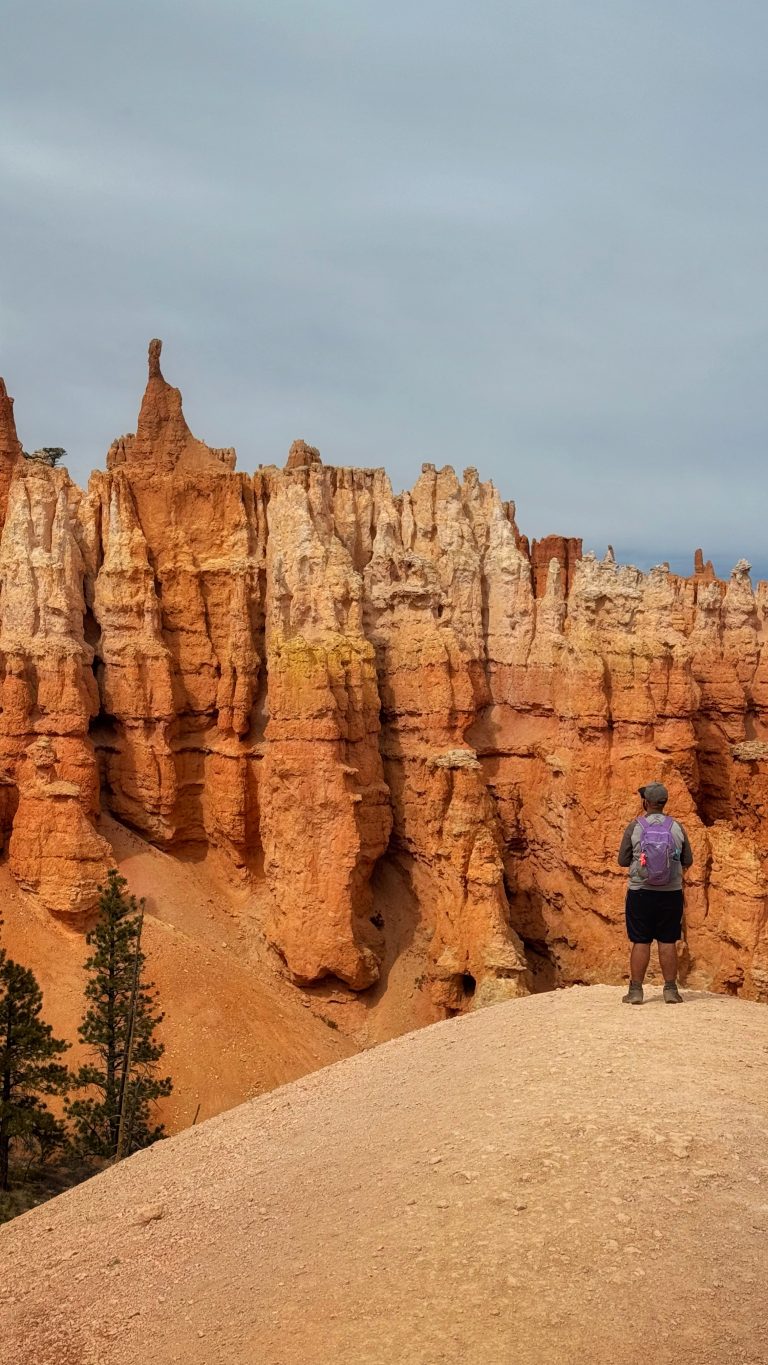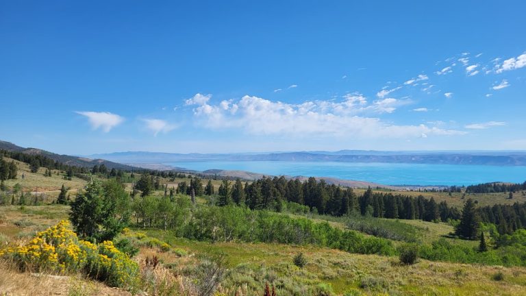
14 Scenic Little Cottonwood Canyon Hikes
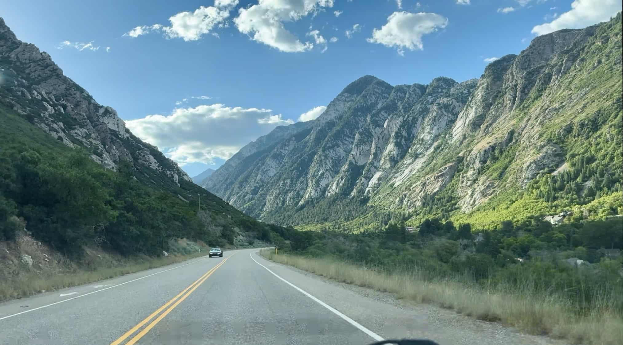
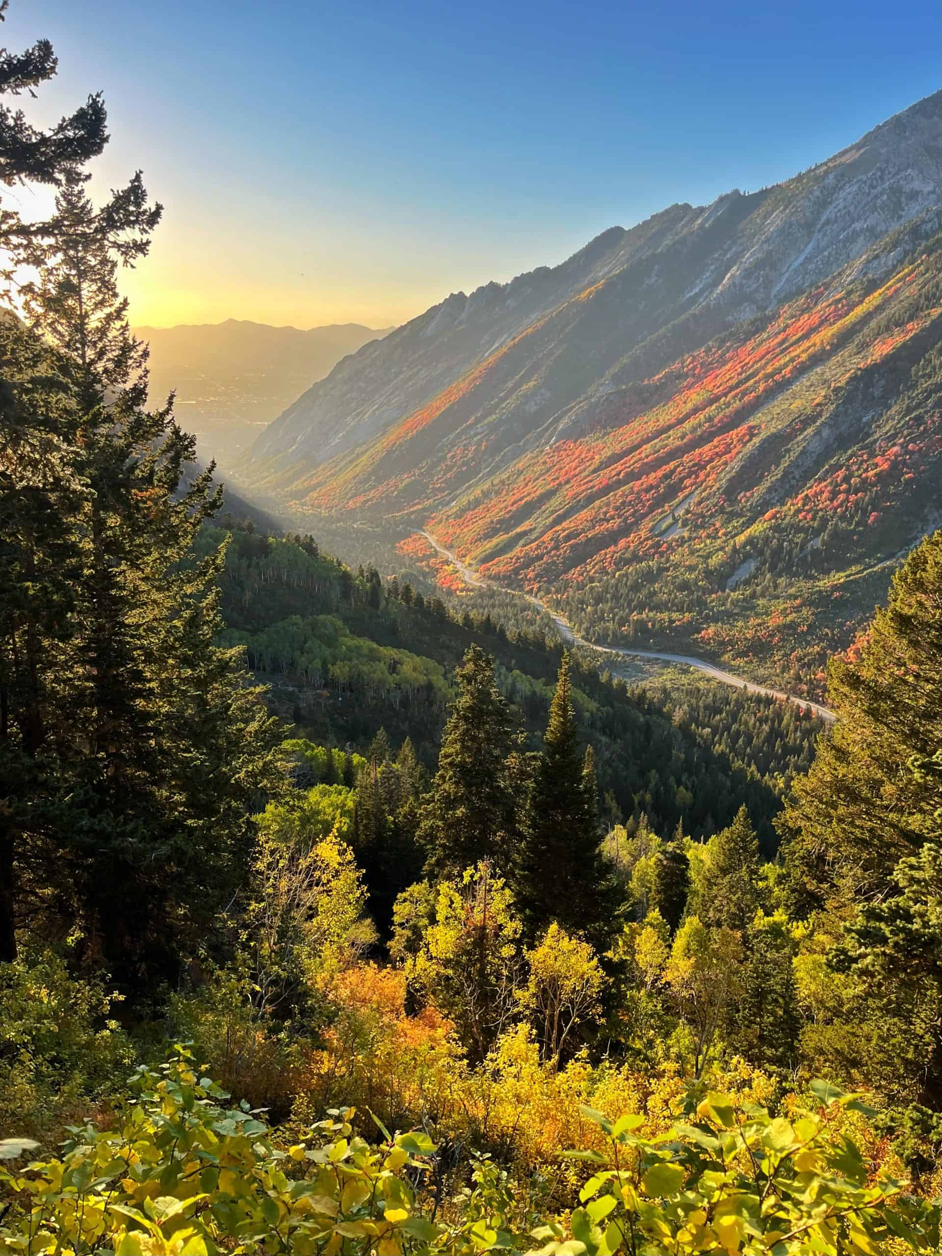
There are over a dozen canyons in the Wasatch Montains and Little Cottonwood Canyon may just be the most epic! Nestled just a short drive from Salt Lake City, the canyon stretches 9 miles (14.5 km) and delivers dramatic cliffs and sweeping views from the moment you enter.
Compared to Big Cottonwood, the canyon feels steeper and more rugged, offering seemingly more backcountry and off-trail exploration. Because of the challenging terrain, there are fewer trailheads, but each one opens the door to multiple hiking trails and adventures.
As a local, I’ve explored every marked trail in the canyon, as well as a few off-trail routes. Here I will share a comprehensive list of my favorite hikes in Little Cottonwood Canyon. The hikes are listed in order from the bottom of the canyon to the top. Let’s dive in!
Can’t miss: Red Pine Lake
Runner-up: Cecret Lake
1. Little Cottonwood Canyon Trail
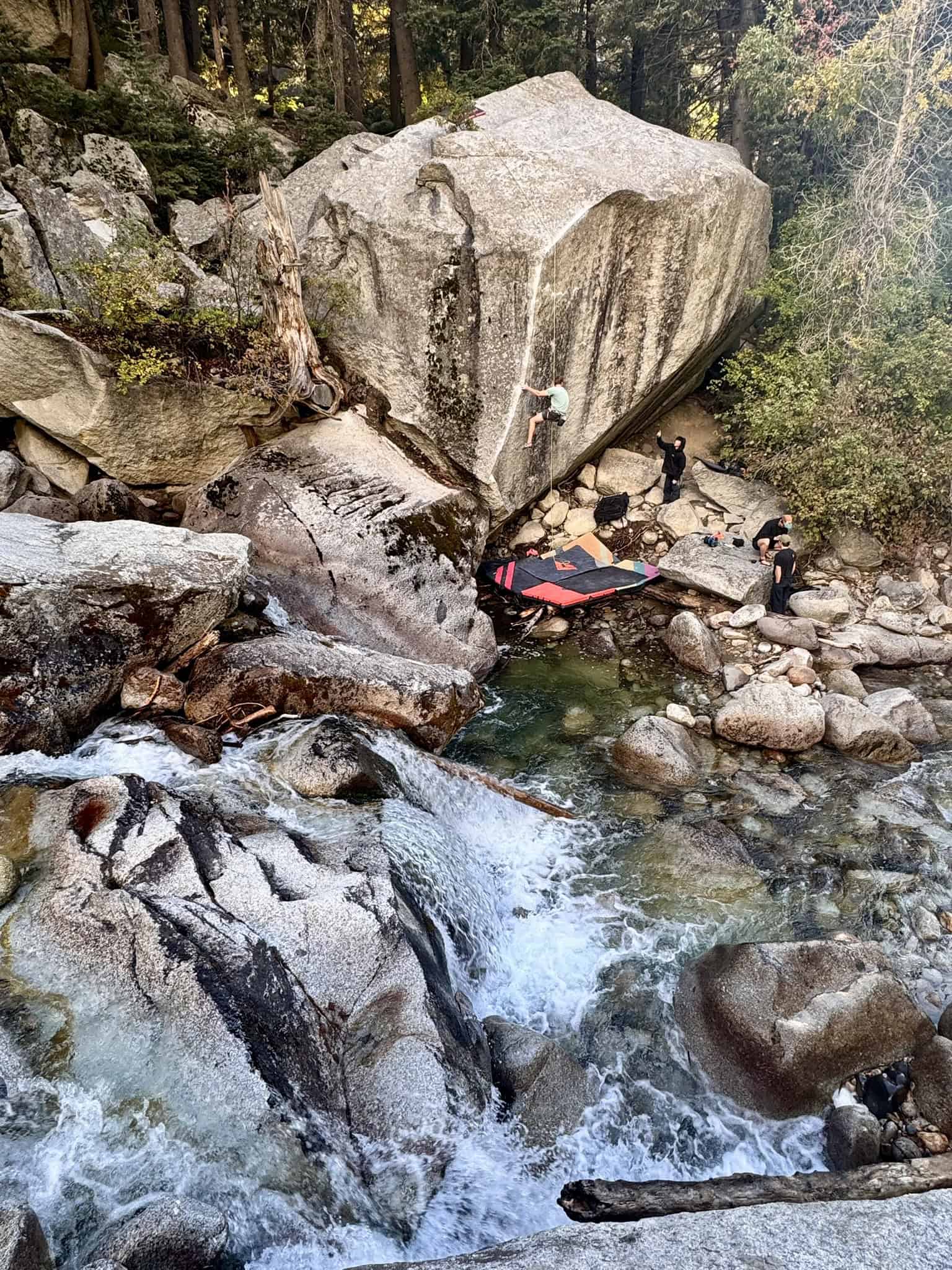
This hike follows Little Cottonwood Creek from the base of the canyon, and it’s one I overlooked for years. I finally completed the 5.5-mile round trip in 2025, and later learned the trail actually continues even farther up the canyon, giving me the perfect excuse to go back.
The hike itself is one of the few hidden gems. Along the way, you might spot rock climbers and a few tucked-away waterfalls. Don’t forget to enjoy the peaceful views with the sounds of the roaring creek.
Pro Tip: You can turn this hike into an easier one-way adventure by starting at the trailhead and finishing at Tanner’s Flats Campground. From there, grab a ride down or call an Uber/Lyft. Alternatively, you can reverse the route if you’d rather enjoy the trail mostly downhill.
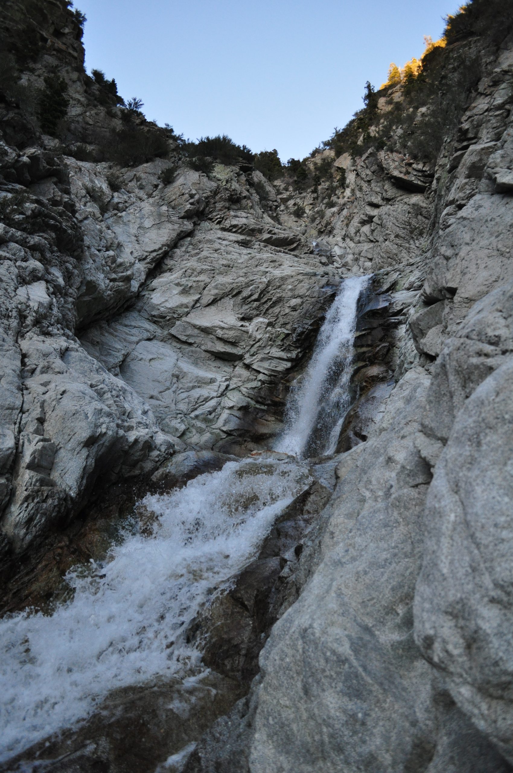
2. Lisa Falls
Lisa Falls can be a short family-friendly outing or a long mountaineering adventure.
As a result, you will see both rock climbers and casual hikers on the short trail.
The main waterfall is worth the short trek, and an avalanche in 2023 slightly changed the waterfall.
If you’re feeling up to it, try scrambling up the side of the waterfall! The farthest I’ve made it is to the third waterfall, out of who knows how many! Just be careful and mindful of your limits!
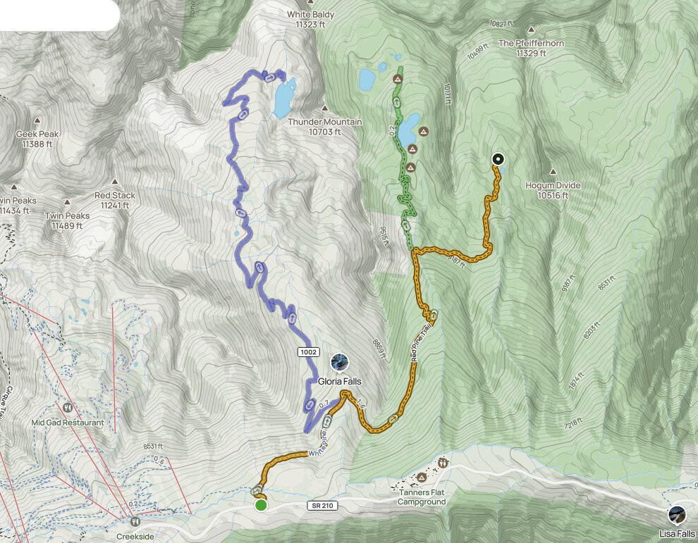
Parking Note: Hikes 3–6 all start from the same trailhead, which requires a $10 parking fee that’s valid for three days. The National Parks Annual Pass covers the fee; be sure to display it on your dashboard. Do NOT park on the road if the trailhead is full (in winter), you will get ticketed.
credit: AllTrails
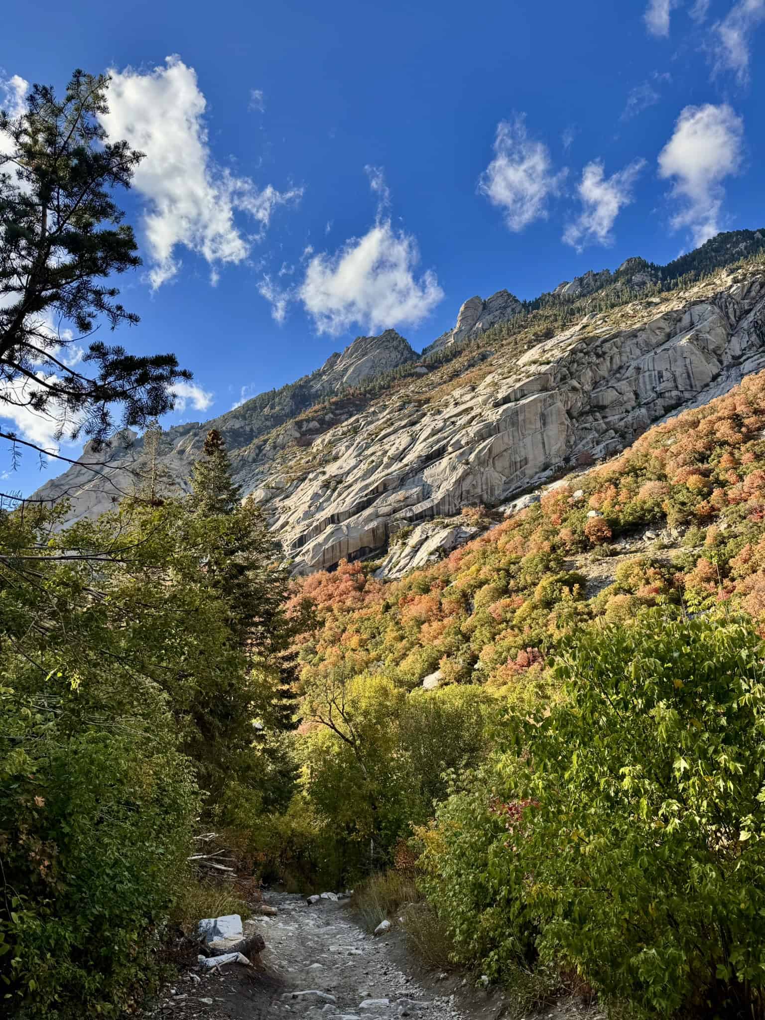
3. White Pine Lake
White Pine Lake sits in a beautiful alpine basin at 10,000 feet (3,048 meters), surrounded by sheer granite cliffs and big mountain views. The hike follows a long, wide trail, likely an old mining road, that gradually leads deeper into the canyon. About 1 mile (1.6 km) in, you’ll reach a clear junction with the Red Pine Trail; stay on the wider path.
While most hikers head toward Red Pine Lake, White Pine is often overlooked and rewards you with a quieter alpine experience. If you’re looking for a peaceful hiking destination away from the crowds, look no further!
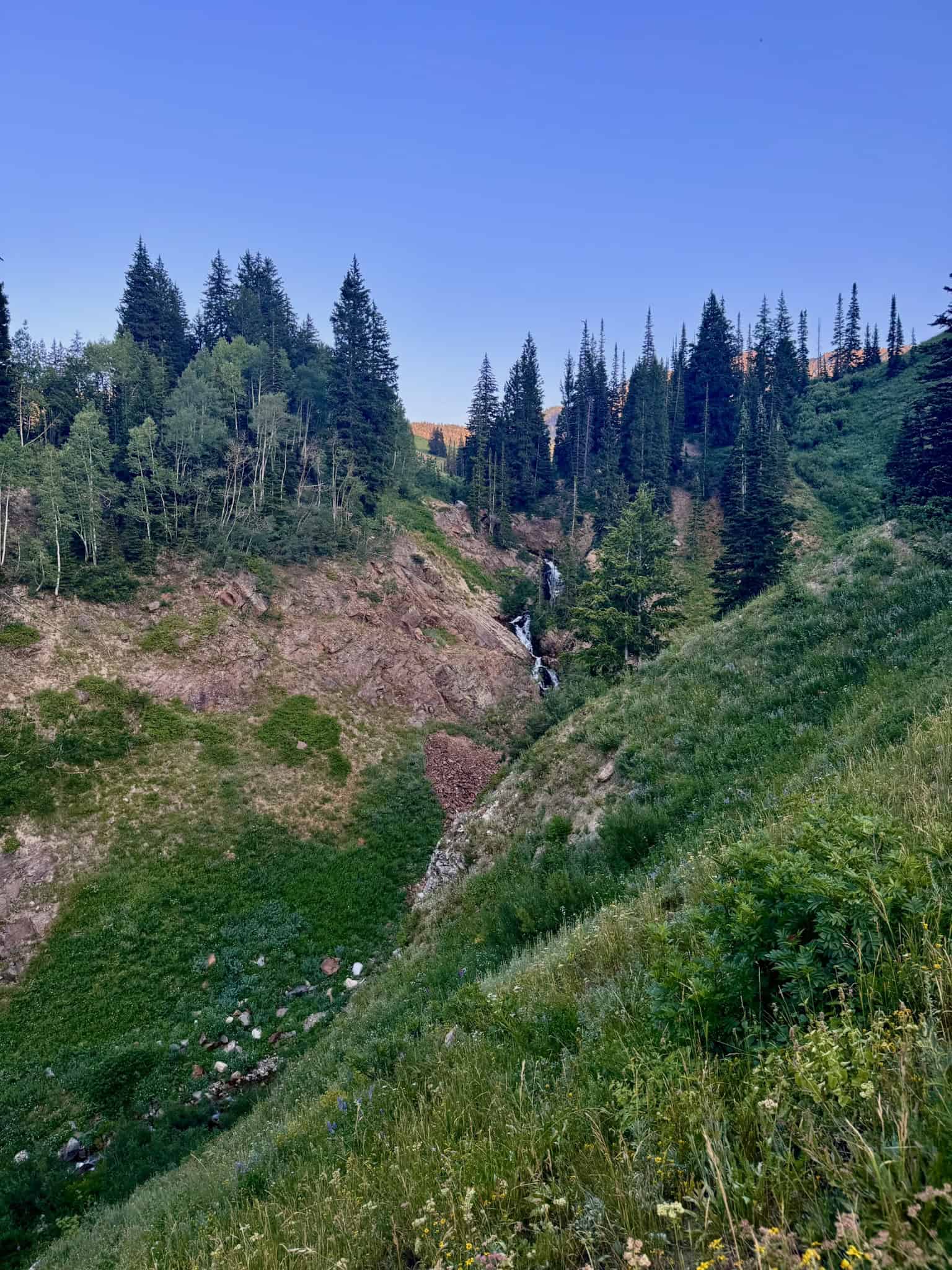
4. Gloria Falls
Gloria Falls used to be a local secret, but word got out during the 2020 pandemic. Even so, it’s still one of the best short hikes in Little Cottonwood Canyon.
About 1-mile into the hike, you’ll reach a junction, where you’ll get off the wider path and continue on the Red Pine Lake trail. Soon, you will reach a wooden bridge, which you will cross.
Turn left immediately after crossing and follow the trail about 1/4 mile to the falls.
If you backtrack to the Red Pine trail and continue hiking another half mile, you’ll reach an overlook with some pretty incredible views down Little Cottonwood Canyon.
This outing is perfect if Gloria Falls isn’t long enough, and you don’t have enough time to make it to Red Pine!
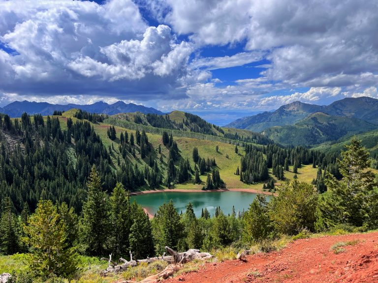
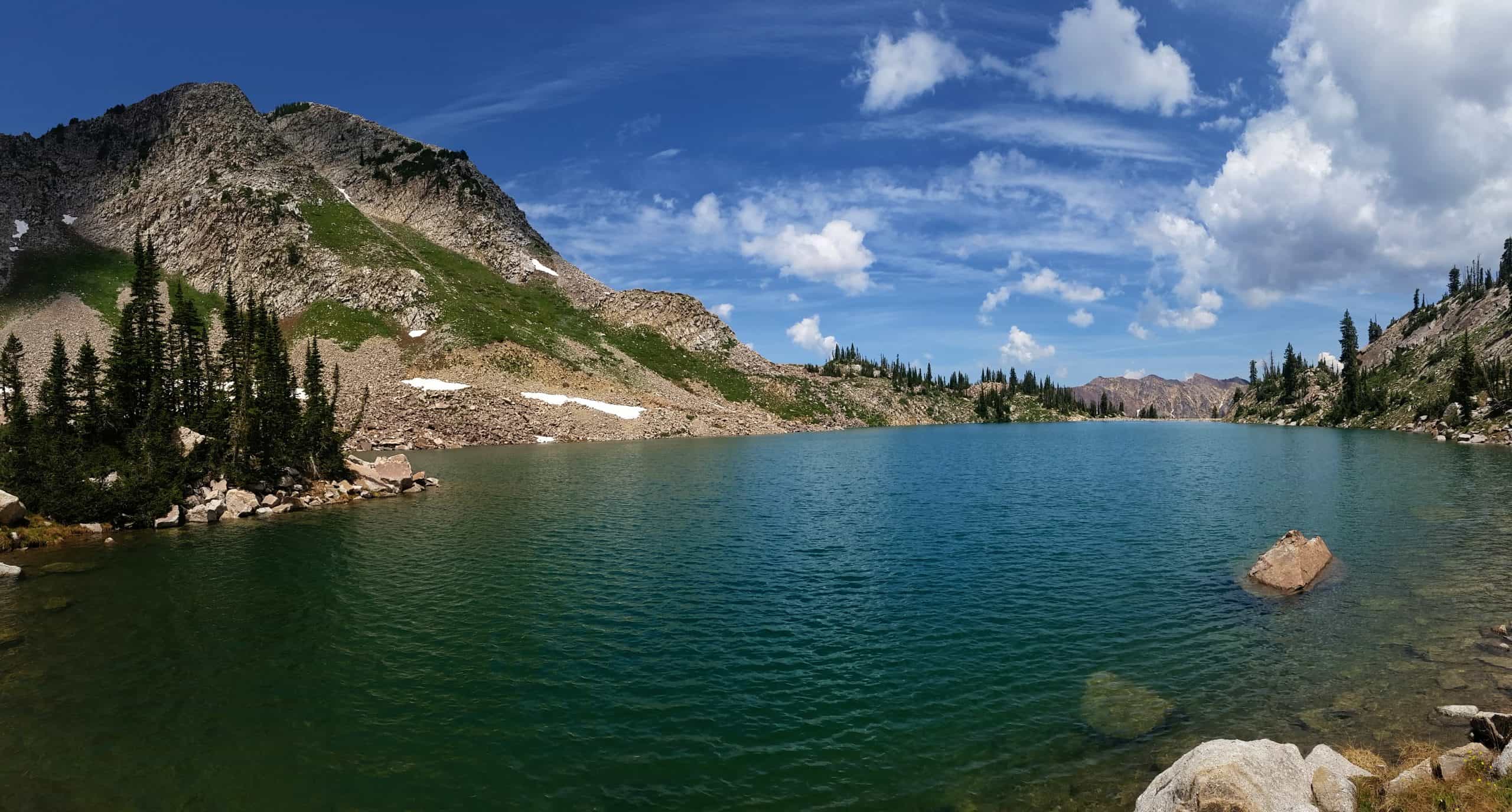
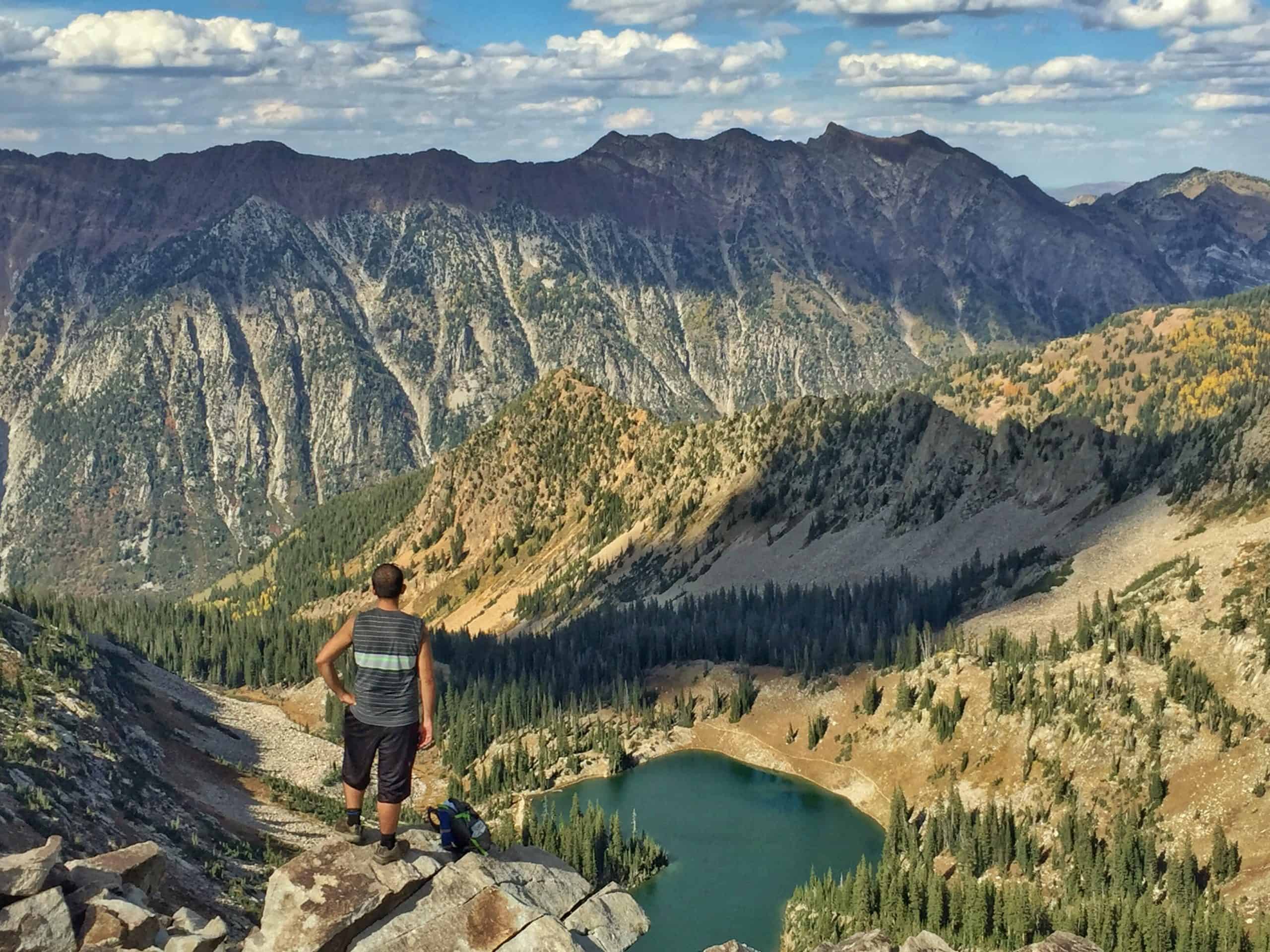
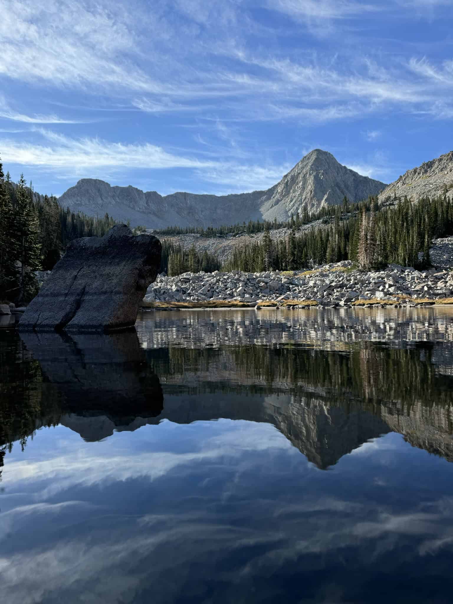
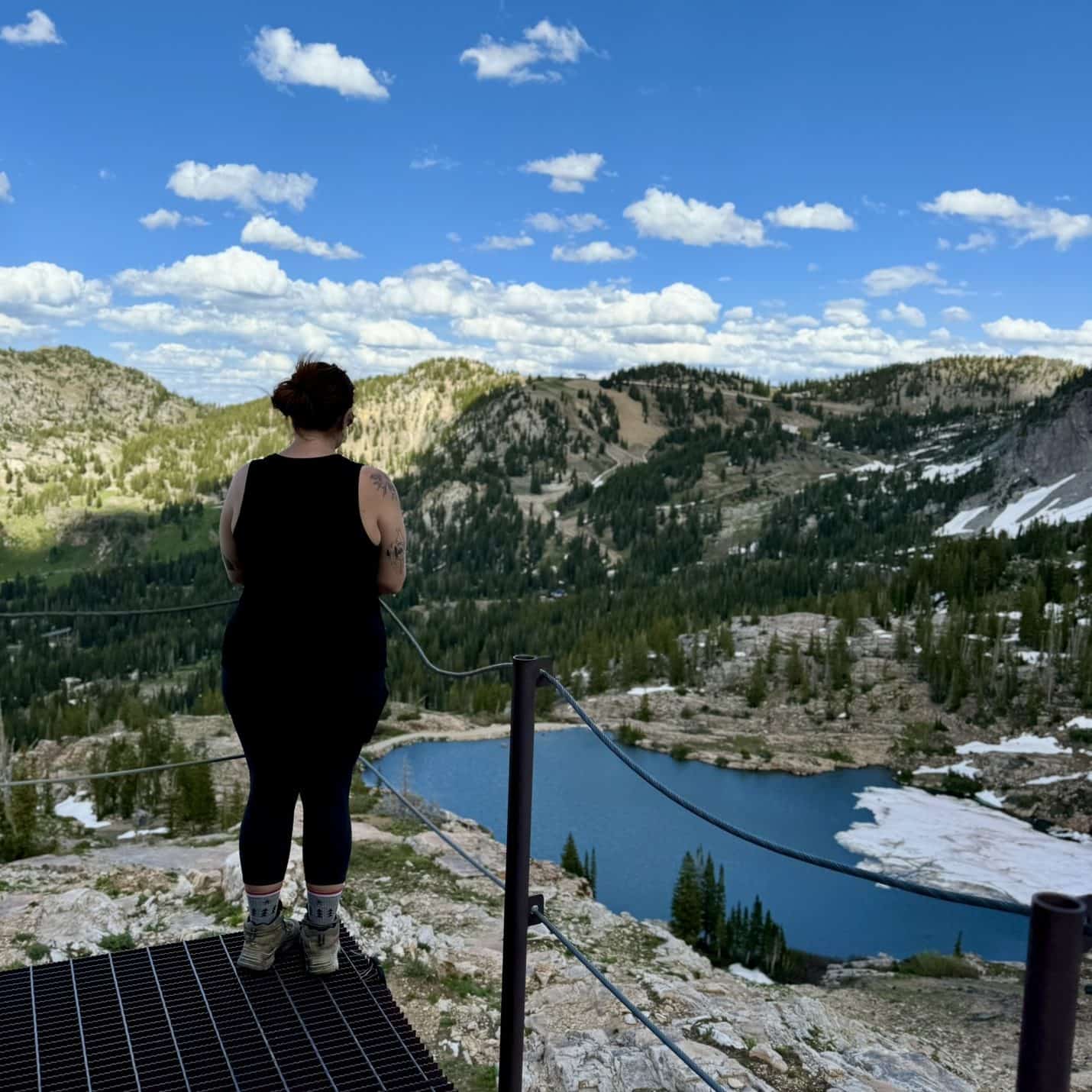
5. Red Pine Lake
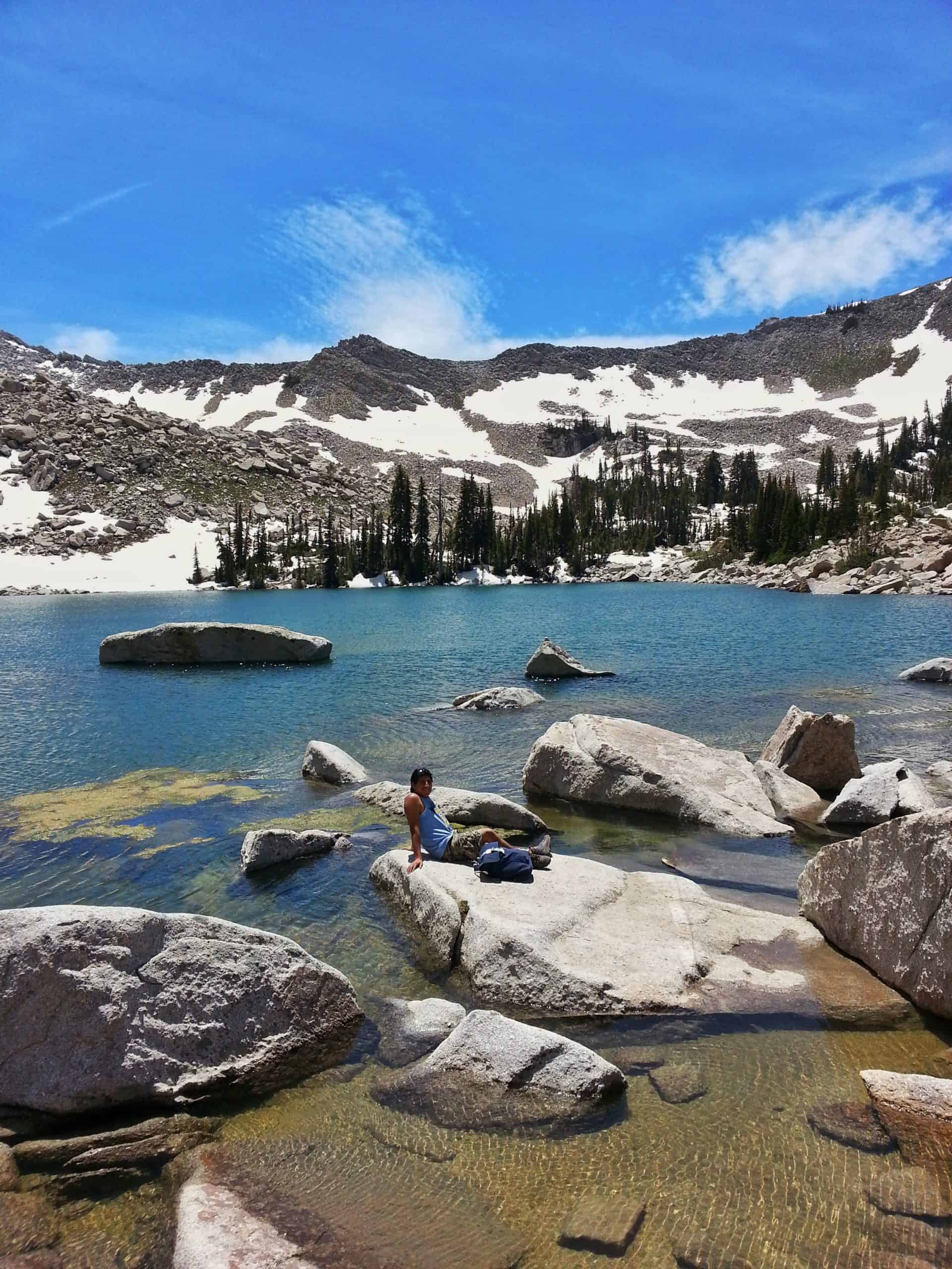
For those willing to go the distance, Lower Red Pine Lake is one of the most scenic alpine destinations in the Wasatch and easily ranks among the best hikes in the area. The trail climbs steadily into a dramatic basin with incredible views along the way.
If you still have energy left, the adventure doesn’t stop there. Continue about 0.75 miles (1.2 km) with roughly 500 feet (152 meters) of additional gain to reach the stunning Upper Red Pine Lakes, where the hiking gets a bit rockier, but the scenery is well worth it.
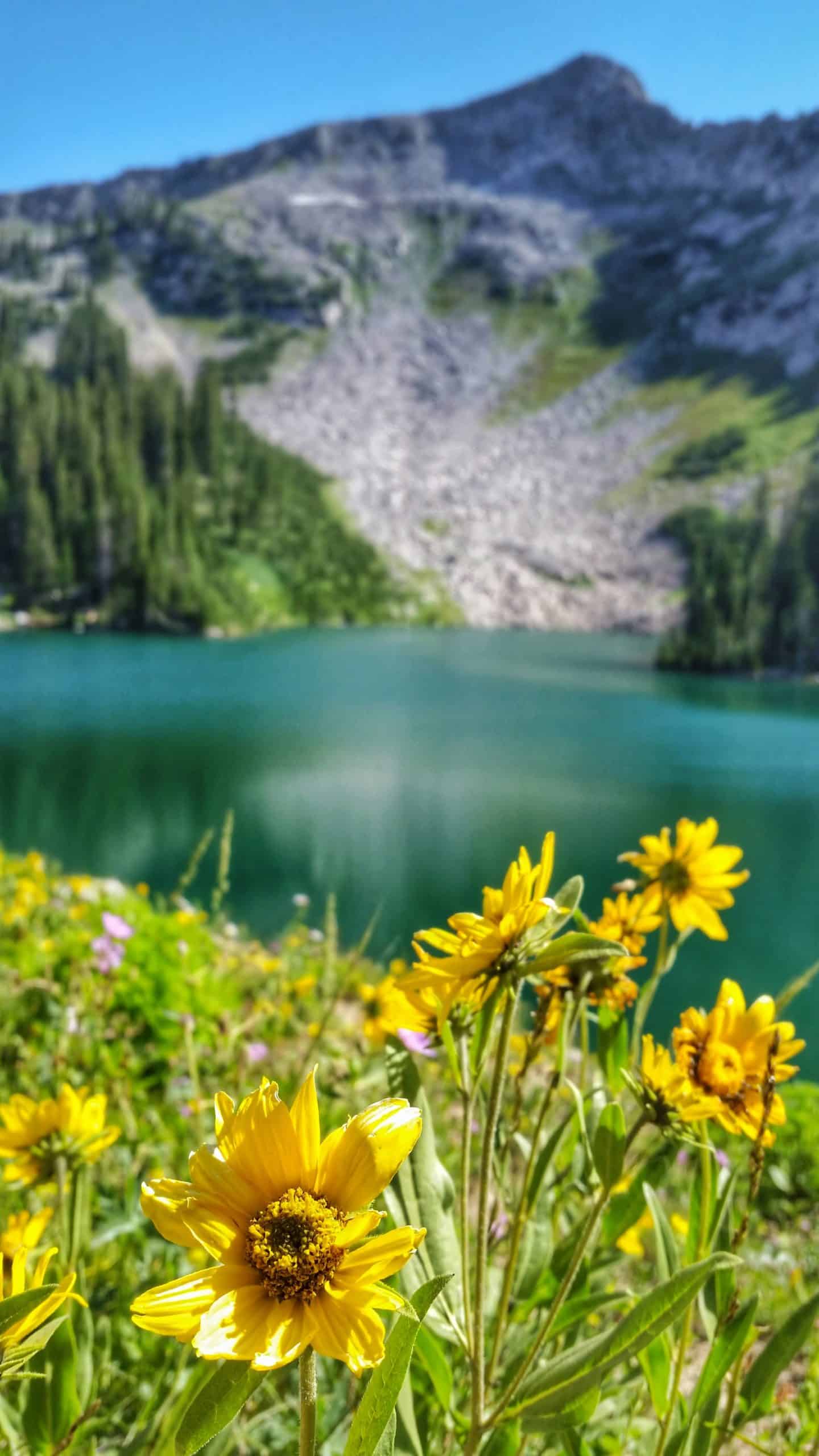
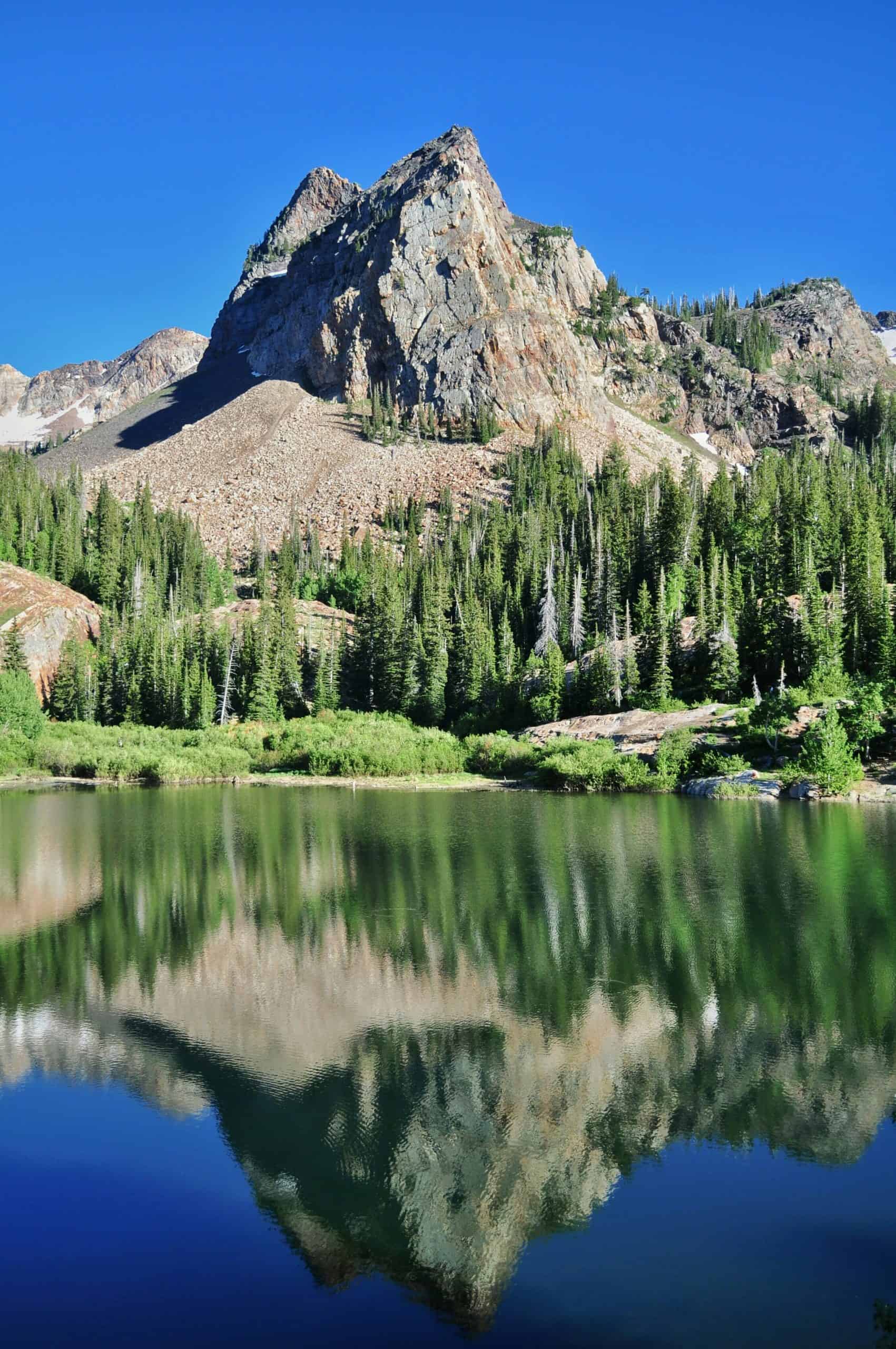
One of the biggest questions I get is: “Red Pine or Lake Blanche?” My answer is always: if you have the time, do both! Each hike leads to a stunning alpine lake, and both include bonus spots to explore, and they tend to attract similar crowds.
And as a local, I can say with confidence that they are the two most picturesque lakes in the Wasatch, and I doubt anyone would debate that!
Our intuition is our guide: when you look at these photos, which one are you more drawn to? If you only have time for one, go with the intuitive choice!
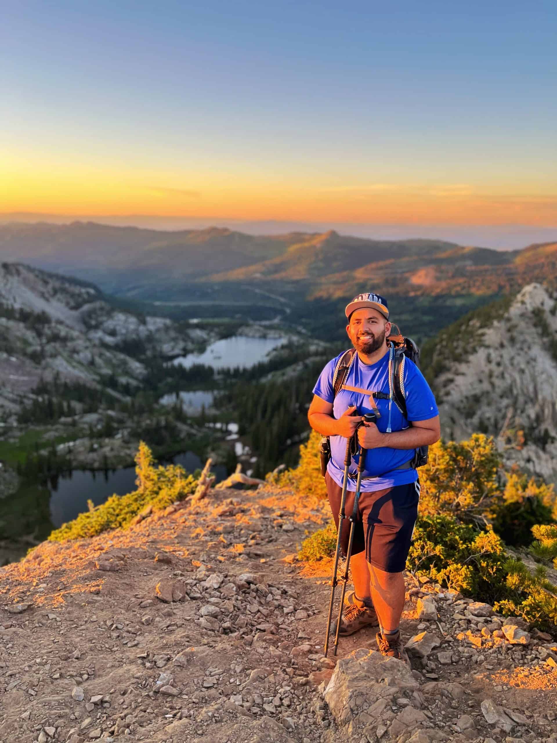
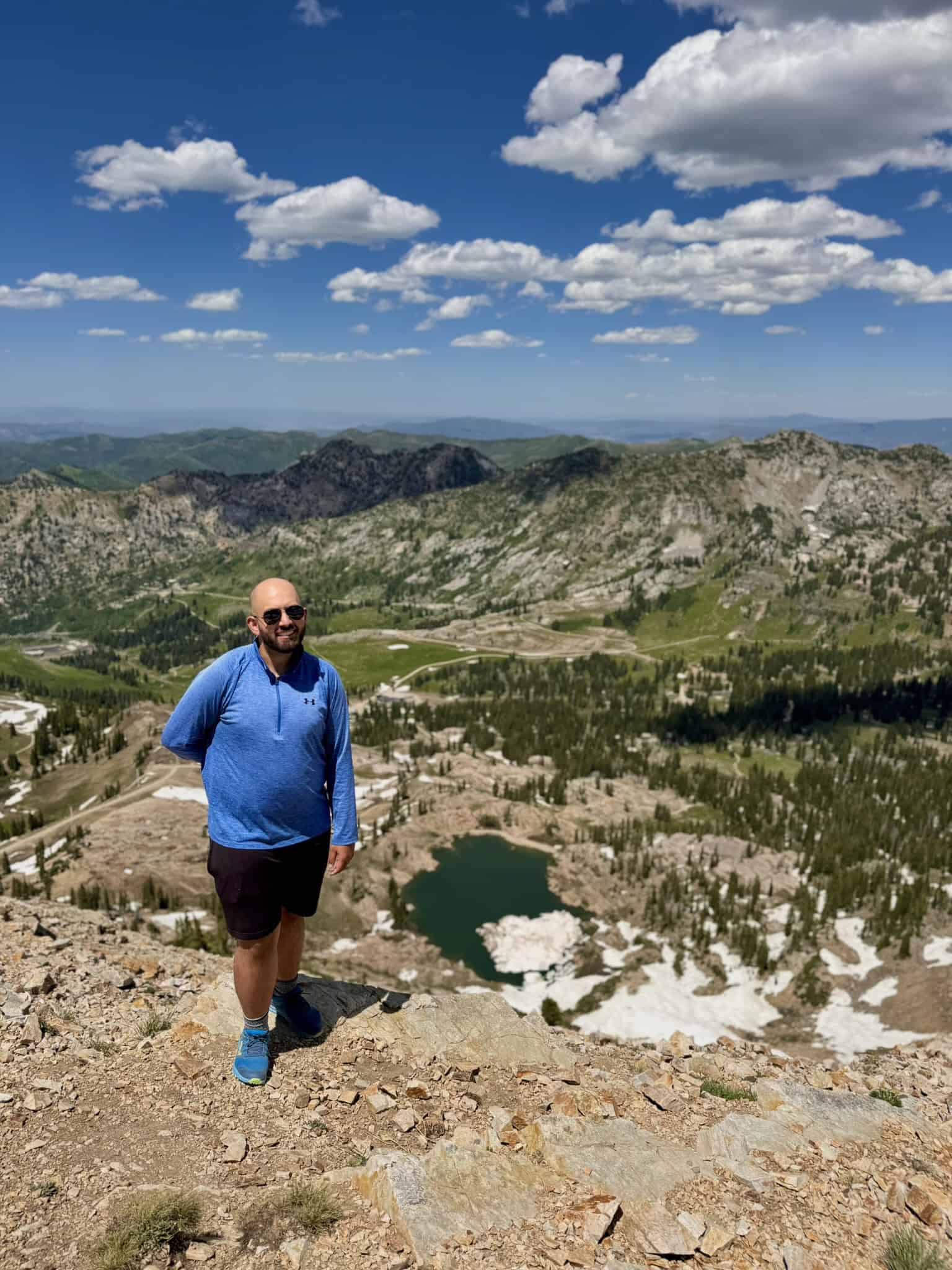
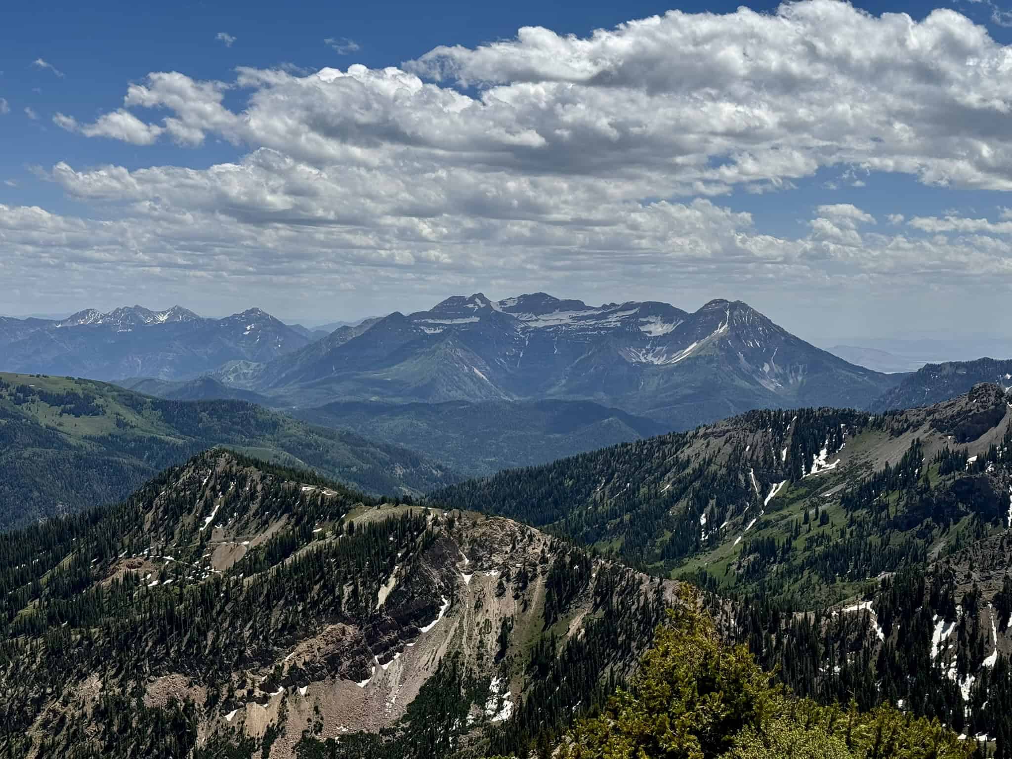
6. Pfiefferhorn
If you’re standing at the Upper Red Pine Lakes and notice a steady line of hikers heading toward the rocky ridge to the west, they’re likely on their way to Pfeifferhorn. At 11,326 feet, it’s one of the famous “Wasatch 11ers,” and a peak-baggers dream!
So how many 11ers are there? That’s still debated among locals. Most lists include 22 true peaks, with another dozen or so points that don’t quite meet the technical definition of a mountain peak (the ~300-foot prominence rule).
For those willing to go all the way, Pfeifferhorn delivers some of the most incredible views in the entire range. Add Gloria Falls and the four Red Pine lakes, and this route easily ranks among the best hikes in the Wasatch!
Note: The trail beyond Red Pine Lake becomes rough and less maintained, with loose rock and sections of scrambling. The final 600 feet are especially steep and require careful footing.
7. Maybird Lakes
While we are still at the White Pine Trailhead, let’s talk about one more hike! I hope you can see now why this trailhead fills up so fast. Maybird Lakes is the last of the three main trails, and is easily the least visited, making it a true hidden gem. The view of Pfiefferhorn from the lower lake is absolutely spectacular!
To get to Maybird, you will follow the White Pine trail for the first mile, get onto the Redpine Trail for the next ~2 miles, and you’ll hit another split for Maybird. You will turn right here and cross the stream. In 2023, the bridge collapsed, but it’s still crossable.
Pro Tip: Hike in June or July, otherwise the lakes may be dried out.
8. Snowbird Observation Point Trail
This scenic paved trail starts at Snowbird and leads to an incredible overlook of Little Cottonwood Canyon. It’s an easy, family-friendly hike that’s perfect for a nice evening stroll, and the entire route is wheelchair accessible.
Parking can be tricky depending on the season. In the summer, I’ve had no trouble parking at the lot closest to the Snowbird Center (the Valet lot)
However, from early August through late October weekends, Snowbird hosts its annual Oktoberfest celebration, which requires a parking fee: typically $15 per car for the lower lots and $30 for the Valet lot. Parking can fill quickly during the festival, so carpool, enjoy the festivities, and add this short hike to burn off some of that beer!
9. Davenport Hill
While Albion Basin and Cecret Lake draw most of the crowds, Davenport Hill feels like a quiet hidden gem near Alta. This short but steep hike climbs quickly to a unique vantage point with incredible views of the Wasatch Mountains and Little Cottonwood Canyon, and its tucked-away location gives you a nice respite from the noise of nearby Alta.
If you have extra time, take the detour to the Prince of Wales Mine for a glimpse into the area’s history. On the hike, keep an eye out for scattered remnants of Alta’s mining past, which add a little extra character to the experience.
Note: There are many forks and junctions on this hike. To prevent getting lost, I created this route on AllTrails, including the Prince of Wales mine.
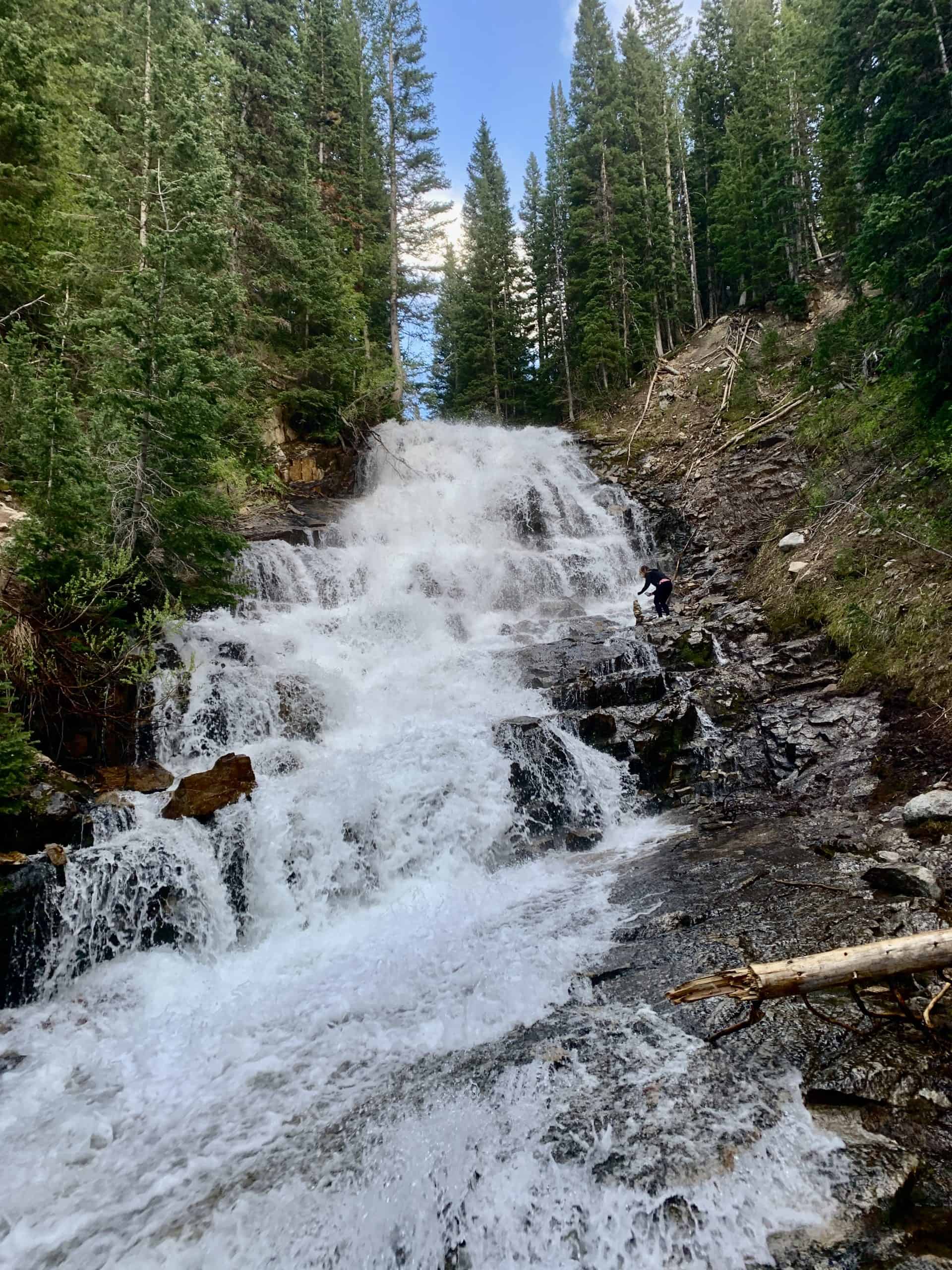
10. “The Gorge” waterfall
In 2024, I stumbled upon this hike without even knowing it existed. I was searching for a way to reach Albion Basin without paying the $10 road fee, and I’m now convinced this is the best way to get there!
The highlight of the hike is a hidden waterfall tucked inside a gorge you’d never expect to find here. The Wasatch Mountains aren’t typically known for waterfalls inside a gorge, which makes this hike feel like an incredibly hidden gem.
Use my custom-built All Trails route to easily navigate your way to the waterfall!
Parking Note: Hikes 11-14 all start on a well-graded dirt road, which is open only in the summer. Check Alta’s official website to check the road’s status. It is $12 to drive past the toll booth, and they allow a limited number of cars to drive up.
11. Albion Basin Meadows Loop
This route is a short, family-friendly stroll through the wildflower capital of the Wasatch. Albion Basin may be the most popular wildflower hike in the range, and while it’s undeniably spectacular, it can also be very crowded.
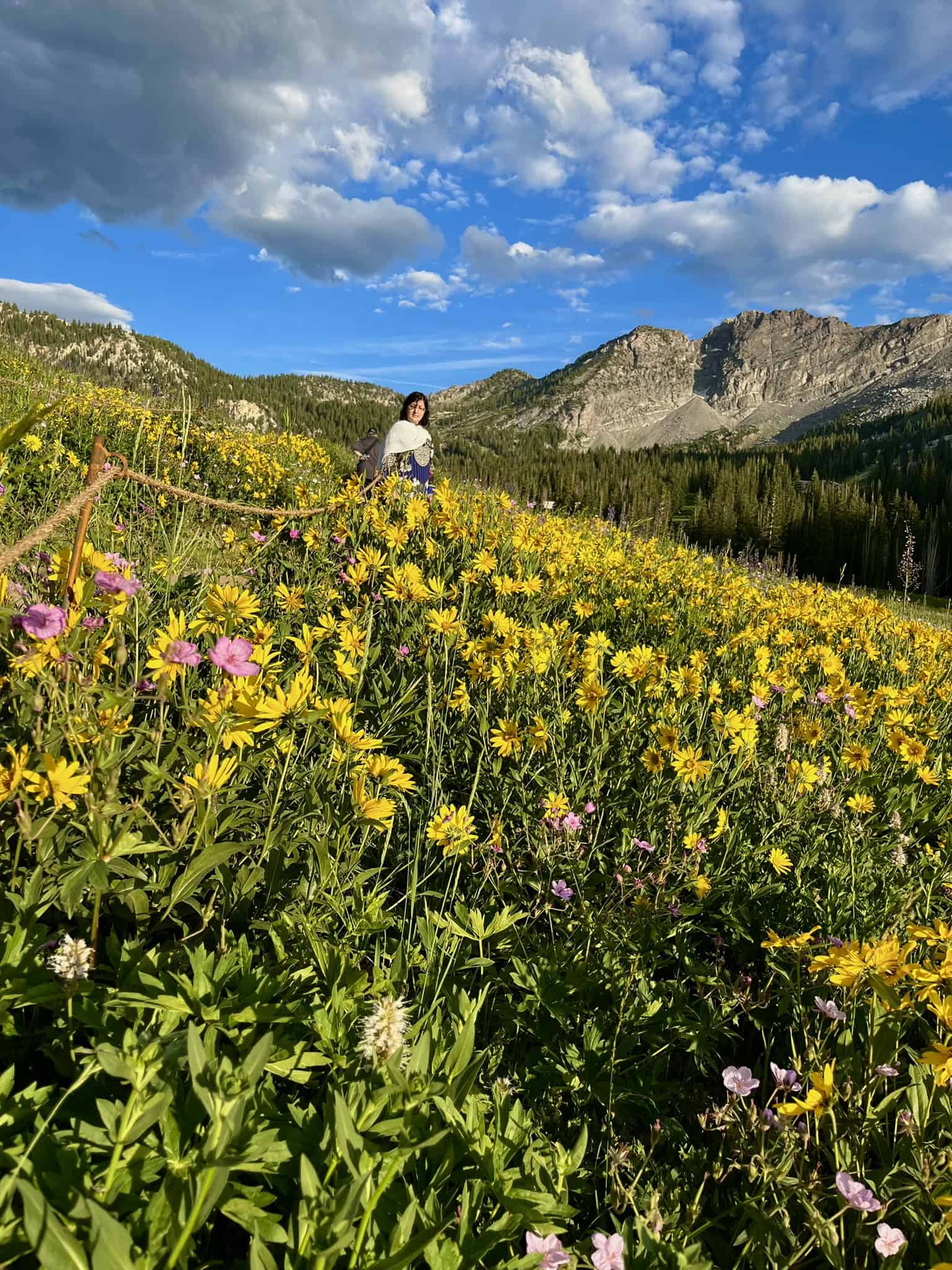
Because of the hike’s popularity, the Forest Service has roped off the flowers and even created designated photo areas that make it look like you’re standing among the flowers. Please respect these protections!
In my recent visit, I noticed people stepping off the trail and damaging the meadow. Preserving this incredible landscape for future generations is a collective effort.
Pro Tip: While Albion Basin is absolutely worth visiting, several other hikes, like Davenport Hill, also offer stunning wildflower displays with fewer people.
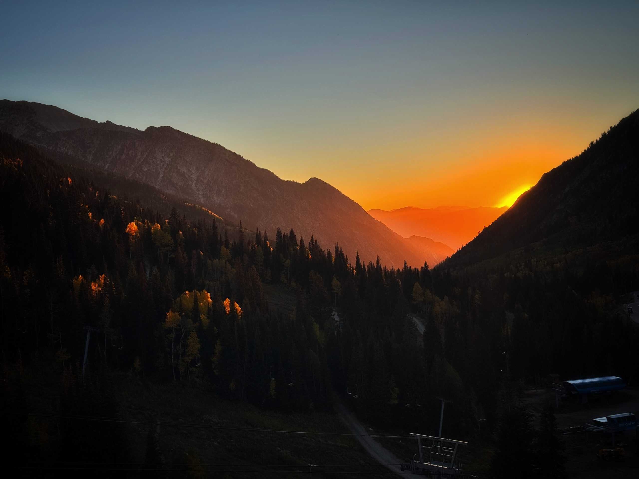
12. Catherine’s Pass and Sunset Peak
While my favorite way to reach Sunset Peak is from Brighton, the Alta route offers a shorter hike to the same stunning views. The trail climbs steadily to one of my favorite summits in the Wasatch, rewarding you with incredible views in every direction.
True to its name, Sunset Peak really shines in the evening light. I’ve done this hike several times, and it never disappoints. It’s beautiful in any season or time of day, though there is no winter access due to the resort boundaries and avalanche danger.
13. Cecert Lake
No, the Lake name isn’t misspelled! This short, family-friendly hike leads to a beautiful alpine lake, making it one of the more popular trails in the area.
The adventure doesn’t have to end at the lake, though. Follow the trail to the right of the lake for a higher viewpoint with even better views. Here you’ll find a metal structure which provides an excellent, elevated view of Cecert Lake!
14. Sugarloaf Peak
Sugarloaf Peak towers directly above Cecret Lake and is one of the “easier” Wasatch 11ers to summit. While Cecret Lake sits at 9,870 feet (3,008 m), Sugarloaf Peak rises to 11,051 feet (3,368 m) above sea level.
It’s a great introductory hike for aspiring peak baggers, though it can still be a challenge. There are two main routes, and my preferred option heads directly west (right) from Cecret Lake toward Sugarloaf Pass, and then to the summit.
The last half mile is steep with loose rocks, but the views from the summit are well worth the effort!
For the extra adventurous, Mount Baldy can be added as a second summit and is similar in difficulty to Sugarloaf Peak. Additionally, the infamous Devil’s Castle sits directly east and is a more technical climb — I have yet to be brave enough to attempt Devil’s Castle!
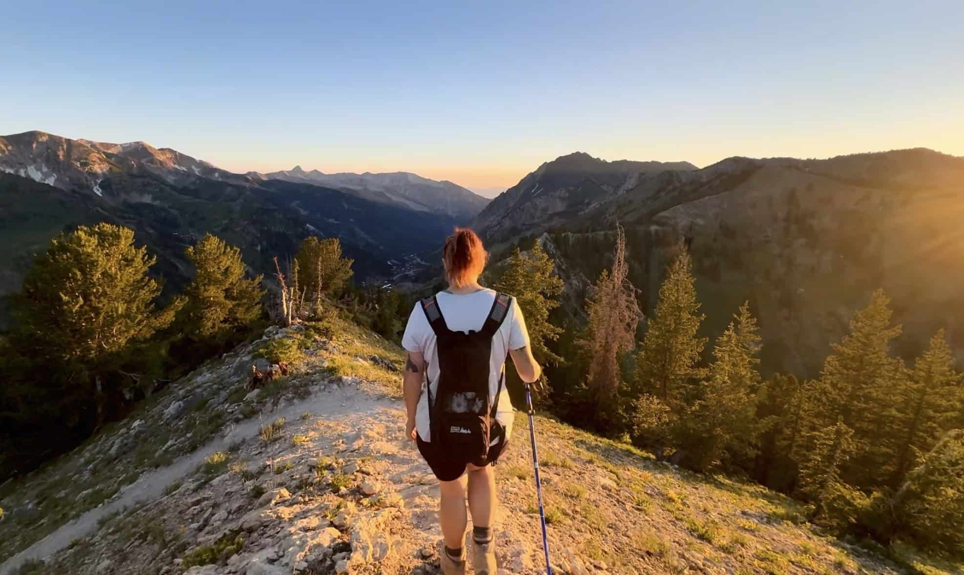
So, is Little Cottonwood Canyon worth visiting?
Whether you’re living in Salt Lake City or visiting, Little Cottonwood Canyon is absolutely worth seeing! Its tall granite walls are very reminiscent of the Sierra Nevada Mountains in California. Think of it as a mini Yosemite National Park; you wouldn’t pass up a chance to go to Yosemite, would you?
Now imagine Yosemite was only a 30 min drive from the airport! Speaking of, I once met a flight attendant on the summit of Pfeifferhorn. He was in Salt Lake City for 24 hours as he awaited his next assignment, and came across this hike. He said he simply couldn’t pass up the opportunity!
Even if you’re not looking to hike something as difficult as Pfeifferhorn, there’s so much else to explore and see in Little Cottonwood Canyon. So is it worth visiting? The answer is a resounding yes!
Disclaimer
Outdoor conditions can change quickly, and potential hazards can appear without warning. All information is provided without warranty or liability. Always be prepared, use good judgment, and hike within your abilities. Difficulty ratings are based on my personal experience, combined with AllTrails data, and your experience may vary.