The Most Overlooked 9-Day Northern California Road Trip

This is easily one of the most underrated and overlooked Northern California road trip. I’ve been lucky enough to take multiple week-long road trips across California, from the rugged Northern Coast to the Eastern Sierra, to parts of Big Sur, and this one manages to even rival those iconic road trips.
I built this road trip from scratch using Google Maps, and what I love is the quieter nature of these destinations, as opposed to California’s more famous destinations, while still offering incredible scenery.
From unique volcanic landscapes, the second-tallest volcano in the Cascades, and two of the deepest and most beautiful lakes in the world, this road trip is a paradise for mountain lovers and geology enthusiasts alike. Let’s waste no more time and dive right in!
9-Day Northern California Road Trip Overview
- Day 1: Arrive at Lake Tahoe
- Day 2: Explore Lake Tahoe
- Day 3: Explore Lake Tahoe
- Day 4: Drive to Lassen, Explore Lassen
- Day 5: Explore Lassen Volcanic National Park
- Day 6: Drive to Shasta, Burney Falls en route, and Heart Lake
- Day 7: Explore Shasta, Drive to Crater Lake in the evening
- Day 8: Explore Crater Lake National Park
- Day 9: Go Home!
Day 1: Arrive at Lake Tahoe
Arrive at Tahoe from your specific destination: we live in Salt Lake City, Utah, and made the 9-hour drive to South Tahoe. We stocked up on supplies in Reno before checking into our Hotel in South Tahoe. We ended the day by hiking to Cave Rock for a brilliant sunset, followed by the perfect meal after a long day!
Morning
We left Salt Lake City at 6 a.m. and made the roughly nine-hour drive to South Lake Tahoe. Travelers flying in will find Reno-Tahoe International Airport the most convenient option, though Sacramento often offers more affordable flights.
As we crossed Spooner Summit along Highway 50, Lake Tahoe finally came into view. Even after multiple visits, that first glimpse of the lake remains one of my favorite moments in the Sierra Nevada.
Afternoon
Prior to checking into our hotel, we bought the 10 Oz Frontiersman Bear Spray from Big 5. Afterwards, we spent the evening stretching our legs on a short hike to Cave Rock.
The drive from Carson City to Tahoe is on the steep, scenic Highway 50. While this is one of several ways to reach Tahoe, it’s the best option for people coming in from the West. After you pass the Spooner Summit, you begin to get peekaboo views of Lake Tahoe! I love this part of the drive.


Soon, we drove through the tunnel carved through Cave Rock, which we would be hiking later! When you first see Tahoe, you will see why it’s special. If you want to help protect the lake, follow the Leave No Trace Principles and consider donating to Keep Tahoe Blue. I love this slogan, let’s keep Tahoe Blue forever!
We arrived at our stay just before the 4 pm check-in time. We stayed at the Hilton Vacation Club Lake Tahoe Resort, and the check-in process was long but the stay was nice, clean, quiet, affordable, and centrally located.
Evening

The plan for the evening was to stretch our legs by hiking to Cave Rock, which is a quick but amazing hike! Having been to Tahoe many times, somehow I didn’t know about this hike before.
The trailhead is very small, and while the hike is only 1 mile (1.6 km) round trip with 120 feet (37 m) of elevation gain, it involves some easy scrambling at the end. The sunset views here are out of this world! We saw several lightning flashes across the lake, near Emerald Bay, which was super cool but also scary!

The incoming storm forced us to head down sooner than anticipated, and we finished watching the sunset from Cave Rock State Park, which sits just below Cave Rock. I imagine you can park here if the Cave Rock trailhead is full, but there is a $10 entry fee. There is a pedestrian crosswalk nearby as well.
For dinner, while there are many options in Lake Tahoe, most restaurants close early. We manage to find a rare open restaurant: Chicken in a Barrel BBQ. I tried the Hawaiian Cheeseburger with sweet potato fries, and my partner had the BBQ pulled pork grilled cheese. We were super impressed! Perfect way to end the first day.
Where to Stay:

We spent the first three nights at the Hilton Vacation Club Lake Tahoe Resort. The stay was nice, clean, affordable, and very conveniently located. We were able to walk down to the lake, to several restaurants, coffee shops, a Gelato shop, and the paved biking/walking path!
Just do your best to avoid the sales pitches during check-in! I found saying “we are not interested in attending the class as we have a really packed itinerary” worked really well! They will tempt you with the “free 7-day stay if you attend the class” pitch, which I almost fell for!
Day 2: Explore Lake Tahoe
Day 2 began with coffee, followed by my favorite scenic drive to Emerald Bay, with a few pit stops along the way! We then hiked to Eagle Lake and continued toward Maggie’s Peak (almost summitting) before heading back to South Lake Tahoe for lunch and a scooter ride. The day ended with a sunset cruise on Lake Tahoe and Emerald Bay!
Morning
A 6 a.m. wake-up led to a quick stop at Free Bird Chai for coffee right across from our hotel. We tried two of the monthly specials: Pistachio Latte and Honey Lavender Latte. I am lucky my partner loves to share her coffee! We loved this spot so much that we returned on day four.
Next, it was onto Emerald Bay! On the way, an old fire burn area reveals seeping views of Lake Tahoe. Soon, the road narrows, and suddenly Emerald Bay comes into view on one side and Cascade Lake on the other: I absolutely LOVE this view, though there’s no pull-off to enjoy it.

Next, we stopped at Inspiration Point, Emerald Bay Vista Point, and Emerald Bay State Park Lookout to take in the beauty of Emerald Bay and snap some photos! We were able to enjoy all the overlooks in about 45 minutes!
Then came the fun part: I wanted to combine Maggie’s Peak with Eagle Lake. I LOVE the hike to Eagle Lake, having done it twice before, and was intrigued by what lay ahead. We’d start at Eagle Falls Trailhead and finish at Bayview Trailhead, but this meant walking the narrow 1-mile road back to the car, which felt like a really bad idea.
By 8 am, we were on the short but steep hike up! Passing by Upper Eagle Falls, we climbed through a canyon of tall pines and granite cliffs to the serene Eagle Lake. Greeted by a perfect mirrored reflection, we spent thirty minutes enjoying this view
Note: At the trailhead, you’ll find a wilderness permit register that all hikers must complete before starting their hike. Day-use permits are free of charge and should be attached to your backpack while you’re in the Desolation Wilderness.

The trail steepens for the next half mile. We both noticed a little “island” in Eagle Lake. Being on this trail brought that “special” feeling of belonging in the Sierra wilderness, perhaps the same thing John Muir felt. After Eagle Lake, we hardly met anyone else.
Arriving at a pass after 3 miles (4.8 km) and 1700 feet (518 m) of climbing, we chose to continue the loop towards Maggie’s Peak. It was 11:30 am, and afternoon thunderstorms were building. The trail climbed a bit more before flattening at the Maggie’s Peak junction.


Here I heard distant rumbling, so we decided not to summit, as the final push required boulder hopping. From there, we quickly descended 1500 feet (472 m) in 2 miles (3.2km), and enjoyed the peek-a-boo views of Tahoe and Granite Lake
The last mile delivered two epic Emerald Bay views before the rain began. We finally made it to the Bayview Trailhead and got lucky hitching a ride with a friendly couple from Texas.
Back at the Eagle Falls Trailhead, it was packed! Leaving quickly, we soon got caught in a torrential downpour. Perhaps not summitting Maggie’s Peak was wise, but starting earlier would have been even wiser!


Afternoon
We stopped at our hotel before riding Lime scooters to Sno-Flake Drive-in. We spotted it earlier, and it looked like a cute lunch spot! I had a Chili Cheese Dog, and my partner ordered a burger with fries. Despite the lower Google rating (3.8/5). The food was better than expected!

On the way back, we stopped the scooters and walked to El Dorado Beach in the heart of South Tahoe City. We barely saw another soul. Though the rain stopped, the thunderstorms kept people inside.
As we headed back to the hotel, something caught our eye that we couldn’t resist: “Art of Gelato!” We enjoyed the Pistachio, Espresso, Maple Pecan, and Coconut Gelato in two medium-sized cups. After our tough hike, we deserved every bite!


Evening
For our 6 PM cruise, we were able to walk straight from the hotel to the docks. Although I saw several lightning strikes across the lake on the north shore, the captain confirmed we were clear to set sail!
From the start, we received a complimentary glass of champagne that gave me a light buzz and set a relaxed tone. The cruise was absolutely stunning, combining informative commentary, music, and a relaxed atmosphere. We crossed over the lake’s deepest point, sitting 1600 feet below, the second deepest in the U.S!
Soon, we sailed into Emerald Bay. Seeing it from below now and seeing it from above just hours earlier was quite the treat!

Historical Note: Vikingsholm Castle.
In 1928, Mrs. Lora Josephine Knight bought the land where the Vikingsholm castle was built, as well as Fannette Island, for about $250,000 (~ $5 million in 2026). The cliffs of Emerald Bay reminded her of her many visits to Norway’s Fjords.
After hiring over 200 men to manually build the castle, she enjoyed it for 15 years and hosted many tea parties before passing away at 84 years old. The property was bought out multiple times since and eventually sold to the state of California, and can now be preserved forever.
Unfortunately for us, Vikingsholm tours were not being offered in 2025 while crews worked to restore and strengthen the castle.

After spending nearly half an hour in Emerald Bay, we began to sail back. The cloudy skies suddenly lit up for the most amazing sunset, putting to ease our initial worries about a gloomy sunset! We enjoyed the rest of the cruise until the last light of the sun faded.
The cruise ended at 8 PM, and while most people would go back to the hotel to unwind, we walked around a little. The night was cold, but a cozy restaurant caught our eye! While we weren’t hungry, we decided to try an appetizer here.


The Mezze Plate at the Artemis Lakefront Cafe hit the spot, and we had decided we’d come back for a full dinner there the next day! Afterwards, we finally went to sleep after a really long, adventure-filled day!
While I absolutely LOVED our sunset cruise, I wish I knew about the MSS Dixie, which we spotted in Emerald Bay. Afterwards, I googled the MSS Dixie Dinner Cruise and immediately added it to my list for next time!
Day 3: Explore Lake Tahoe
Day 3 of our Northern California road trip began with coffee, followed by a scenic drive to Incline Village, where we rented bikes and tackled the 10-mile round-trip ride to Sand Harbor Beach. After lunch, we continued our journey around the rest of the lake, making a few unexpected stops. We wrapped up the day with dinner in South Lake Tahoe.
Morning
Day 3 began early at 7 AM with a visit to Three Pines Coffee Company. I ordered a yummy Pistachio Cardamom Latte while we split the tastiest coffee cake, made in-house! This was the perfect way to start a sleepy morning, where it felt hard to get moving!
We then drove 45 minutes north to Incline Village and rented bikes from Village Ski Loft. The entire rental process went super smoothly, and I highly recommend them!

We rode the 5-mile (8 km) ride to Sand Harbor Beach and zoomed past multimillion-dollar homes, flower-lined streets, turquoise pockets of water, and forests that rivaled the PNW. The ride was unforgettable, though a storm was brewing overhead. This is easily the BEST biking path for lake views!
With our bikes, it only cost $2/bike to enter Sand Harbor, while dodging both traffic and the reservation system! We spent nearly 1.5 hours soaking in the views, dipping in the water (the sun even showed for a moment), and warming up with a delicious London Fog from the Kokanee Bar & Grill. But the storm continued building!


Changing back into our biking clothes, we quickly rode back to Incline Village. The route back was just as amazing, though the final stretch was all uphill. We ended our ride at about 3 PM and worked up quite an appetite!
If you’re looking for E-Bike rentals, I highly recommend booking with Tahoe Multisport. I have rented their e-bikes before, and they are just as amazing!
Afternoon
We found a charming little lunch spot called Incline Bak’d, where we enjoyed a Spinach and Roasted Pepper Stromboli with Coconut Chia Seed Pudding and Avocado Chocolate Mousse on the side! This food was amazing, filling our bellies with happiness as our stomachs had been rumbling!
Suddenly, a different rumbling began overhead! By 3:30 PM, as we left Incline Village to drive around the lake, the sky opened up in a downpour. How lucky were we with our timing!
We drove straight to Tahoe City, which sits in the northwest corner, while passing by charming towns like Dollar Point and Kings Beach. Luckily, the rain stopped upon arrival, giving us a chance to explore.


For an hour, we walked to the Lake Tahoe Dam and the closed Gatekeepers Museum. This dam controls water flow to the Truckee River for downstream communities and has raised the lake by 10 feet. I hope to hike or bike the Truckee River Trail here someday!
Driving the west shore with no real plan, we suddenly noticed people standing on a rocky outcrop above us. We spontaneously pulled into a nearby lot to see if we could hike to it, and sure enough, we could!

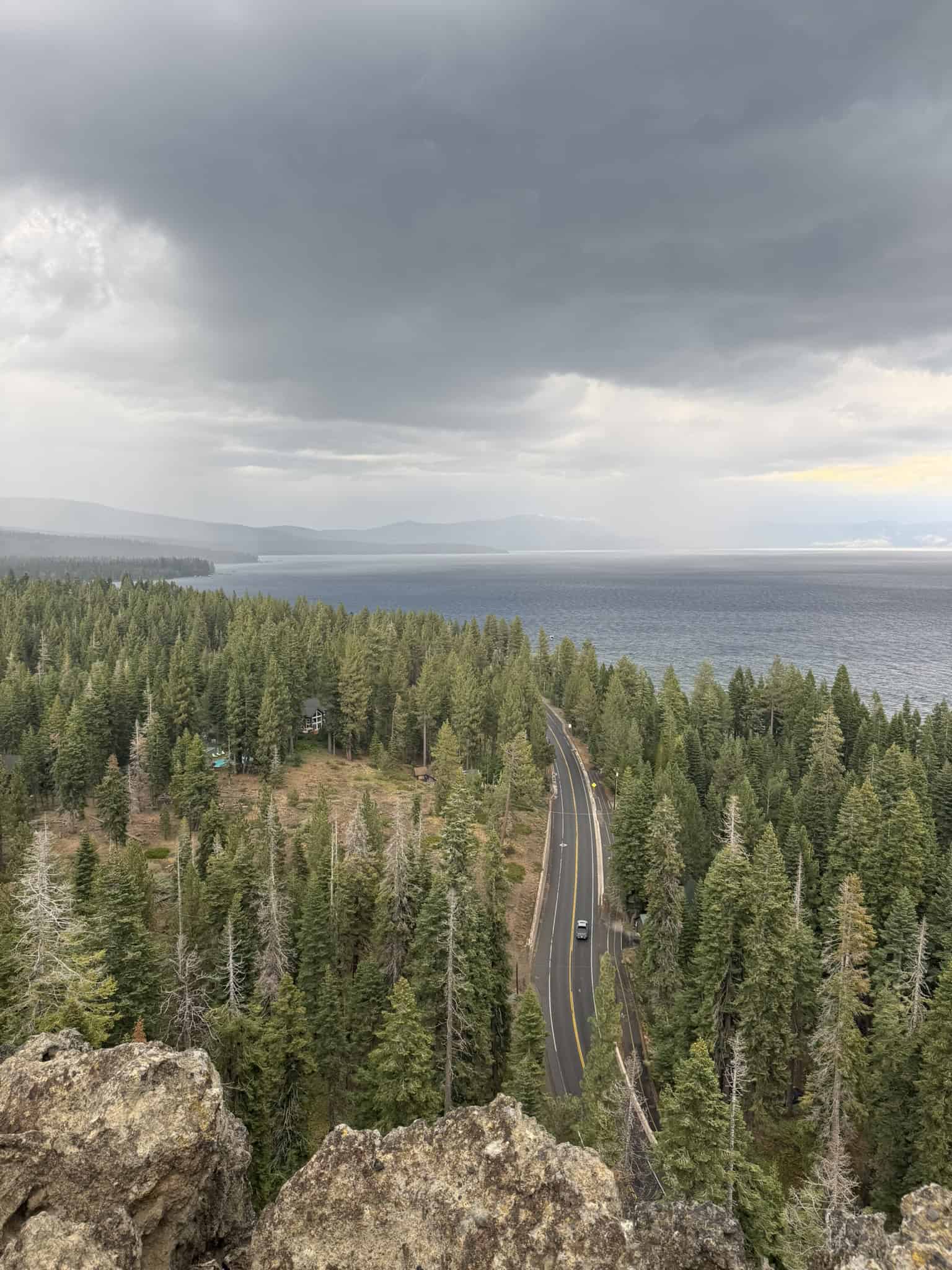
We had just discovered Eagle Rock, a volcanic plug, with some of the best views of Lake Tahoe. This was an unexpected and magical stop. I mean, look at that view! Standing atop the rocky outcrop and watching the storm we had just driven through was invigorating. We completed the hike in about 35 minutes, as it was fairly short but steep.
Historical Note: Da-ow
It’s here that we learned about the Washoe tribe, who called Lake Tahoe “Da-ow”, meaning “The Lake.” I try my best to remember the Native American names of places I visit!
We continued to drive along the West Shore, not stopping much as it started raining again. Shortly, reached the Emerald Bay area, which I can’t get enough of!

We had one stop left: Camp Richardson’s Ice Cream Parlor, where they give you a huge ice cream serving! I tried the Pistachio Almond, and my partner enjoyed the Rocky Road. While not my absolute favorite Ice Cream, I still recommend them. We sat outside in the cold weather, and something about that just hit different!
Evening
Back at the hotel, we freshened up before deciding to go explore South Tahoe City and find a dinner spot. Shockingly, everything was closed by 9, and the city felt like a ghost town.

We planned to eat at “Tipsy Putt,” but they were only serving drinks by 9 PM. Several other places had just closed as well. We ended up at Dumpling 85 for some delicious and warm noodles. While we wanted to walk around South Tahoe City, it was cold, and most of it was closed, so we called it a day.
Day 4: Lake Tahoe to Lassen Volcanic National Park
Day 4 began with a repeat cafe visit, followed by a farewell breakfast and beach walk at Zephyr Cove. We then embarked on the four-hour drive to Manzanita Lake in Lassen Volcanic National Park, with a few surprise visits along the way. After setting up camp, we drove to Bumpass Hell, tackled this iconic hike, and then called it a night.
Morning
Before leaving South Tahoe, we made a last stop at Free Bird Chai for coffee, with a nearly identical order as before, because it was so good! From there, we headed to Zephyr Cove for breakfast at the Zephyr Cove Restaurant.
The restaurant has a warm, cozy atmosphere just minutes from Lake Tahoe. We split the Zephyr Special, a hearty breakfast with an omelet, hash browns, and toast. It was simple, delicious, and exactly what we needed to fuel up before a long day of driving.
After breakfast, we walked down to the Zephyr Cove Beach. Unlike the previous morning, which had been cloudy and moody, this morning greeted us with beautiful skies.
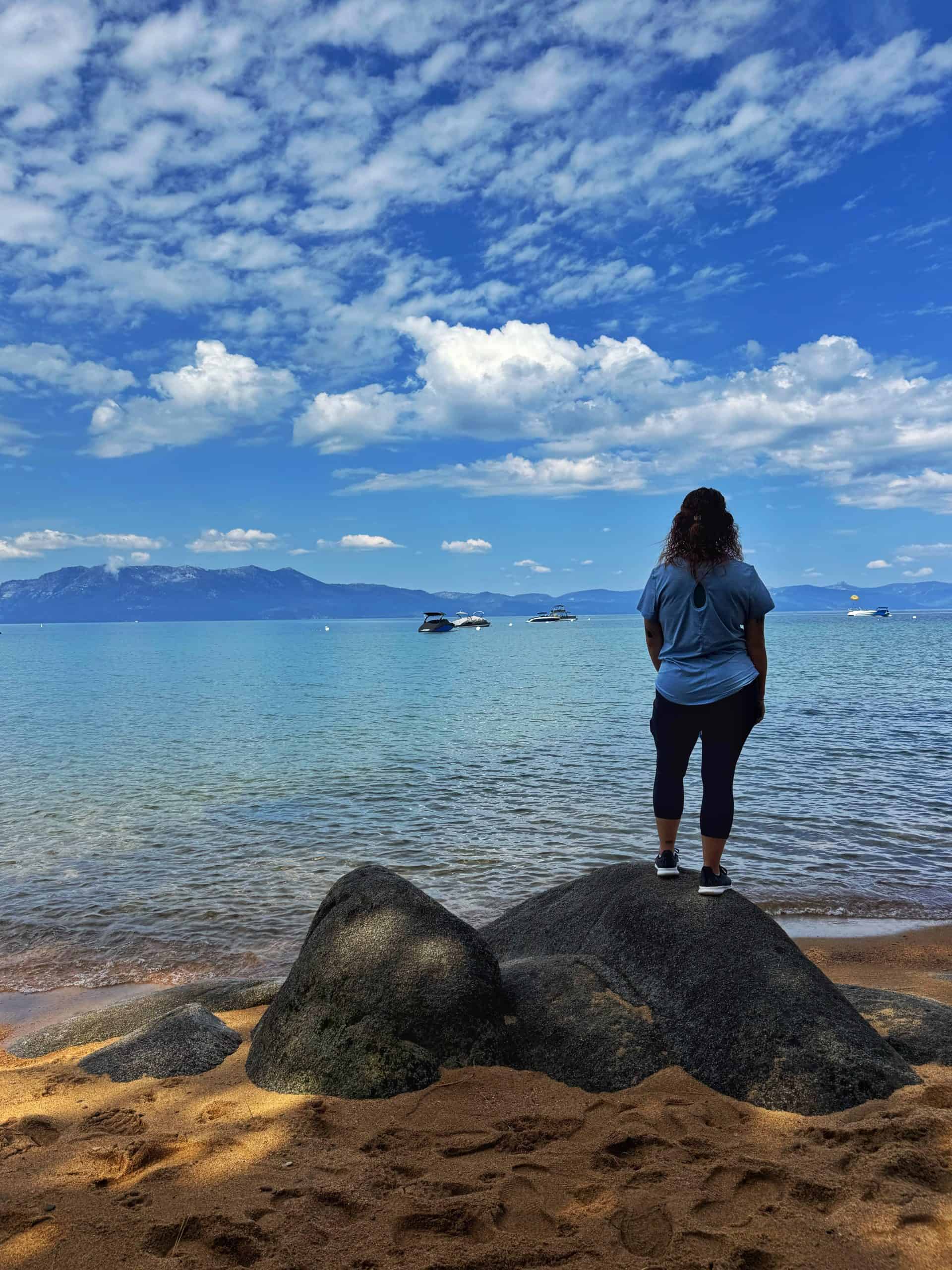

We wandered along the shoreline and took in the views one last time. The Zephyr Cove day-use area looked incredibly inviting, making it even harder to leave. By the time we finally drove away around 11 a.m., we were already talking about coming back someday. Three days barely scratched the surface of what Lake Tahoe offers!
Subscribe Here!
If you’re enjoying this content, sign up for My Weekly newsletter!
Afternoon
The drive to Lassen Volcanic National Park would take nearly four hours, and was quite the surprise! This part of California feels so underrated as you transition from high desert into dense PNW forests and volcanic terrain in just a few hours.
Scenic Drive Details:
After Reno, we followed Highway 395 north before we stopped at Safeway in Susanville to resupply before continuing west along Highway 44, part of the Volcanic Legacy Scenic Byway. As we drove, dark storm clouds began building overhead, a familiar sight during our trip.
Earlier in the drive, we spotted distant towering storm clouds, and now they were directly above us. The monsoonal moisture was producing some strong afternoon storms that week!
The scenery along this stretch is both beautiful and sobering. Large sections of forest remain scarred from the 2021 Dixie Fire, the largest single-ignition wildfire in California history. Seeing the burn areas firsthand was a powerful reminder of the power of nature.
Eventually, the sky opened up on us as rain pelted our windows! We were caught under a microburst. Not long afterward, the rain let up, and we spotted a sign for the Hat Creek Rim Scenic Viewpoint. If you know us, you already know what happened next. We pulled over immediately!

The short detour rewarded us with sweeping views of the surrounding landscape, including our first clear look at Lassen Peak and a glimpse of the distant Mount Shasta rising on the horizon. It felt like the perfect introduction to the volcanic wonders of Northern California.
Before entering the park, we stopped in the small station of Old Station to pick up firewood and any last-minute necessities.
Immediately after passing the park entrance station, Manzanita Lake appeared beside the road, offering a beautiful first impression of the park. We checked into the Manzanita Lake Campground, set up camp beneath the pines, and spent a little time browsing the nearby gift shop before heading out to explore.
Pro-Tip: Grab your “America the Beautiful” National Park Pass in advance. I get it every year. It covers not just all the national parks, but also includes national park sites, and forest service sites (parking fees and campground discounts)
Evening
With camp set up, it was finally time for the hike we had been looking forward to all day: Bumpass Hell! The name alone made it enticing.


The drive to the trailhead was worth the price of admission itself. As we drove higher, we found ourselves stopping every few minutes to admire the views. Meadows stretched across the landscape, Lassen Peaks dominated the horizon, and Lake Helen looked almost surreal in the afternoon light.
Eventually, we reached the Bumpass Hell Trailhead and started hiking around 6:20 p.m. The trail immediately impressed us.
This hike treats you to stunning views of Lassen Peak and Brokeoff Mountain, while colorful lupine meadows line portions of the trail. After about a mile of gentle climbing, we reached the overlook where Bumpass Hell finally comes into view.
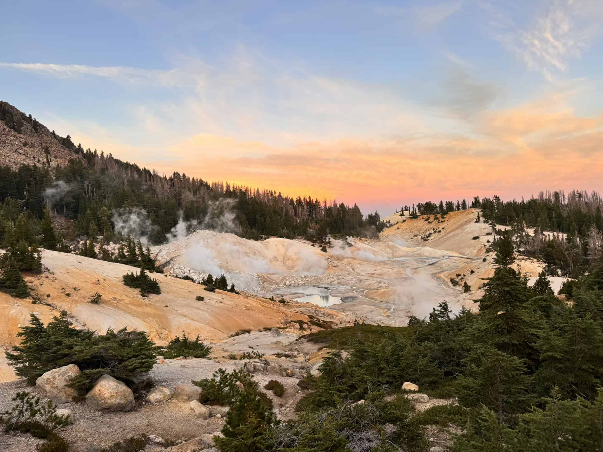

From a distance, you barely get a view of the colorful basin. Do not stop here! The real magic begins when the trail steeply descends to the boardwalk below.
Thanks to the late hour and a midweek visit, we had the area entirely to ourselves. Walking through the geothermal basin felt like stepping onto another planet. Bubbling mudpots, steaming vents, colorful pools, and hissing fumaroles surrounded us in every direction. The landscape felt ancient, alive, and strangely otherworldly.
The silence here made it stand out when compared to Yellowstone, but I still find it difficult to describe places like Bumpass Hell, as photos never seem to capture the feeling of being there. More than anything, it reminded me how fascinating and dynamic our planet truly is.

As the sun began to set, we started the steep climb back toward the overlook. The surrounding mountains glowed with warm evening colors, turning an already beautiful hike into something truly unforgettable!
On the drive back to Manzanita Lake, we pulled over several times to admire the darkening sky. Distant flashes of lightning flickered far beyond the horizon, and as night settled over the park, countless stars began appearing overhead. Lassen is known for its especially dark skies.


Back at camp, we built a small fire, ate dinner, and reflected on everything we’d seen. It had been a long day, and it felt as if we had already experienced an entire vacation’s worth of scenery.
And somehow, the best part of Lassen was still waiting for us the next morning.
Where to Stay
We highly recommend Manzanita Lake Campground by the northern entrance. It offers clean restrooms, drinking water, a cozy sheltered forest setting, and a wonderful, convenient store with amazing coffee, food, and a gift shop!
The name is slightly misleading since the sites do not offer direct lake views, but you can enjoy a beautiful morning walk to Manzanita Lake. I mean, name a better way to start the day?
Sites book up fast during peak season, so reserve yours ahead of time through recreation.gov.

Day 5: Explore Lassen Volcanic National Park
Day five was one of the highlights of our entire Northern California road trip. The day began with a hike to Lassen Peak itself, followed by two stunning alpine lakes stops, a unique volcanic feature, stunning mountain scenery, and one of the best sunsets of the trip. Looking back, I am so happy we spent about 36 hours exploring this gem of a national park. There is more here than I ever imagined!
Morning: Hiking Lassen Peak
While originally planning to leave camp by dawn to secure a parking spot, seeing the size of the parking lot the day before made us realize an alpine start was unnecessary.
I woke up around 6:30 and realized I had left warm embers in our fire pit, which is not good practice, and I highly recommend against it. I relit them and got a small fire going while we got ready. It made the morning feel a little more relaxing before our busy day. Our morning fuel consisted of delicious caffeinated hot chocolate and Spylt protein shakes.
We quickly packed up and drove the 45-minute scenic stretch of the Volcanic Legacy Scenic Byway, reaching the Lassen Peak trailhead at 8:50 AM and starting our hike right at 9:00 AM. With only a dozen cars at the trailhead, we had no trouble finding a spot, as there are easily 100 parking spots!
Lassen Peak wastes no time and gets you straight to open mountain vistas! Since the drive is basically the approach, the rest is pure mountain euphoria. The well-maintained path passes at least a dozen interpretive signs that explain the local geology, wildlife, and eruption history. It feels like hiking through an outdoor museum, which we both absolutely loved!


Right off the bat, you will spot the Vulcan’s Eye: a prominent rocky outcrop that flanks Lassen’s southwest slope. From there, the trail climbs steadily on long switchbacks through fields of wildflowers. Every time we looked around, the views somehow got better!
A light haze from distant wildfires added depth to the layers of ridges, and Lake Almanor made an appearance, barely poking out beneath the haze. From here, the trail continues to switchback up the flank of the mountain.

Geological Note: Quenched Blobs
One of my favorite interpretive stops explained the “quenched blobs”, which are unusual rocks created when the cooler, lighter dacite rock fell into a mixture of hot basalt lava from the 1914 eruption of Lassen Peak. As the lava cooled off, the dacite rock became encased by the darker basaltic rock. Look at some of the rocks to see if you can spot these dacite “blobs”.
Shortly after, Lake Helen appeared below us. Its turquoise water shimmered against the volcanic landscape, which looked so unreal. As we climbed higher, I couldn’t help but stare at the ridgelines extending southwest, which we later learned are the remnants of an ancient volcano known as Mount Tehama.

I kept imagining what the original volcano looked like before it collapsed 400,000 years ago. What a sight it must have been!
Geological Note: California’s Youngest Rock.
Just before the final stretch, we passed a sign marking California’s youngest rock. Black dacite rock formed directly in the crater during the 1914 eruption. Pressure from building steam eventually caused the lava dome to fracture, scattering the newly formed rock across the summit area.
Just before the false summit, a descending hiker warned us of nasty wind gusts at the true summit and suggested we leave our backpacks behind. The advice proved accurate. The winds on the scrambling section were so bad that we turned back temporarily.

After resting in a wind shadow until we felt better, we switched to a more sheltered route that required a bit more scrambling but kept me out of the worst of the wind. As I reached the true summit, I finally stood on my first Cascade Volcano!
Ironically, the actual summit is super rocky, and the false summit offers a better view. But, halfway between the two summits, is the absolutely perfect framed photo of Mount Shasta, the second-highest volcano in the Cascade Mountains!

Reaching the summit was an emotional moment for me, after a long recovery from retinal detachment surgeries, which had kept me from hiking for over 7 months. Standing above 10,000 feet felt like reclaiming a piece of my identity!
The hike in total took us about five hours, including all the stops, with a 3:10 moving time. This is a decent pace considering we are fairly average hikers. Follow me on AllTrails to see all the details!
Afternoon
We spent the afternoon exploring the rest of the park road to see what it had to offer. These three spots stood out to us, and I would 100 percent visit them again!
Lake Helen
A revisit allowed us to discover a nice picnic area with several tables close to the water. The color of Lake Helen is unbelievable, bright turquoise in the shallows and rich emerald deeper in. Lassen Peak looms directly behind it.

It’s easily my favorite lake in the entire park. It is incredibly accessible, making it the perfect stop. We originally had no intention of picnicking here, but the lake kept pulling us back in. We ended up having a blast and even dipped our toes in the freezing water! Perfect post-hike spot!
Emerald Lake
Just two minutes further down the road was our next stop. At first glance, I was not super impressed with Emerald Lake, but as we walked along the shoreline, we found the perfect spot where a fallen log stretched straight across the water, and my perspective shifted. The emerald color absolutely lived up to its name.

Lake Helen still wins my vote for the prettiest lake in the park, but Emerald Lake is right on its heels. I wish there were a proper trail circling the lake, but it did not stop us from enjoying it. I am truly amazed by how much scenery is packed into such a small park!
Sulphur Works
Bubbling mud pots are fascinating in and of themselves, but it’s the geology at Sulphur Works that shocked me.
Geologic Note: The Volcano’s Belly
Brokeoff Mountain, Mount Diller, and Mount Conrad once formed a single massive volcano known as Mount Tehama. We learned this earlier, but the real scale became apparent here. That ancient volcano measured over 11 miles (18 km) wide and stood roughly 1000 feet (305 m) taller than Lassen Peak.
And Sulphur Works? Well, here, you’re standing directly in the heart of Mount Tehama. You are literally standing where the magma chamber used to be, and this steam vent is all that’s left. That fact still gives me chills.
The site also holds interesting human history. A prospector sold Sulphur from the area in the 1860s, and a lodge called the Sulphur Works Inn opened in the 1950s, featuring a bathhouse heated by natural steam vents. I imagine it would have been a fun place to visit!

To the End of the Road
From Sulphur Works, we drove to the south end of the park, where there’s a visitor center and a campground. You can follow along on this free guided audio tour, which starts at the Visitor Center and ends at Manzanita Lake. I highly recommend it as it helps you understand the history, geology, and human history into one interconnected story.
Since service is spotty inside the park, if you can’t download the free audio guide, I highly recommend purchasing this Self-Guided Audio Driving Tour, which offers a far more detailed and immersive experience than the free guide.
Evening
Back at the campground, most people would call it a day, but we couldn’t pass up the opportunity to watch the sunset. So we drove a few minutes and then hiked about half a mile (0.8 km) to the Lassen Peak Overlook on Manzanita Lake.

We encountered a juvenile deer a few feet away. I initially thought we had found the main photo op, but we kept walking and stumbled onto the official overlook, which I didn’t know existed. From here, Lassen Peak and the Castle Crags lit up in golden alpenglow, reflected perfectly in Manzanita Lake. Perfect timing!
For about 20 minutes, we took photos, set up my GoPro for a night lapse, and soaked it all in. Perfect way to end the day. This hike can be as short as a 1/2-mile (0.8 km) or a full 2.5-mile (4 km) flat loop. We parked our car at a pullout near the park entrance and took a quick jaunt from there.
After sunset, we made our way back to camp. We grilled hot dogs, made simple bean and cheese burritos, and enjoyed another campfire, which I properly put out this time. We snapped a few photos of stars before turning in around 10 PM. The daylight was already shrinking noticeably, a sign of Autumn approaching.
Day 6: Lassen to Mount Shasta
Day 6 began with a surprisingly great coffee shop, followed by the drive to Mount Shasta. Along the way, we spent two hours exploring the wonder that is Burney Falls. After checking into our Airbnb, we enjoyed dinner at an amazing restaurant, visited Lake Siskiyou, and completed one of the best hikes of the entire trip!
Morning
I woke up before sunrise with one thing on my mind: my GoPro! I wanted to retrieve it before anyone else wandered by and potentially stole it, so we walked back to the overlook to retrieve it.
The bonus was watching the sunrise, with the soft morning light on Lassen Peak reflected across the lake. It made for the perfect farewell to the park.

After taking down camp, we stopped at the campground store again. I had noticed a small café attached to it the day before and decided to give it a try. I ordered a White Chocolate Brownie Sugar Mocha with no expectations. It ended up being the best coffee of the entire trip!
Somehow, this tiny coffee shop inside Lassen Volcanic National Park was the winner. Not only that, but the gift shop attached to the store was also one of the best of the entire road trip! Such a hidden gem, I could have bought so many things from there!
From here, we drove towards Burney Falls, and once again, I felt overwhelmingly grateful that I still had my vision and the ability to experience places like this. A moment of gratitude.
Afternoon
The drive to Burney Falls takes only 50 minutes from Manzanita Lake, making it the perfect pit stop en route to Mount Shasta.
Pro Tip: Visit Burney Falls on a weekday, or as early as possible. As of 2026, advanced reservations are required on Friday, Saturday, and Sunday during peak season.
We arrived there around 10:40 a.m. and paid the $10 entrance fee. One of the first things I noticed was a volunteer directing traffic in the parking lot. It’s a small detail, but efficient parking can make a huge difference at popular parks. I took a moment to thank him.
We immediately familiarized ourselves with the area, between the hiking trail, the gift shop, a store, and a restaurant. Our goal was simple: see Burney Falls! Ever since I heard about this waterfall, I had been imagining the day I get to experience it.


Simply put, photos don’t prepare you for the real experience. Unlike most waterfalls, Burney Falls features two large cascades dominating the center, with water also spilling from countless cracks throughout the volcanic cliff face, creating a waterfall curtain.
Geologic Note: Burney Falls Water Source
The geology here is fascinating. Rather than relying primarily on a river, Burney Falls is fed largely by underground springs and snowmelt filtering through porous volcanic rock before emerging directly from the cliff itself. As a result, the waterfall maintains an impressive flow year-round, even during California’s dry summers.
We took our time walking down the paved switchbacks to the base. Every turn revealed a new angle, and somehow each view seemed better than the last. When we reached the bottom, I truly understood why Teddy Roosevelt dubbed Burney Falls the “Eighth Wonder of the World”

Pro-Tip: Walk the entire loop, as it winds through a beautiful forest, offers quiet river viewpoints, and isn’t too difficult.
We spent nearly two and a half hours exploring the state park, including one of the coolest visitor centers I’ve ever visited. They had microscopes set up for examining feathers, rocks, plants, and insects, and for a few minutes, I felt like I was back in elementary school, rediscovering how fascinating nature can be.
Leaving Burney Falls, Mount Shasta seemingly got bigger with each passing moment. The 1-hour-long drive featured dense forests lining both sides of the road, while this enormous volcano kept appearing between the trees. Every few minutes, I found myself saying the same thing: “Man, that’s massive!”


Eventually, we arrived in Dunsmuir and checked into our Airbnb before grabbing lunch at a place called Drizzle. I heard about this place through Instagram, and figured it was worth a try.
My partner ordered a burger and fries, while I went with a Chipotle bowl loaded with chicken, black beans, cabbage, kale, cheese, and homemade chipotle sauce. Everything was fantastic. In fact, we liked it so much that we’d come back the next day!
Evening

A quick stop at Lake Sisikyou was a highlight en route to our next destination. This lake is confusing, as there are multiple beaches and a paid resort.
Pro Tip: Cable Beach is the only free beach you can access that gives you a view of Mount Shasta from the shore! Sunsets here are stunning!
Our goal for the evening was to hike to another place I’d been dreaming about for years: Heart Lake. This hike is a little misunderstood, as the viewpoint we hiked to looks down onto Castle Lake with Mount Shasta off in the distance. Heart Lake itself is a small lake that sits 1/2-mile (0.8 km) before the overlook.

The trail begins on the shores of the stunning Castle Lake, before climbing gradually through gorgeous meadows. With every step, the views get better.
Before long, Mount Shasta dominates the horizon behind you. We were racing to catch the sunset, and every step we took was in anticipation of the view we sought. Eventually, we made it to Heart Lake, where we realized we still had to go a bit further. We kept hiking, increasing our pace while chasing the sunset (quite literally!)
Eventually, a short off-trail boulder hop brought us to an overlook that was better than either of us could have dreamt of! Castle Lake stretched out below us. Mount Shasta towered in the distance. Golden evening light washed across the landscape. It was so much more beautiful than I imagined.

We sat down with our snacks, took way too many photos, and talked about life. By the time the sun started dropping toward the horizon, everything felt okay. Better than okay. These are the moments we live for!
As the light faded, we climbed a little higher onto the rocks above our original vantage point. Somehow, the view got better as more mountain peaks popped into view. I must have taken a hundred photos as Mount Shasta glowed in the distance, and I don’t regret a single one.
Where to Stay
We stayed in an Airbnb just 10 minutes north of Mount Shasta in the small town of Dunsmuir. Our stay was small, simple, and cozy: one of those places that feels surprisingly comfortable despite having only the basics. We met our host on the morning of Day 7, with whom we shared the kitchen and living space.
I highly recommend this stay if you are on a budget. The only downside was the porta-potty, which I am not the biggest fan of, but I loved the outdoor shower!
Day 7: Mount Shasta to Crater Lake
Day 7 was the most hectic day of the trip. We started with coffee before heading out to see the three McCloud Falls. From there, we enjoyed a scenic chairlift ride at Mount Shasta Ski Park, followed by lunch. We then drove to Panther Meadows, and after that, we tried kayaking on Lake Siskiyou. From there, it was a 1.5-hour drive to Klamath Falls.
Morning
The day started with a serious vacation dilemma: we hadn’t found any good ice cream since Lake Tahoe. It sounds silly, but a great local ice cream spot is a must-have on a vacation! One spot in Mount Shasta was closed, and a barista almost talked us into buying a pint from a grocery store, but that felt wrong. We wanted something more local and unique.
With that dilemma unresolved, we decided to sleep in and enjoy the morning in our Airbnb in Dunsmuir. Soon, we were back on the road with Mount Shasta once again towering above the forests beneath a blue sky.
Our first stop was Theory Coffee Roasters in the town of Mount Shasta. We were originally hoping to solve the ice cream problem there, but that didn’t work out. The coffee was decent, and we split a ham-and-cheese croissant while figuring out our plan for the day.
We had another dilemma: our very busy agenda. We wanted to sleep in, find an ice cream shop, hike to the three McCloud Falls, ride the Mount Shasta Ski Lift, Drive to Panther Meadows, Kayak Lake Siskiyou, and then drive 1.5 hours to our hotel in Klamath Falls. Phew, that sounds like SO much, right? Could we do it?
The coffeeshop was extremely busy, and by the time we left, it was nearly 10 a.m. We decided our first destination would be the McCloud Falls. The decision paid off immediately.

Originally, we wanted to hike the 4-mile (6.3 km) round-trip trail that connects all three waterfalls, but due to time restrictions, we decided to drive to each. First stop: Middle Falls. We walked down a steep set of switchbacks to what is, in my opinion, the best of the three falls!
Next was Upper Falls, which is a short walk from the parking lot to a viewpoint of the waterfall. While not quite as dramatic as Middle Falls, it had its own charm. Near the parking lot, we found a more gentle section of the McCloud River, where we dipped our feet to cool off! It was starting to get warm!
Last was Lower Falls, which was easily the busiest of the three. Here you can walk to a small cliff above the falls, from where people were cliff-jumping. While I didn’t find it quite as beautiful as Middle Falls, I completely understood why people love it!


All three waterfalls felt unique, and together they made for an epic waterfall experience! I recommend going in the order we did. All three are well worth visiting!
Pro-Tip: The earlier you go, the less busy! Additionally, there is no entrance fee, but parking can be limited.
Afternoon
Next, we headed toward Mount Shasta Ski Park, and the drive alone was worth it, with Mount Shasta reminding us of its presence.
The ski area itself is small and quaint, but that’s part of its charm. We immediately noticed how friendly everyone seemed, from the employees working the lifts to the staff selling tickets.


The chairlift operates only during summer “community days” and is easily one of Shasta’s hidden gems. It was slow and squeaky, but the views were not! We spent over an hour at the top, admiring Mount Shasta and enjoying the quaint Black Diamond Grill, from where my partner ordered a super refreshing drink
After descending the lift, we returned to Drizzle for an early dinner and ordered the Hot Mess Fries, loaded with fries, veggies, and meat. Honestly, nothing else seemed as appetizing! We also ordered a specialty latte because we couldn’t miss the opportunity!


At that point, it was 4 p.m., which meant we were surprisingly ahead of schedule. The previous night, we had agreed to skip Panther Meadows to fit everything else into the schedule, but we realized we might actually have time after all.
So we went for it! Just a 25-minute drive took us to the base of Mount Shasta. The drive up was spectacular. At one point, as we turned the corner, Mount Shasta suddenly and briefly appeared directly in front of us. Both of us practically screamed in joy when we saw it. Those moments are why road trips are so special.
We continued all the way to the Old Ski Bowl Trailhead, the highest accessible point on the mountain by road. Standing there, surrounded by volcanic landscapes and glacial floodplains, felt like being on the edge of something much bigger than ourselves.
Historical Note: Mount Shasta National Park?
On the way back down, we stopped at Bunny Flat, the starting point for climbing Mount Shasta itself, where we chatted with a forest service employee. We discussed climbing, search-and-rescue operations, and the history of why Lassen became a national park while Mount Shasta never did.
Essentially, there was a huge push to designate Mount Shasta as a national park in the 1910’s, but then something happened in 1914 that took the attention away: Lassen Peak erupted. This pretty much cemented Lassen as a national park, but not Mount Shasta.
Encounters like that always become some of my favorite travel memories.

Evening
The final activity for the evening was kayaking on Lake Siskiyou. Unfortunately, it didn’t work out.
The previous day, we got a little frustrated trying to figure out the layout of Lake Sisikiyou, and the frustration continued today. When we entered the resort on the west end of the lake, we were told rentals stopped at 5 pm, but online reservations had slots open until 8 pm.
After struggling to find the rental place, we found out the website was incorrect, and they had closed early. We were understandably disappointed. My partner was looking forward to kayaking all afternoon. In hindsight, we could have kayaked first and then drove to Panther’s Meadows, but we always knew we’d miss one activity that day.


Since we had already paid $6 to enter the Lake Siskiyou Camp Resort, we figured we’d spend some time wandering the lakeshore. It wasn’t the worst outcome, as it led us to one of the best sunset views of the entire trip.
We left Lake Siskiyou before dark, and as we drove north toward Klamath Falls, golden light began illuminating Mount Shasta behind us. The mountain glowed pink and orange while the setting sun lit up the haze on the opposite side. Eventually, we reached the official Mt. Shasta View Point, where we joined a handful of other travelers watching the final light fade.
The view was incredible! From this angle, Shastina stands out prominently beside Mount Shasta, giving a completely new perspective from what we had seen earlier. We spent nearly half an hour taking photos, admiring the scenery, and soaking in what would likely be our last view of the mountain.

By the time we reached Klamath Falls that night, we were exhausted. We checked into our hotel, unpacked for the evening, and immediately noticed a pizza place across the street that would become tomorrow’s dinner plan. But before going to sleep, one thing was still on our minds: the Crater Lake boat tour.
Tickets were still unavailable. Tomorrow was our only chance. And after missing them earlier that day, I went to bed wondering whether I’d blown our opportunity.
Where to Stay:
We stayed at the Maverik Motel in Klamath Falls, which had served its purpose. It was affordable, comfortable, and safe, but there was a strange seasonal bug infestation, though the bugs were harmless. The room was basic and got the job done. We were traveling on a budget, and it was perfect for us!
Day 8: Explore Crater Lake
Day 8 began with smoky skies and an early start for exploring Crater Lake. After making a few stops on the way to the park entrance, we explored the visitor center area and spent the rest of the afternoon visiting nearly 12 of the 30 overlooks along the Crater Lake Scenic Rim Drive. Dinner and dessert turned out to be a delightful surprise and the perfect way to end the day.
Morning
The day greeted us with a smoky sunrise. At first, we assumed the haze was coming from fires near Mount Shasta, but we would later learn much of the smoke was drifting in from fires farther north in Oregon.
Despite that, we had a reason to get moving early: Crater Lake. The only problem? We still didn’t have boat tour tickets.
For more than a day, we’d been refreshing the reservation system every chance we got: while eating meals, driving between stops, and when eating. Every opening disappeared before we could book it. We were starting to prepare ourselves for the possibility that we may not get tickets.
Note: Why was the boat tour such a hot commodity all of a sudden? This was the last summer both the tour and the hike down Cleetwood Cove were open. An ambitious construction project is closing the area down until 2029!


The drive from Klamath Falls to Crater Lake was beautiful enough to distract us from the smoke. We made a few unplanned stops to admire a small waterfall and fascinating rock formations left behind by ancient pyroclastic flows from Mount Mazama: the volcano whose collapse created Crater Lake thousands of years ago.
We arrived at the park early enough, so the entrance station wasn’t staffed, and we easily found parking at the visitor center. As we got our first view of the lake, we couldn’t help be feel a little disappointed.
The water was perfectly calm, almost mirror-like, but the smoke muted the famously vivid blue color Crater Lake is known for. My partner had dreamed about seeing this place for years, and I’ll admit I was worried the haze was going to take away from the experience.

Then we overheard another visitor talking about how the smoke created its own kind of beauty. The layers of haze softened the landscape, while the calm water perfectly reflected the sky. Honestly, we needed that attitude adjustment. You can’t control these things, so why let them ruin the beauty?
We proceeded to visit the Crater Lake Lodge, reading historical exhibits and sitting next to a cozy fireplace, while obsessively trying to secure a boat tour. By late morning, we’d mostly accepted defeat.
Side Note: Crater Lake Boat Tours
Everyone at the lodge was asking the receptionist the same question. “Can you book a ticket for us?” The answer was always no. You had to reserve online, 24 hours in advance. There were time slots nearly every hour during the day, and for different types of tours:
- Standard Tour: essentially a two-hour tour that takes you around the entire lake and teaches you all about the geology and history of the lake
- Wizard Island Shuttle: a boat that drops you off at Wizard Island, where you have 3 hours to explore the island and even hike to the top!
- Wizard Island Tours: A combination of the top two tours, and basically the most immersive experience!
We didn’t care which tour we got; we just wanted to get on the lake. The reservation system was overloaded, tickets vanished in minutes, and nobody could guarantee anything. By late morning, we’d mostly accepted defeat. Being Labor Day weekend likely didn’t help.
From there, we walked to one of Crater Lake’s most interesting overlooks: a domed observation structure where visitors can look directly down into the lake. It’s also a fantastic place to learn the geology of the park.
Geologic Note: Crater Lake Formation
It turns out, Crater Lake isn’t actually a crater at all. It’s a caldera. Roughly 7,700 years ago, Mount Mazama erupted catastrophically. After the eruption emptied the magma chamber beneath the volcano, the summit collapsed inward, creating the enormous caldera we see today.
Over thousands of years, rain and snowmelt filled the basin, eventually forming the deepest lake in the United States. A body of water with no outlet is considered, in geologic terms, a pond. But “Caldera Pond” doesn’t quite have the appeal as “Crater Lake”, right?
Nearby, Wizard Island rises from the water as a younger volcanic cone that formed after the original collapse.
Learning the history while appreciating some of the best views of the lake gave us a much greater appreciation for what we were seeing.


Afternoon
With the boat tours a bust, we considered riding the trolley, but that was also booked out. So we decided to drive the rim road, enjoy the overlooks, and make the most of our day. The rim road is also considered part of the Volcanic Legacy Scenic Byway, which we had basically been following since Susanville, California.
After a quick lunch from the visitor center café, which is the equivalent of gas station food, we started driving clockwise around the lake, stopping at as many viewpoints as possible. Every overlook offered something different.
Some highlighted Wizard Island. Others showcased dramatic cliffs, hidden coves, and sweeping views across the caldera. Even with the smoke, Crater Lake remained stunning. As the afternoon progressed, the smoke began to thin out.
Then, at the Devil’s Backbone overlook, everything changed. Out of habit, I pulled out my phone and refreshed the reservation page one more time. I wasn’t expecting anything. Honestly, I had completely given up and was humoring myself. The page loaded. I clicked reserve.

The spinning wheel appeared. Normally, that was where the process failed. This time, it kept spinning. A little longer. It kept going. Still no expectations, as my cell service was spotty.
And then, suddenly, a confirmation page appeared. Touchdown!! I couldn’t believe my eyes. After more than a day of trying, refreshing, failing, and refreshing again, we had somehow secured two tickets for the next day’s boat tour at 1:15 PM, when we least expected it!
At first, it didn’t even feel real. Then the excitement hit. Our entire mood changed instantly to relief. The rest of the day felt lighter, brighter, and infinitely more exciting knowing we’d be on the lake in 24 hours.

However, this came at a cost. We would be taking on an 11-hour drive home to Salt Lake City after 4 pm the next day, which was a Monday. Luckily, we both had Tuesday off. But with the pressure finally gone, we continued to enjoy the scenic drive.
We spent the next 5 hours visiting each overlook, something we both LOVE to do. The rim drive is one of the best things to do at Crater Lake National Park. Every mile, another dramatic view lurked around the corner. Even if you don’t step out on a hike, Crater Lake rewards you nonstop. Our favorite spots were:
- Watchman Overlook: Large overlook with the best up-close view of Wizard Island
- The Devil’s Backbone: A little pullout with a close-up view of the rocky spine.
- Grotto Cove: while not an officially named overlook, it was one of my favorites!
- Pumpice Castle: A small collection of orange hoodos along the crater rim
- Phantom Ship: A rocky island that looks like a ship from a distance, the official viewpoint was closed for us.
Some stops lasted only a few minutes, while others turned into half-hour breaks spent soaking in the scenery and watching the crowds disappear. By late afternoon, the lighting improved dramatically as the smoke began shifting. The lake started showing more of its famous deep blue color!


Evening
Due to construction, the last quarter of the rim drive was closed, so the farthest we could drive was to this unnamed overlook, and then we drove back the same way.
Back at the hotel, we walked across the street to Rodeo’s Pizza for dinner. While it was busy, we got our freshly made pizza much faster than expected, and it was amazing! I stuck my go-to “BBQ chicken” pizza and it absolutely delivered!
But the real goal of the evening wasn’t pizza. It was ice cream! For days, we’d been searching for a proper ice cream stop and hadn’t found a single spot since Day 3. But thanks to my partner, the long-awaited search was over: Sugar Pine Treats.


The place was absolutely perfect! We ordered a six-flavor sampler and ranked our favorites. Peanut Butter & Jelly and Huckleberry Cheesecake were the clear winners, while Maple Pecan and Caramel Cold Brew weren’t far behind. The Play-Doh and Pistachio Almond came in last, but they were still very tasty!
Looking back, Day 8 perfectly captured how unpredictable travel can be. Most importantly, we went to bed excited for an extended last day of travel!
Day 9: Crater Lake to Home
Day 9 began early with a very unique coffeeshop, followed by a 1.5-hour drive straight to Cleetwood Cove. We then hiked down to the rocky beach and enjoyed swimming in the lake! Then came the boat tour; we scored tickets for the standard lake tour. After this, we hiked out and drove all the way back home.
Morning
It was Labor Day morning; the sky was still smoky, and while we were excited about what lay ahead, we could feel the smoke in our lungs.
First, though, our final coffee stop. The first two coffee shops I found turned out to be closed for the holiday. Just as we were about to settle on gas station coffee, we spotted a place called BS Coffee on our way out of town and decided to give it a shot: I’m so glad we did!
From the outside, it was just a warehouse, but the inside was the most unique coffee shop we visited on this trip: a cute, small teardrop-style trailer sat inside a large warehouse. The menu was simple: drip coffee or cold brew, with your choice of delicious syrups made in-house. Simple, effective, and tasty!

I ordered a hot pistachio-flavored drip coffee, and my partner went with a Cinnamon Toast Crunch cold brew. The coffee was excellent, and the atmosphere moreso! The barista was incredibly friendly and helpful!
From there, it was straight to the Cleetwood Cove Trailhead. We knew parking would be a nightmare as we saw cars spilled onto the park road for miles the previous day. Most hikers are trying to experience the lakeshore one last time before the closure.
We reached Cleetwood Cove at 10 a.m., and the main parking lot was already full. So we parked a bit further at a scenic pullout. We quickly checked in at the parking booth and then began the hike.
The Cleetwood Cove Trail is no joke. It’s only about 2.2 miles (4.1 km) round-trip, but you lose over 800 feet (244 m) of elevation on the way down, making the return hike even more difficult. At nearly 7,000 feet (2134 m) above sea level, it is very demanding, especially in the afternoon heat.
As we hiked down, we caught peekaboo views of the lake, but the best views don’t arrive until the final switchbacks near the shore. Suddenly, the water appears below you, impossibly blue and absolutely surreal.
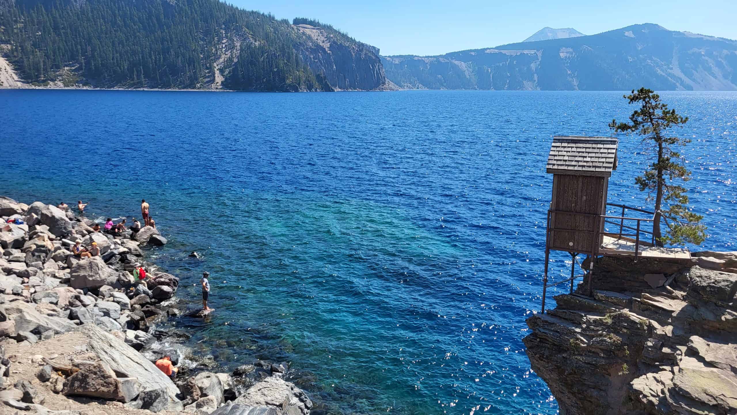
When we reached the bottom, we still had a few hours before our tour, so we decided to enjoy the lake. First, we found a quiet spot for photos and snacks. Then we worked up the courage to get in the water. Crater Lake is cold, but boy, was the cold water welcoming on an 80°F (27 °C) day
After soaking my feet for a few minutes, I committed and jumped in completely. Once the initial shock wore off, it actually felt incredible. Looking back, swimming in Crater Lake is one of those memories I’ll always remember! I even convinced another hesitant person to take a soak!
Afternoon
Before long, it was time to line up for the boat tour. An employee gave us a tip: sit on the right side of the boat for the best views. Whether that was completely true or not is debatable, but we followed her advice and settled in.
The captain welcomed everyone with a phrase we’d heard used multiple times throughout the day: “Congrats, you guys just won the lottery.” Honestly, he wasn’t wrong. Being on that boat felt surreal, and the tour itself was fantastic.
As we cruised across the lake, the guide explained the geologic history of Mount Mazama and how the massive eruption thousands of years ago created the caldera that eventually filled with water and became Crater Lake.

We passed Wizard Island, which was one of the features I was most excited to see. Even though we couldn’t stop on Wizard Island, getting that close was still incredible. However, we were on the wrong side of the boat for this little bit.
The guide also pointed out Devil’s Backbone, and seeing it from the water gave us an entirely different perspective from the day before. My favorite section came next.
Along the south side of the lake, numerous waterfalls cascaded down volcanic cliffs into shallow turquoise water near the shoreline. This was easily the most picturesque area and honestly looked more like something you’d see in the Caribbean rather than Oregon.


We also passed Phantom Ship, Pumice Castle, and the towering Palisades. Every few minutes, there seemed to be another feature worth photographing. By the end of the two-hour tour, we both agreed it had absolutely been worth the effort! Worth the stress. Worth constantly checking reservations. And worth rearranging our schedule.
The hike back up Cleetwood Cove was every bit as challenging as advertised, but we powered through it knowing we had one final mission left: getting home. That mission turned out to be harder than expected.
Evening
We grabbed food in the tiny town of Bly at a place called the Bread Wagon after our first two restaurant options turned out to be closed. But we got lucky again as the Indian Tacos and Fried Bread were amazing. The cold brew and donut also hit the spot, giving us some much-needed energy for the drive ahead.


Then came the long journey home. As the sun set, we crossed eastern Oregon and northern Nevada, taking turns driving through the night. We drank far too much coffee, stopped whenever necessary, and slowly watched the miles disappear beneath us.
The exhaustion eventually caught up with both of us. And we needed to pull over for a short nap at a Maverik gas station. By sunrise, we hit some bad traffic near Tooele because of an accident. By the time we finally arrived back in Salt Lake, we were completely drained, and it was 8 AM the next day.
In hindsight, we both agreed that driving through the night probably wasn’t our smartest decision. If we had stayed one more night near Crater Lake, we could have enjoyed another hike, rested properly, and made the drive home much easier. But we had errands to run on our day off.
Despite the exhaustion, I have zero regrets, and this is a road trip I will remember for a long time!
Interested in planning your own Crater Lake Itinerary? Check out my full 2-day Crater Lake Itinerary
FAQs
Here are some of the most common questions we get asked about this unique Northern California road trip itinerary that I created from scratch.
Is Lassen Volcanic National Park worth visiting?

The answer to this question is a resounding yes! Lassen is one of California’s least-visited and most underrated national parks. We barely scratched the surface during our trip, and there’s still so much to explore next time, including the Cinder Cone Trail, Kings Creek Falls, and Brokeoff Mountain.
If you prefer a quieter, more intimate national park experience and love volcanic landscapes, Lassen is the place for you. While it may not rival Yosemite in sheer grandeur, its tranquil beauty and uncrowded trails make it a worthy contender.
When is the best time to visit Crater Lake?
Because the Rim Drive is unplowed in the winter, summer is the best time to visit Crater Lake. Visitation peaks from June through August, with July drawing nearly 200,000 visitors: about 30% of the park’s annual total.

Road opening and closing dates vary each year due to heavy snowfall, which can exceed 40–50 feet (12–15 m) annually! Fall offers fewer crowds, though early snow is possible. The North and West Rim sections usually open first, while the East Rim often doesn’t open until early July. Be sure to check conditions on the national park page before heading out.
How long does it take to drive from Lake Tahoe to Crater Lake?
The drive can be done in under seven hours as a straight shot, but if the itinerary above has convinced you, there’s so much to experience along the way. We spent four days exploring this route, and I still feel like we missed so much!
Is cell service reliable on this Road Trip?
As an “old soul,” I don’t typically mind having no cell service. I like to use the national park maps to navigate, or I will buy detailed maps of the area I am visiting.
That said, cell service is generally reliable around Lake Tahoe and Mount Shasta outside of remote backcountry areas. In contrast, service is virtually nonexistent in Lassen Volcanic National Park and can be limited or spotty around Crater Lake, so it’s a good idea to have offline maps or a paper map available.
- Lassen Volcanic National Park Map
- Crater Lake National Park Map
- Lake Tahoe Map
- Mount Shasta Map – I have yet to find a good one.
Do I need a 4WD or Snow Chains?
For this particular road trip, you do not need a 4WD vehicle. There is no off-roading required. That said, if you plan to follow this route in the winter, a 4WD vehicle and tire chains are highly recommended. I visited the Crater Lake area in December once, and we rented a Jeep Wrangler to handle the winter conditions.

Packing Tips
I happen to know someone who is absolutely terrific at making packing lists, and I highly recommend using her guide: How to Pack for a Two-Week Trip in Just Carry-On to build your packing list for this trip! In addition, I have a few tips:
- Layers! The weather can change so much from the beaches of Tahoe to the summit of Lassen. Always dress in Layers
- Bring Sunscreen
- Bear Spray isn’t necessary, but I feel better having it with me!
Conclusion
Looking back, this Northern California Road Trip (and Southern Oregon) had a little bit of everything: incredible scenery, great food, amazing sunsets, unforgettable hikes, stressful moments, random conversations with strangers, and plenty of unexpected surprises.
Most importantly, it reminded me not to take life for granted. We came home exhausted and sleep-deprived. But with memories from Lake Tahoe, Lassen, Burney Falls, Mount Shasta, and Crater Lake that neither of us will forget anytime soon.
I left with a much longer “next-time” list than when I started! And honestly, that’s probably not a bad thing. Click here to download a PDF of a simplified version of this itinerary.
